CDT thru-hikers typically identify as either NOBO (northbound starting from Mexico) or SOBO (southbound starting from Canada). I’ve decided to call myself a SNOBO, meaning a NOBO turned SOBO due to the snow. Nearly all of the northbound hikers I got to know in New Mexico have now “flipped” up to Canada and are hiking south like us, each walking back to the place from which they left off.
Beauty around every corner
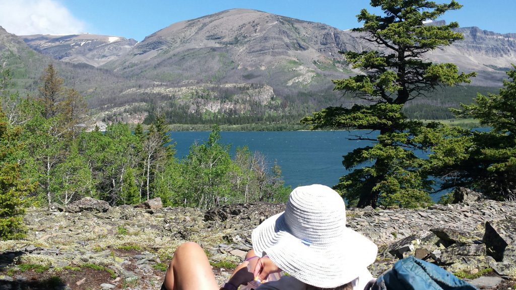
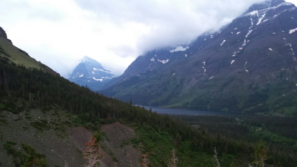
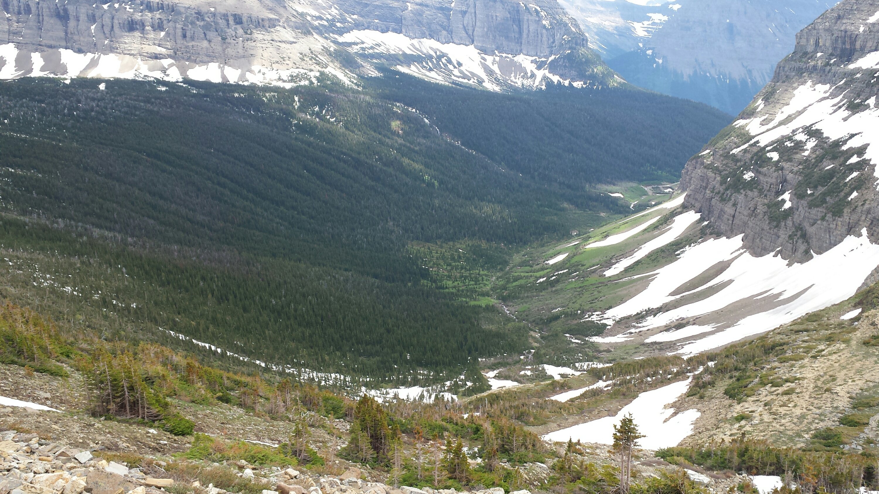
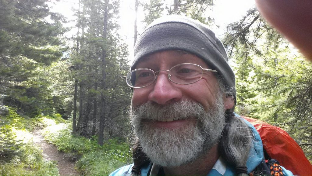
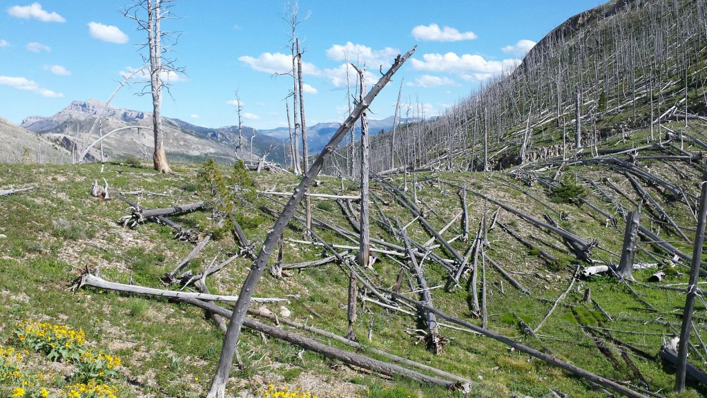
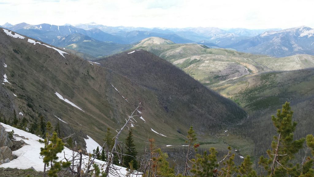
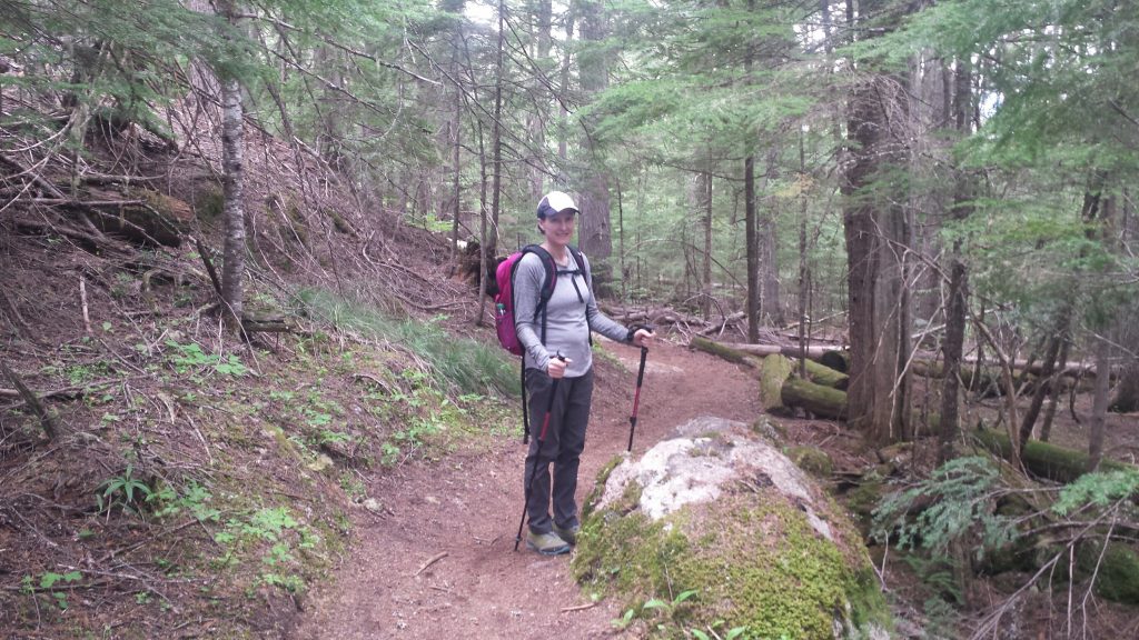
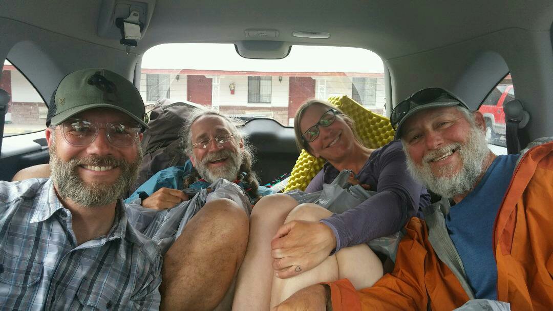
I apologize for the lapse in updates but after hiking through Glacier National Park, the first trail town we reached (East Glacier) did not have great cell service so I had to wait on my update until now. Since I last posted, we’ve hiked another 300 miles, from the Canadian border to near Lincoln, Montana (from which I’m posting this update…thank you Lincoln Public Library!). I’m now about 1100 miles into the hike. Its hard to imagine anything on the trail will possibly top the magical back country in Glacier National Park.
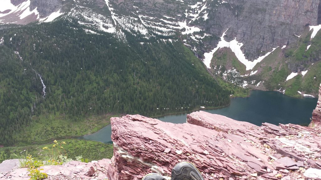
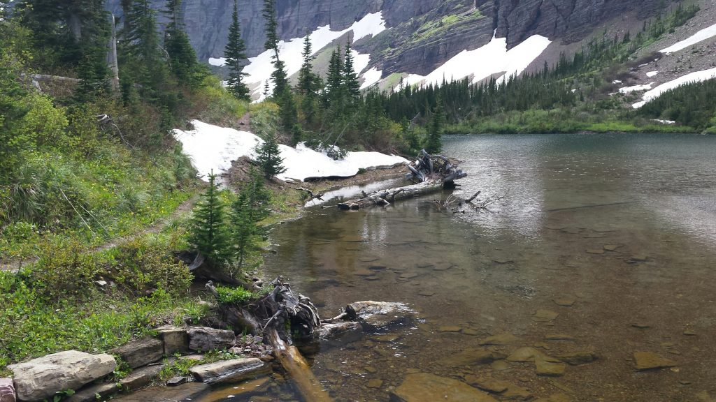
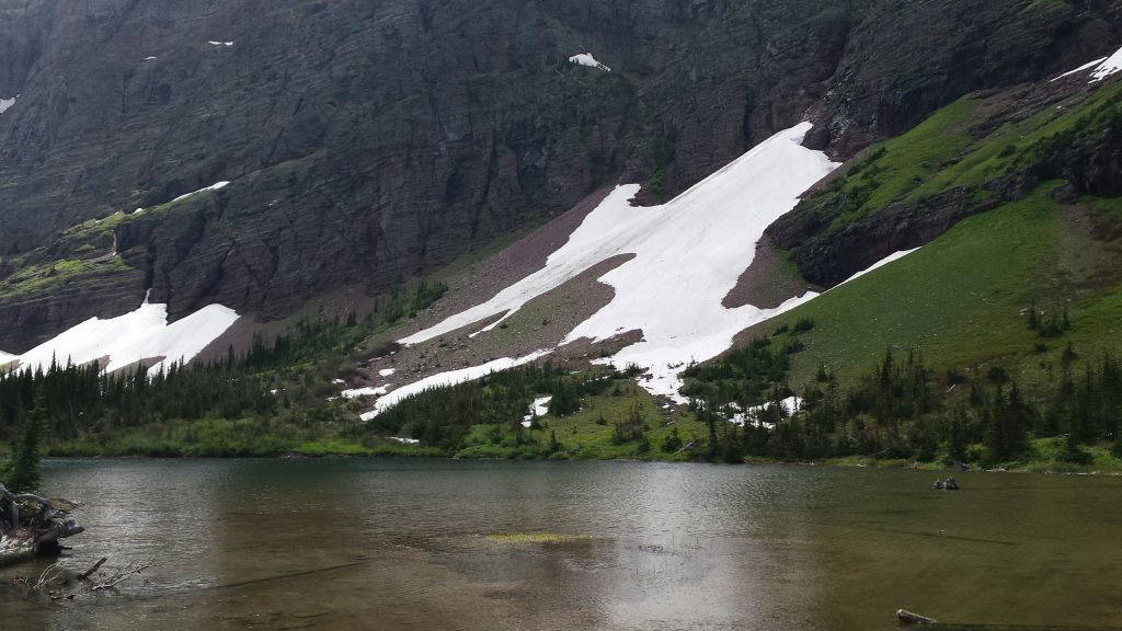
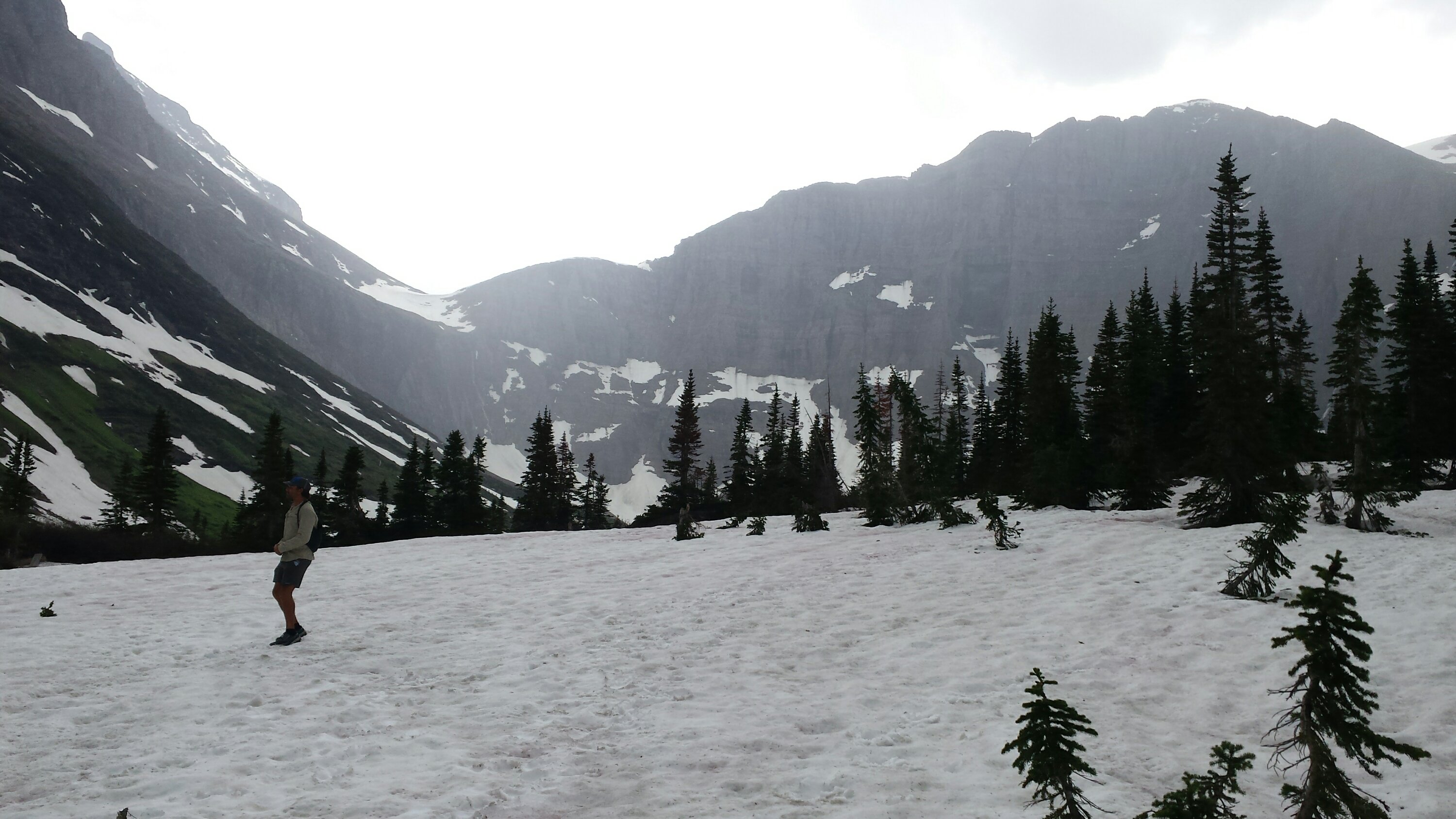
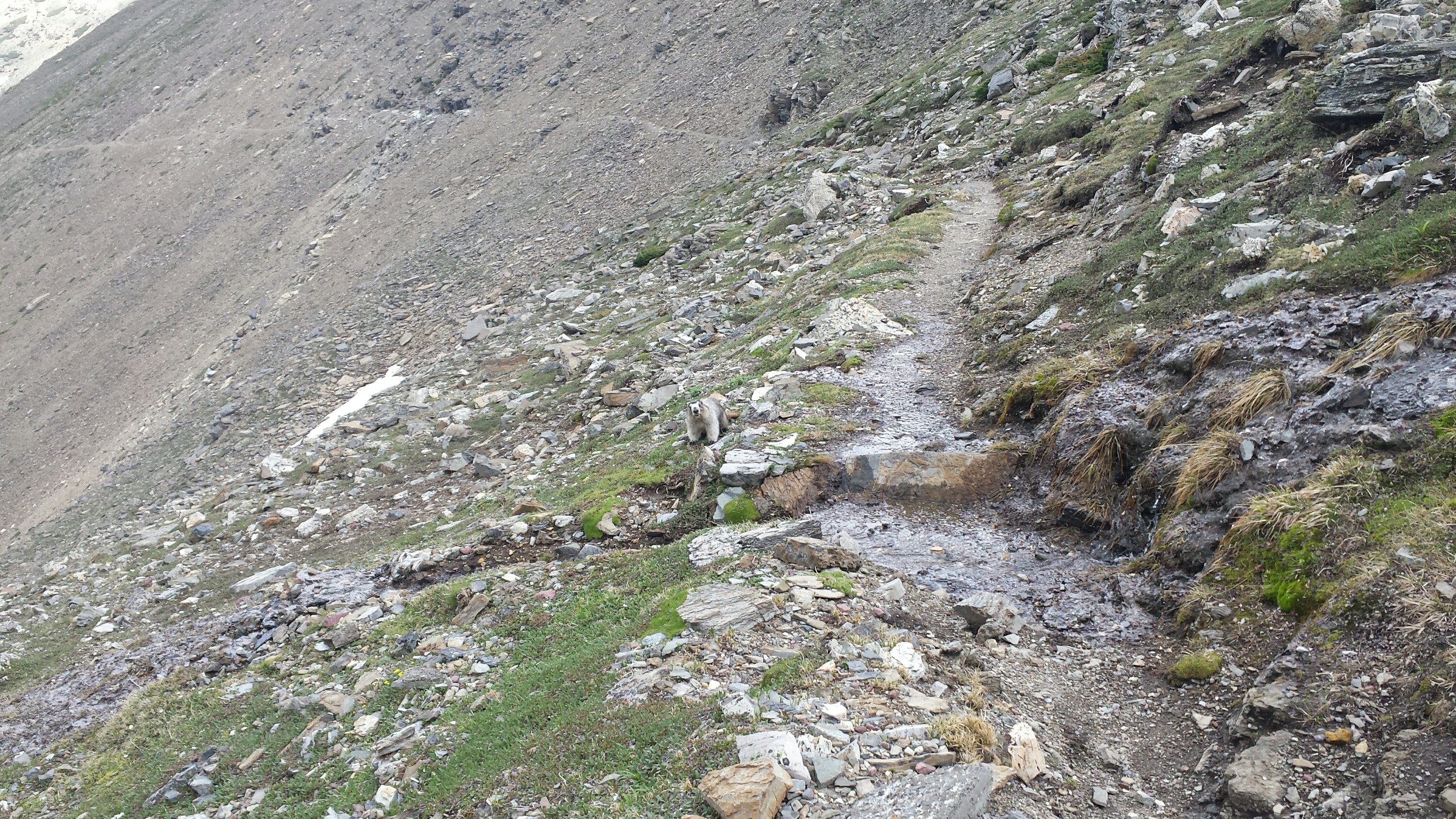
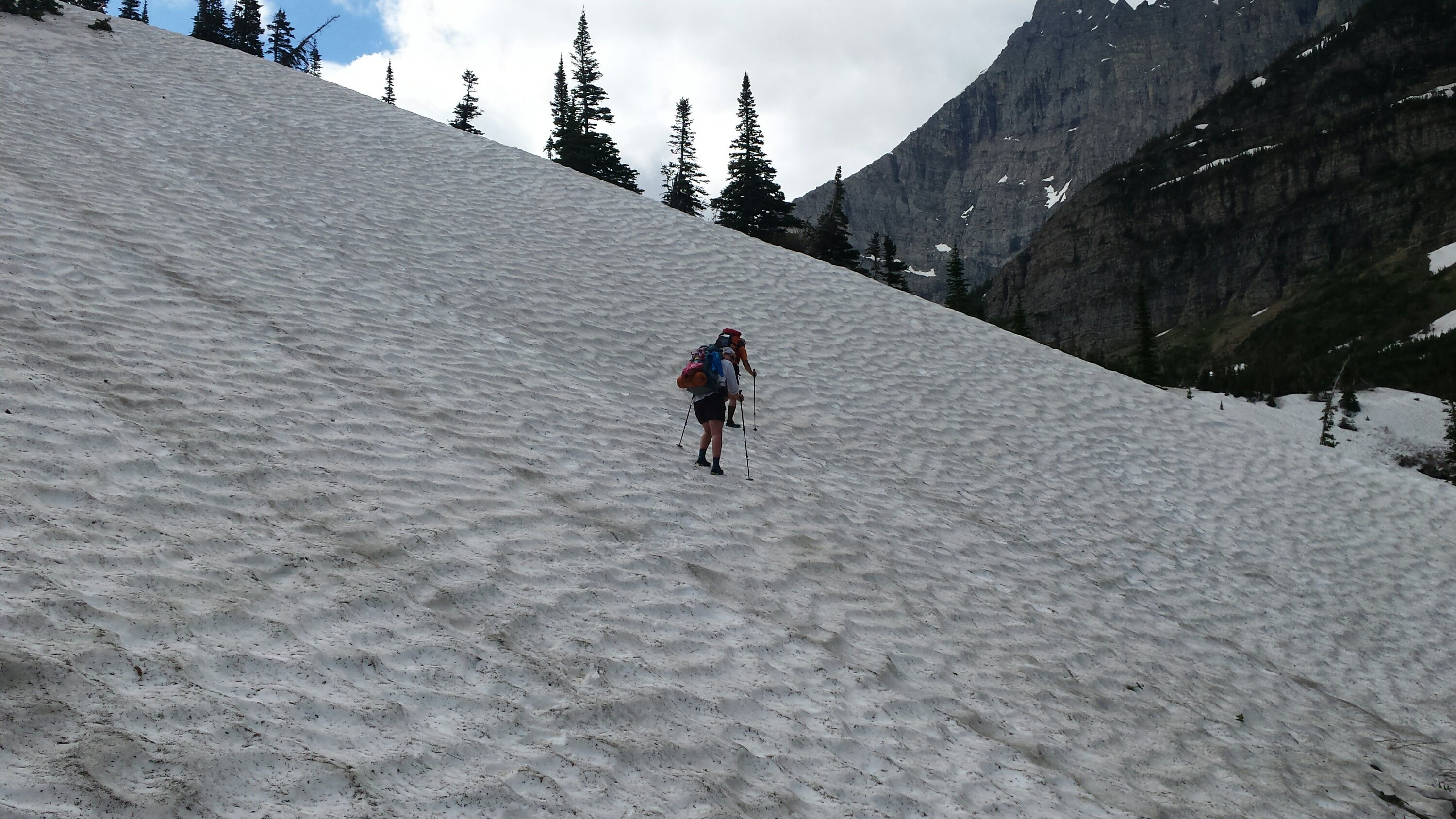
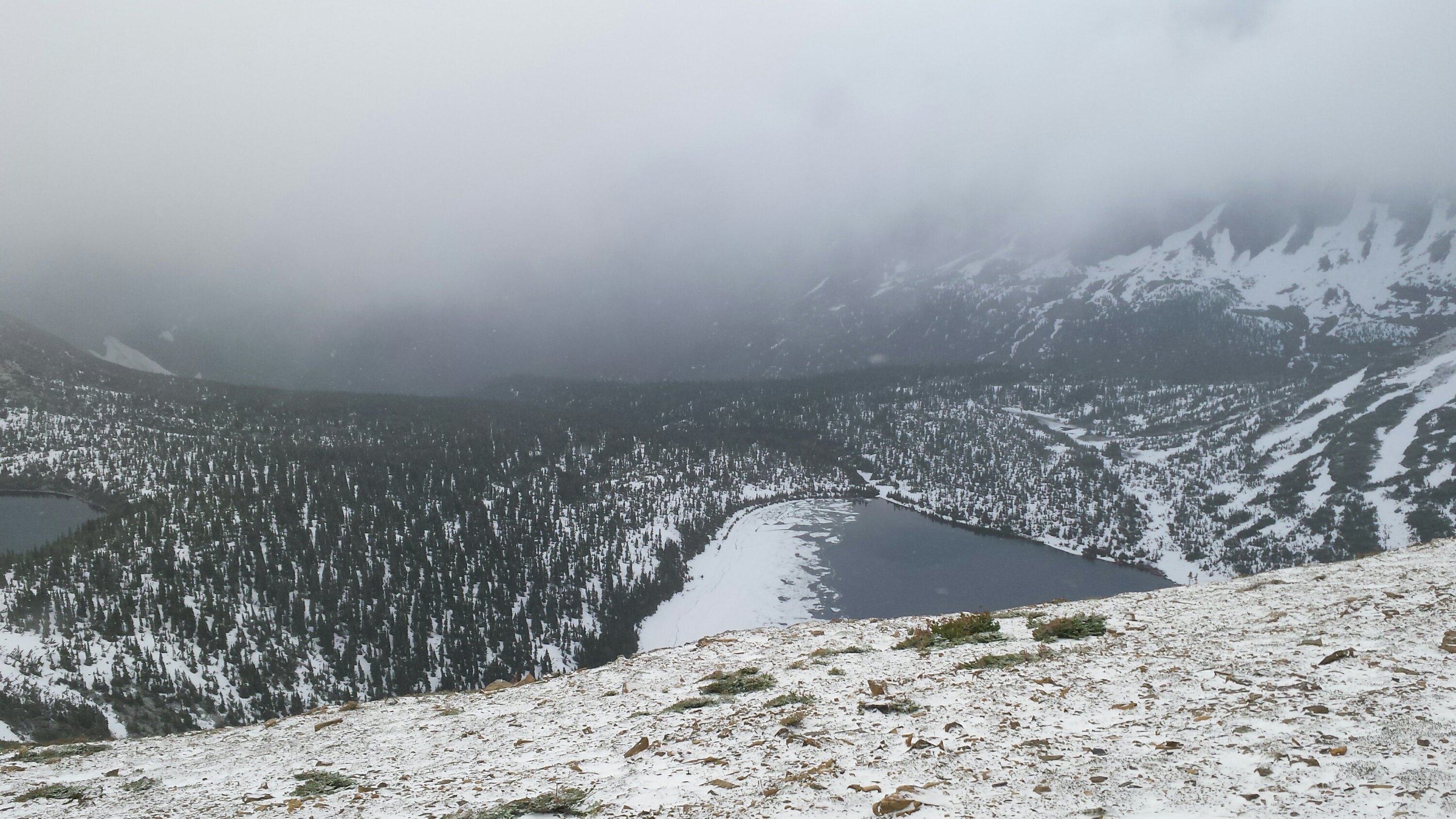
Cougar taking in the scenery on a lunch break“When superlatives fail, use expletives.”MAV and Hammer in GlacierWe crossed many snow fields in Glacier and used our micro-spikes on a few of the trickier ones
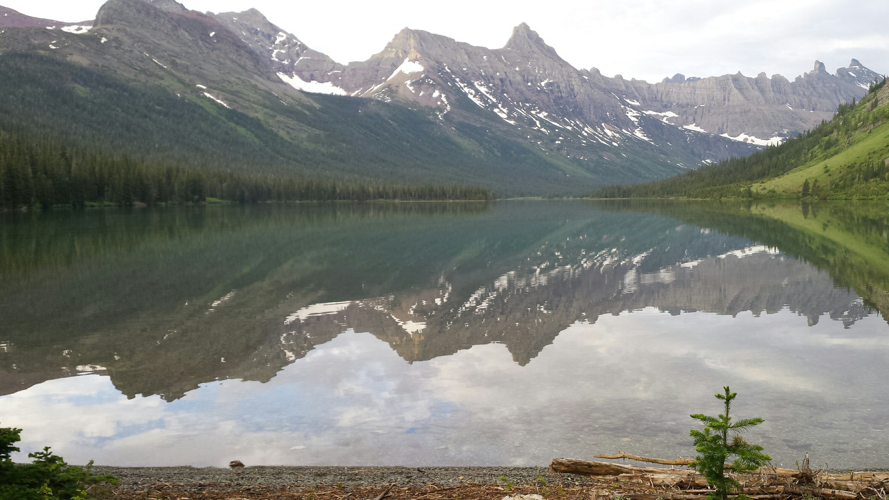
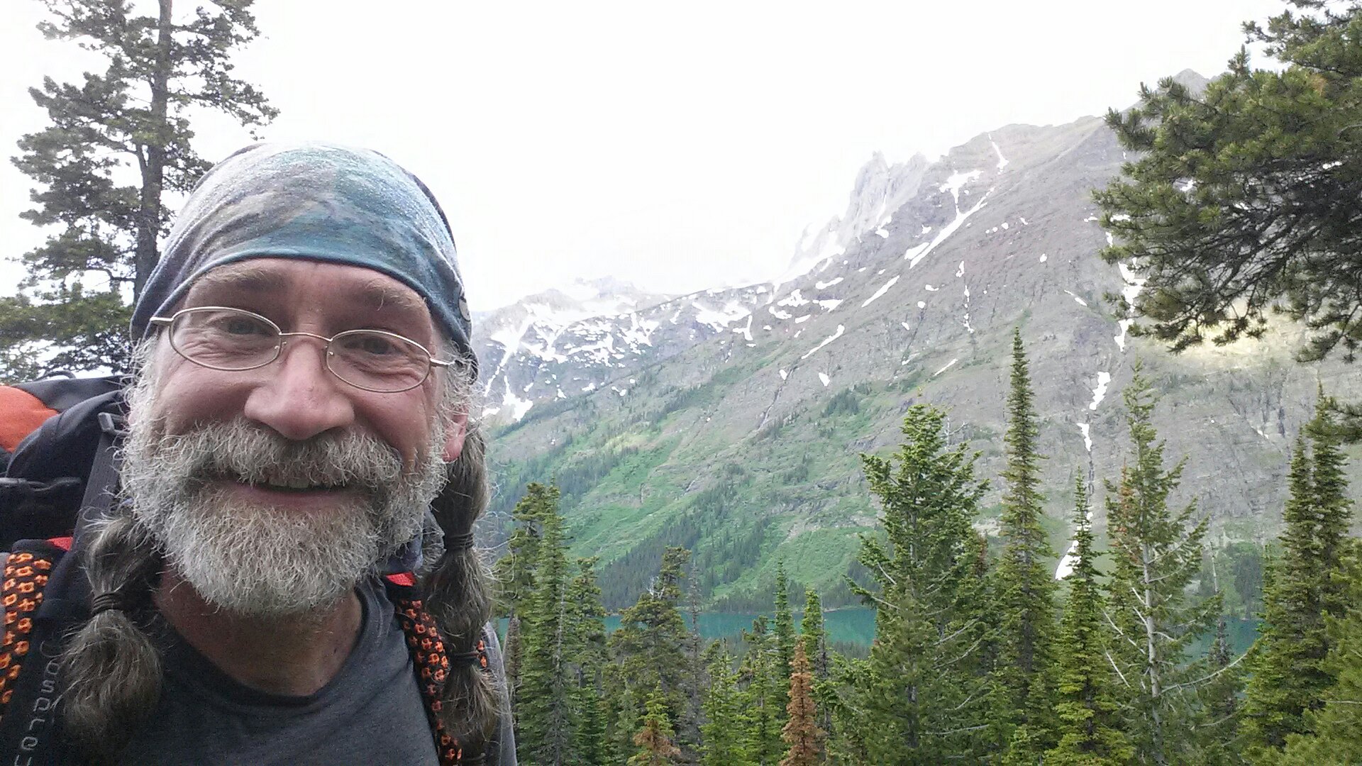
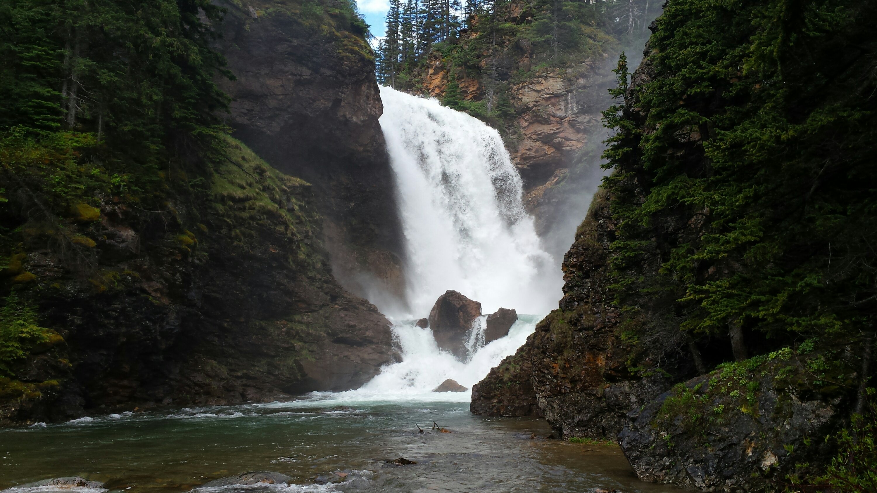
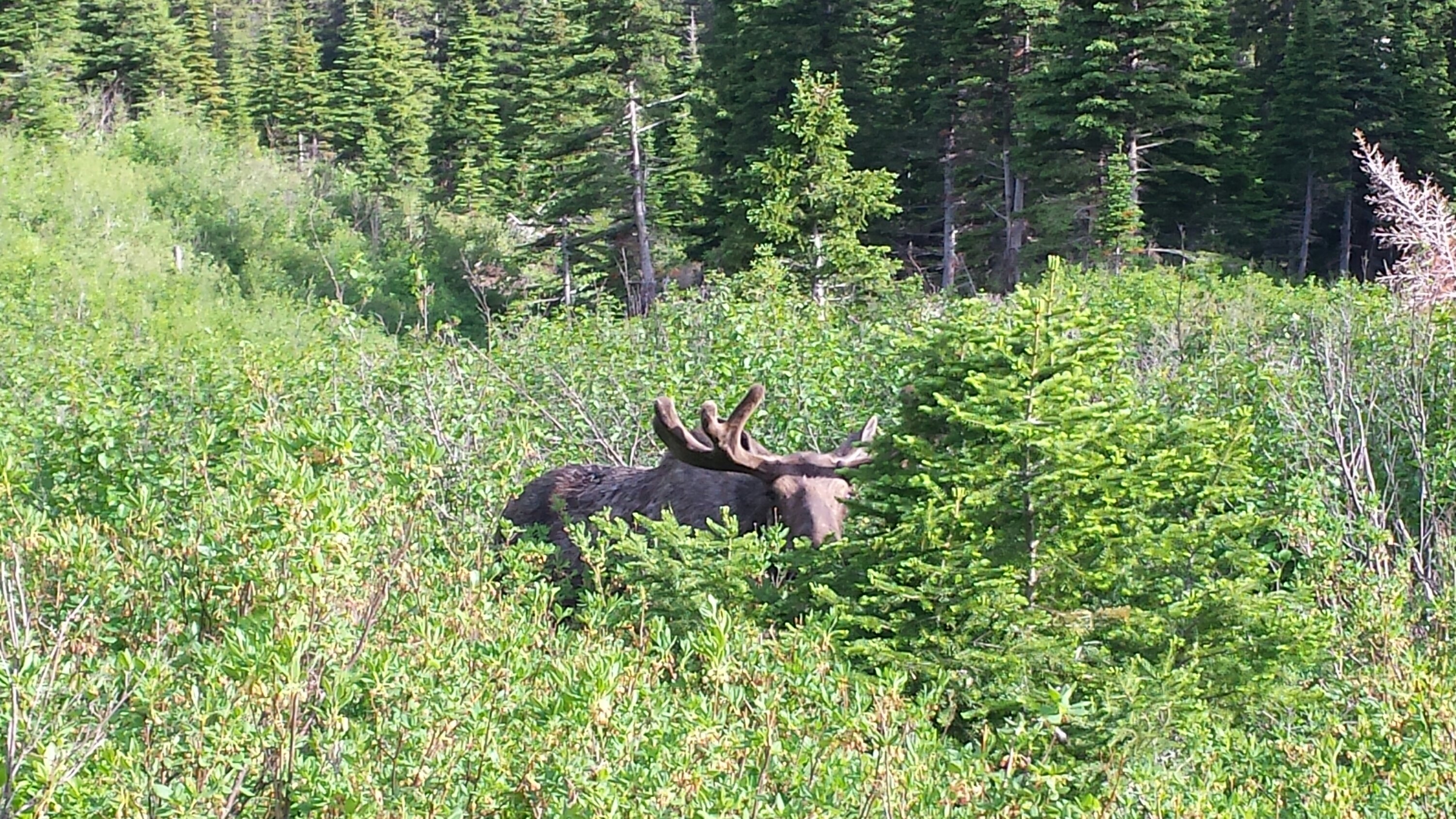
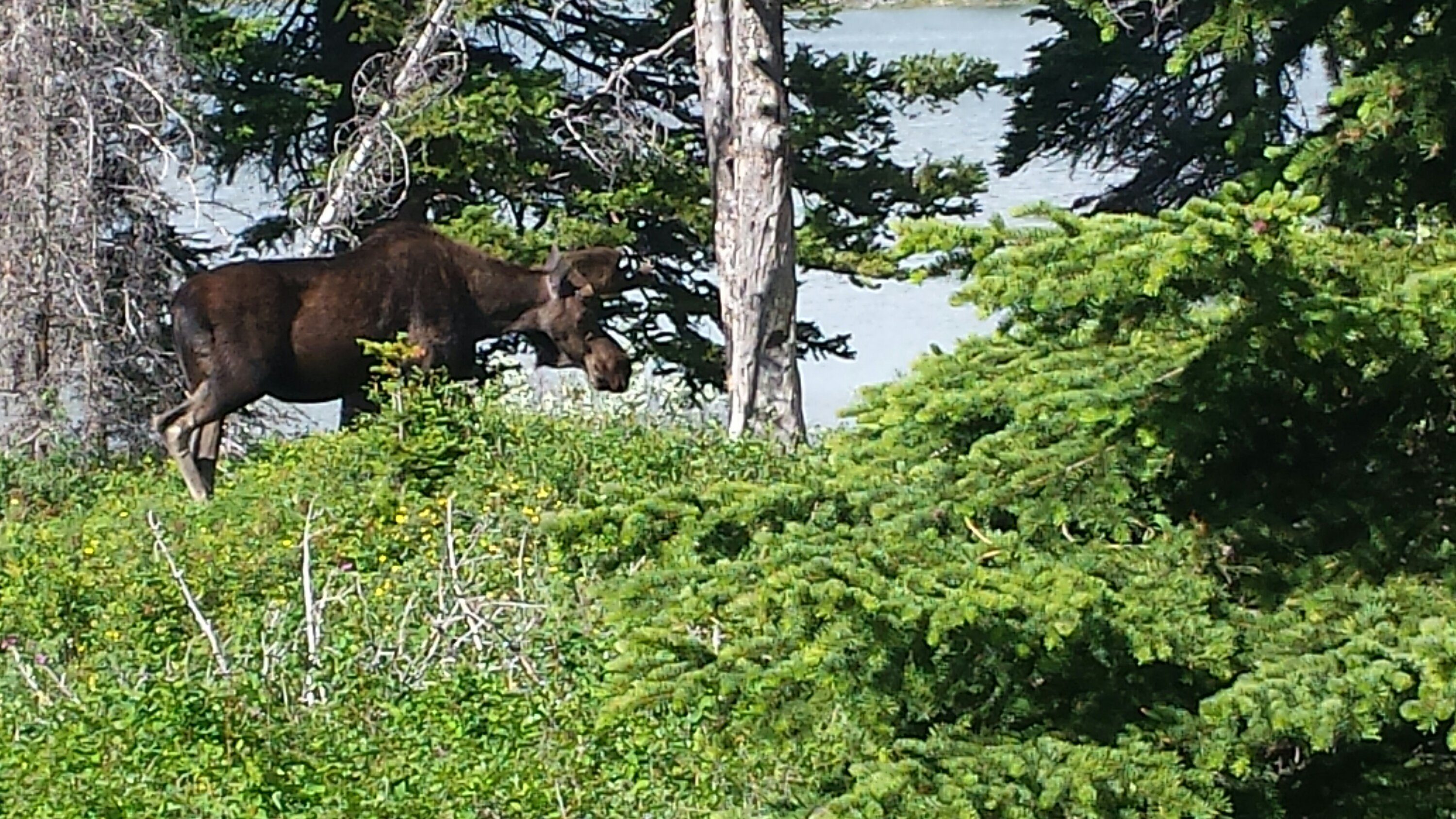
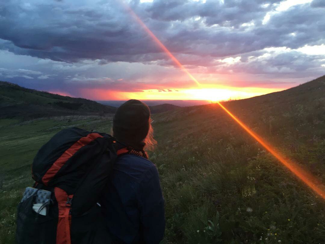
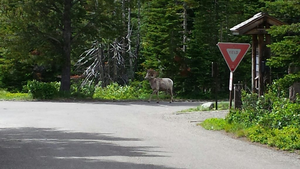
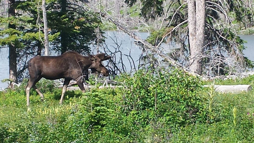
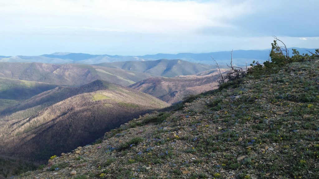
Mirror image beautyZipchip (mini disc) session with Hammer atop a large snowfieldThe mountains and meOne of the stunning falls in GNPThis goat didn’t mind us as long as we kept away from his haremCougar, Paya, Hammer, Moonshine and MAV. Weeks earlier we all breathed a sigh of relief when Moonshine was air-rescued in very deep snow from the San Juan mountains in the southern Colorado part of the trailThe trail cutting across a Glacier mountain sideMoose sighting, antlers still velvetyLarge moose that walked through our camp and put on a show of all kinds moose behavior, the biggest of the three we sawYep.Sunrise in the Bob Marshall WildernessBighorn strolling through the Two Medicine campground like he’s buying marshmallows for a big cookout Cougar crossing a snow field in her spikes. It’s not obvious from the picture but a misstep on such can send you sliding down a hundred or more feet of snow slope that typically terminates in rock.Saw this young moose munching grass during a morning stroll near Many GlacierIn additional to jaw-dropping scenery, I had very close encounters with a couple of moose, two grizzly bears (one small, one very large), mountain goats, big horn sheep, snowshoe hare and marmots. (From left) T-Pain, MAV and Dos Tacos drying out gear and eating a snack on the front porch of a ranger station in the Bob.Me in the woods, deftly avoiding the camera’s eye
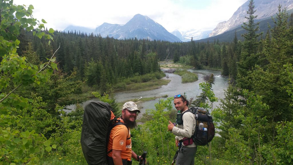
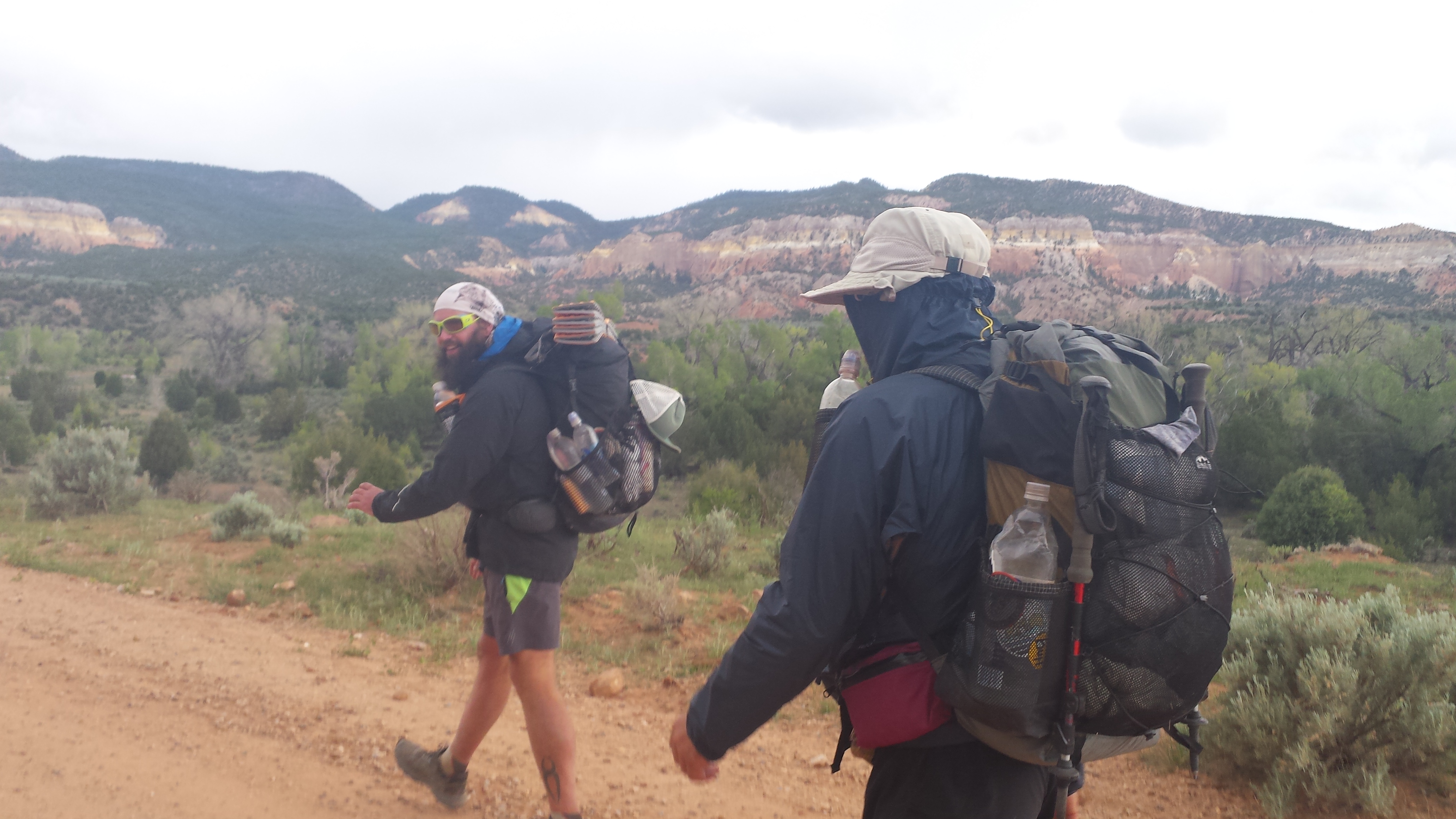
After hiking through the park for about a week, we continued south through the roadless Bob Marshall Wilderness, known as “the Bob.” We hiked through the Bob (nearly 200 miles) on a single food carry, meaning we went the entire distance without an intervening resupply of food. Over the course of the past couple of weeks we’ve been gradually rebuilding our hiking stamina since being off trail for a few weeks and are now back to walking 20-25 miles per day (yesterday was 30+).
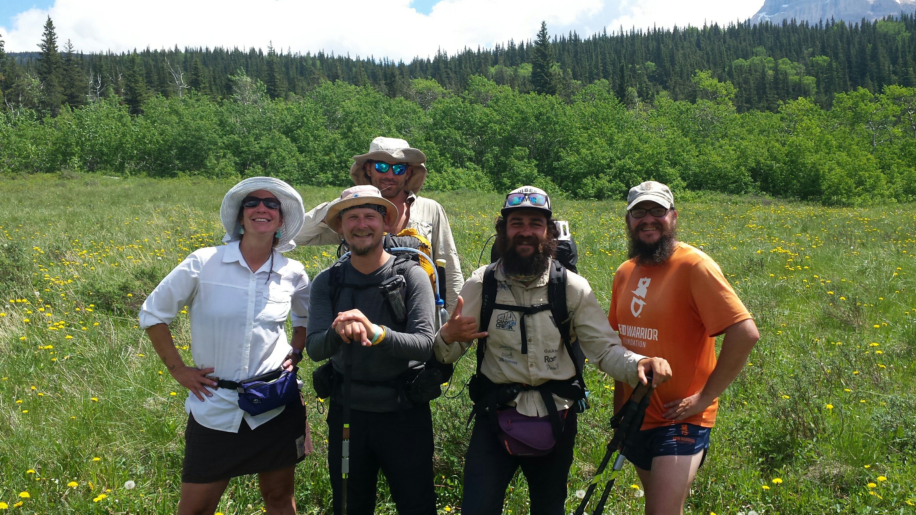
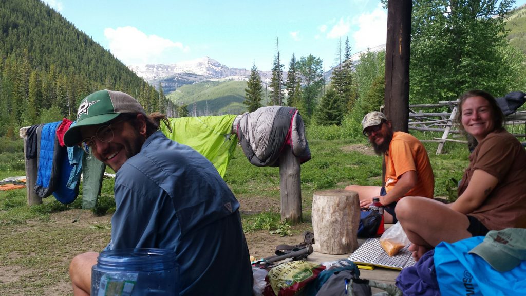
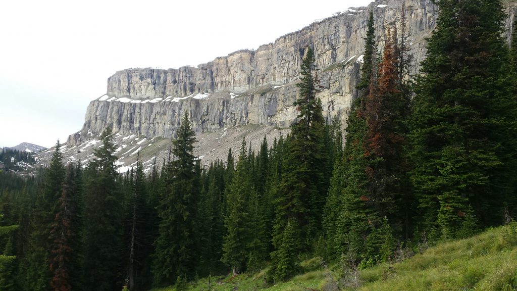
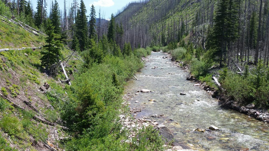
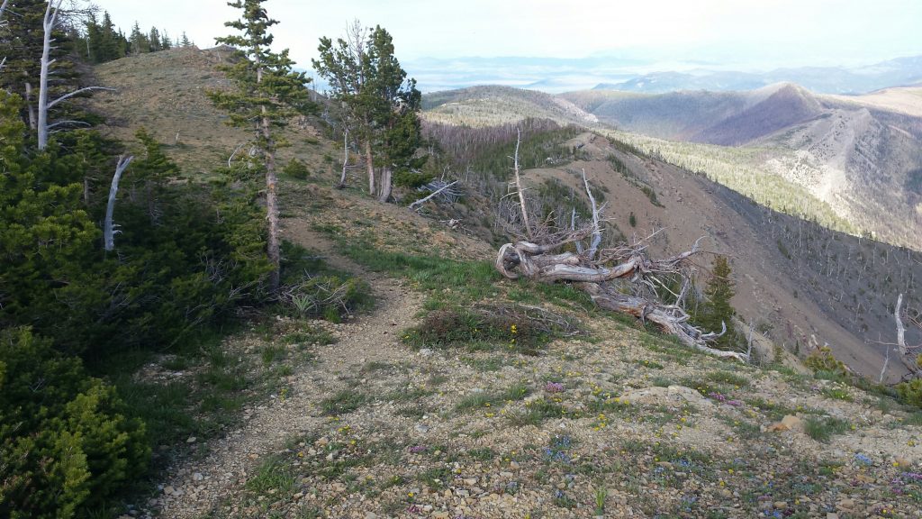
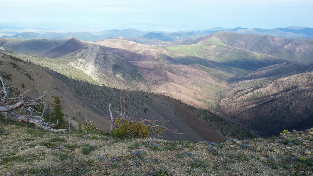
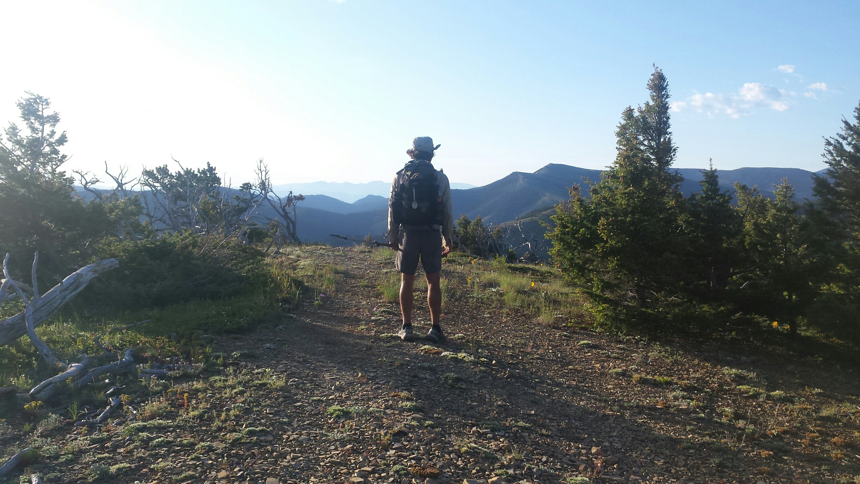
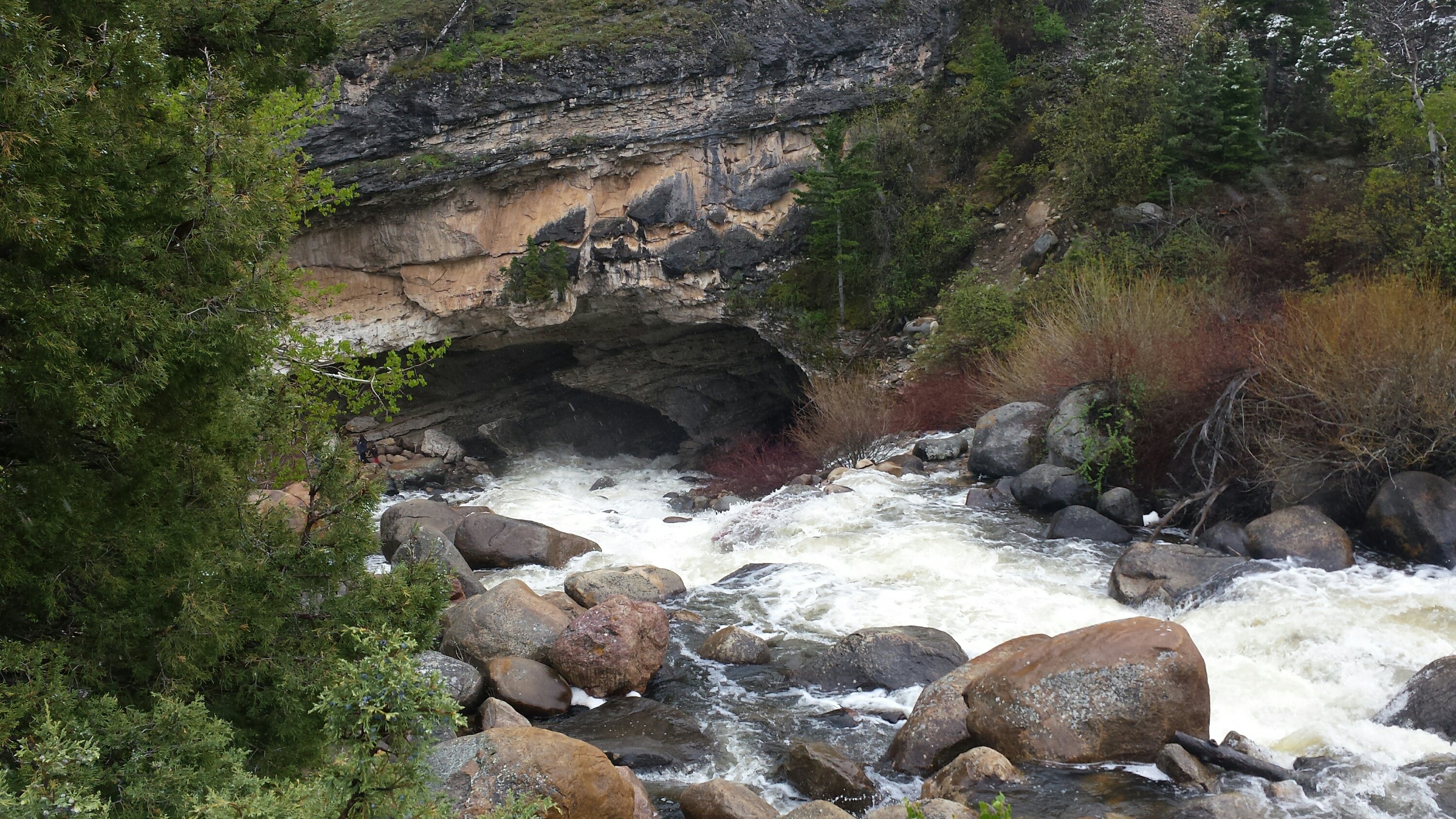
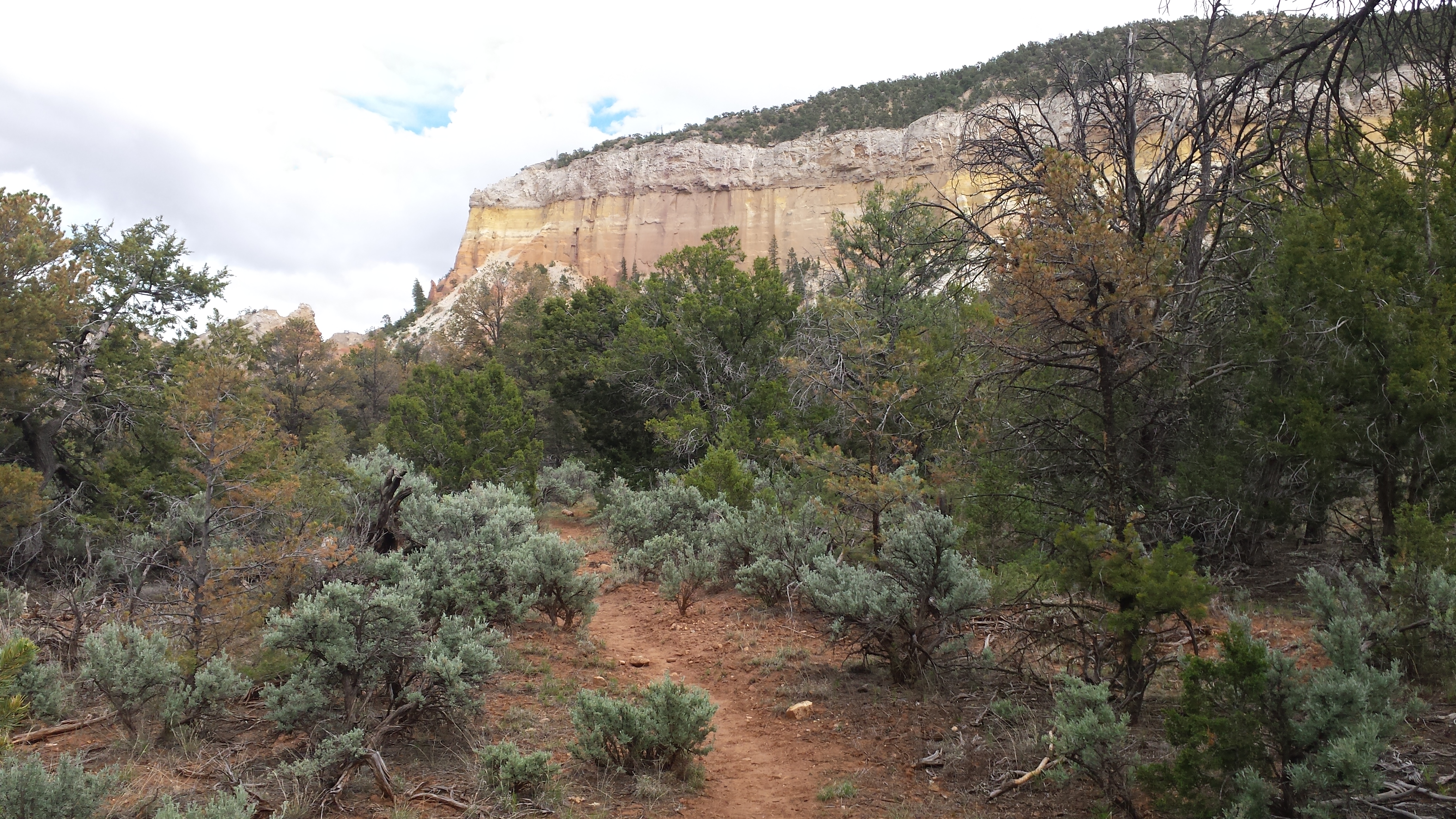
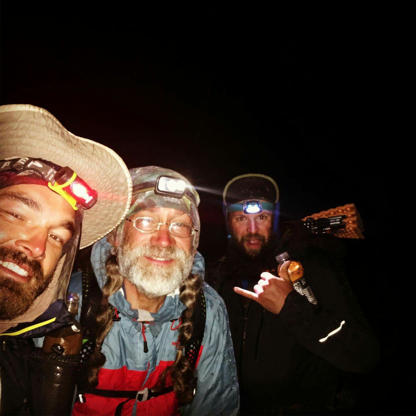
The “Chinese Wall” is one of remarkable features in the Bob Marshall WildernessOne bit of sad news to report: Cougar, one of the hikers with whom I walked in New Mexico and who started southbound with us from Glacier re-injured a problem knee and had to leave the trail for the time being. She’s such a great hiker and fun person to be around and we’re going to miss her. Meanwhile, MAV, Hammer and I carry on, having added a couple of new hikers (T-Pain and Chicken Fat) as we go. After the extended distance through the Bob under very rugged conditions, we’re all taking a “zero” tomorrow (no hiking) to rest and get caught up on town duties (shower, laundry, eat, re-supply, eat more).Brisk current in this river in the BobMany of the miles we hiked through the Bob were through fire areas littered with blow-downsRidge-walking trail in the Bob. From the top you can see your path along the spine of the ridgeThe Bob from a ridge, #1The Bob from a ridge, #2The Bob from a ridge, #3
Confession: I’m falling asleep at the computer as I try to get this update completed. The two weeks since I re-started my hike have been a whirlwind of miles, climbs and heavy packs that have left me exhausted. Snowy lake in Glacier from one of the passesHammer on the final morning in the BobThe next trail town (Helena, Montana) is only a three day walk so my pack will be much lighter when I leave Lincoln the morning of 7/3. I’ll definitely try to reduce the time before my next update. Cheers and sweet dreams! Max.
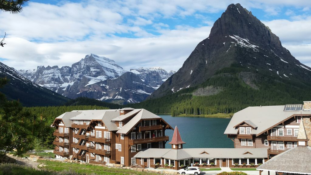
Picture-perfect Many Glacier Hotel, the morning of my “prepare to get hikin’ again” hike in Glacier
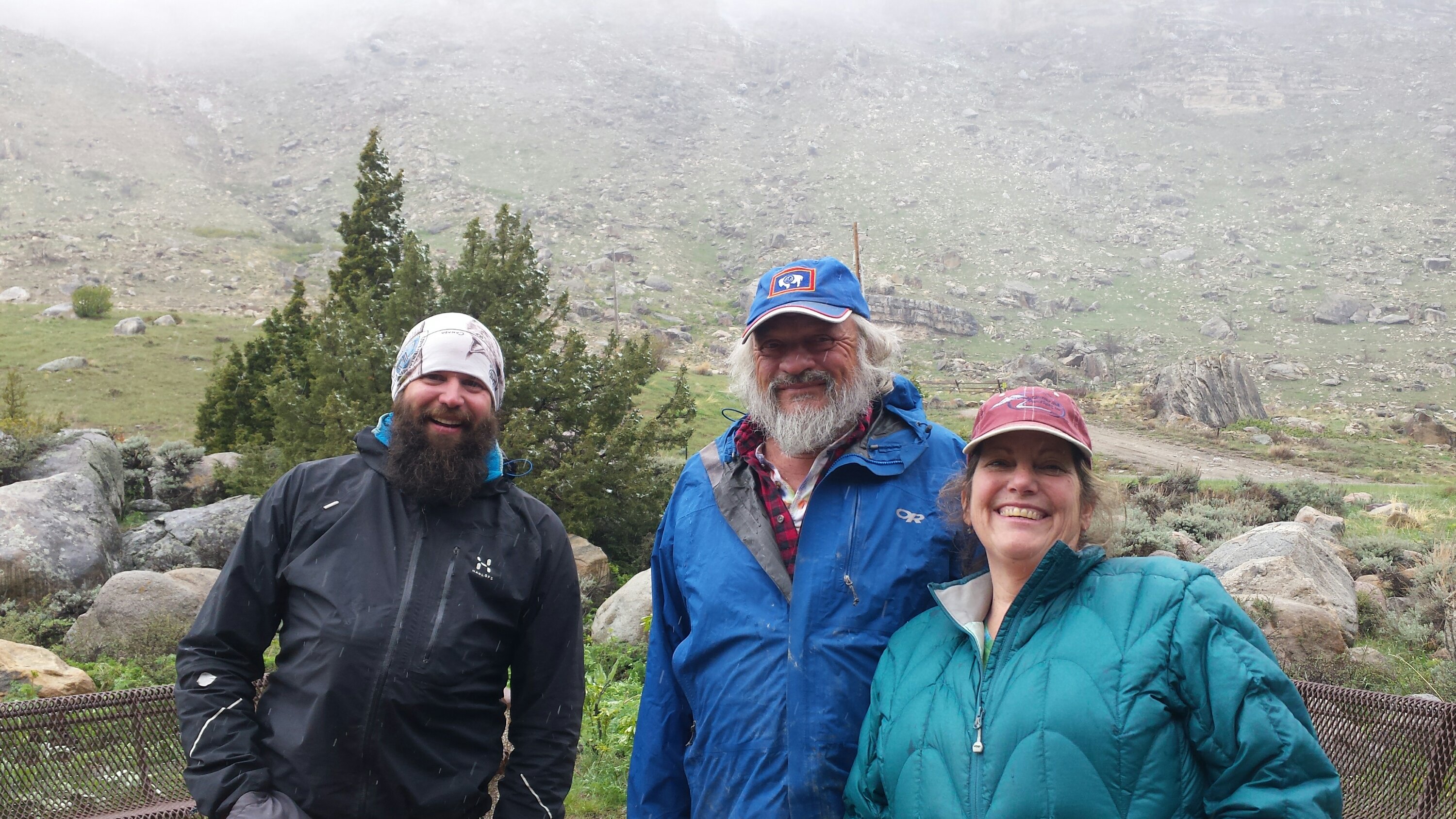
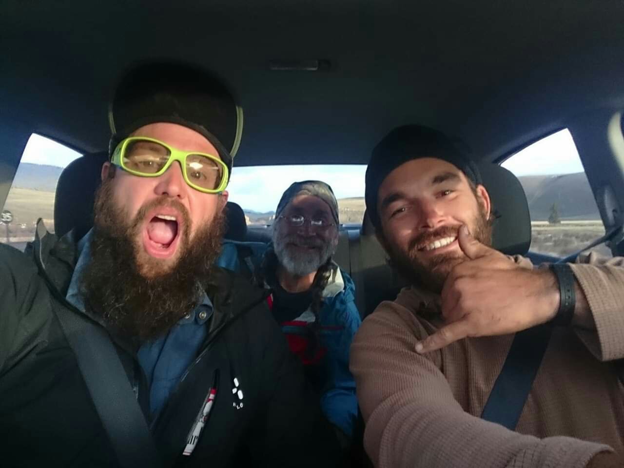
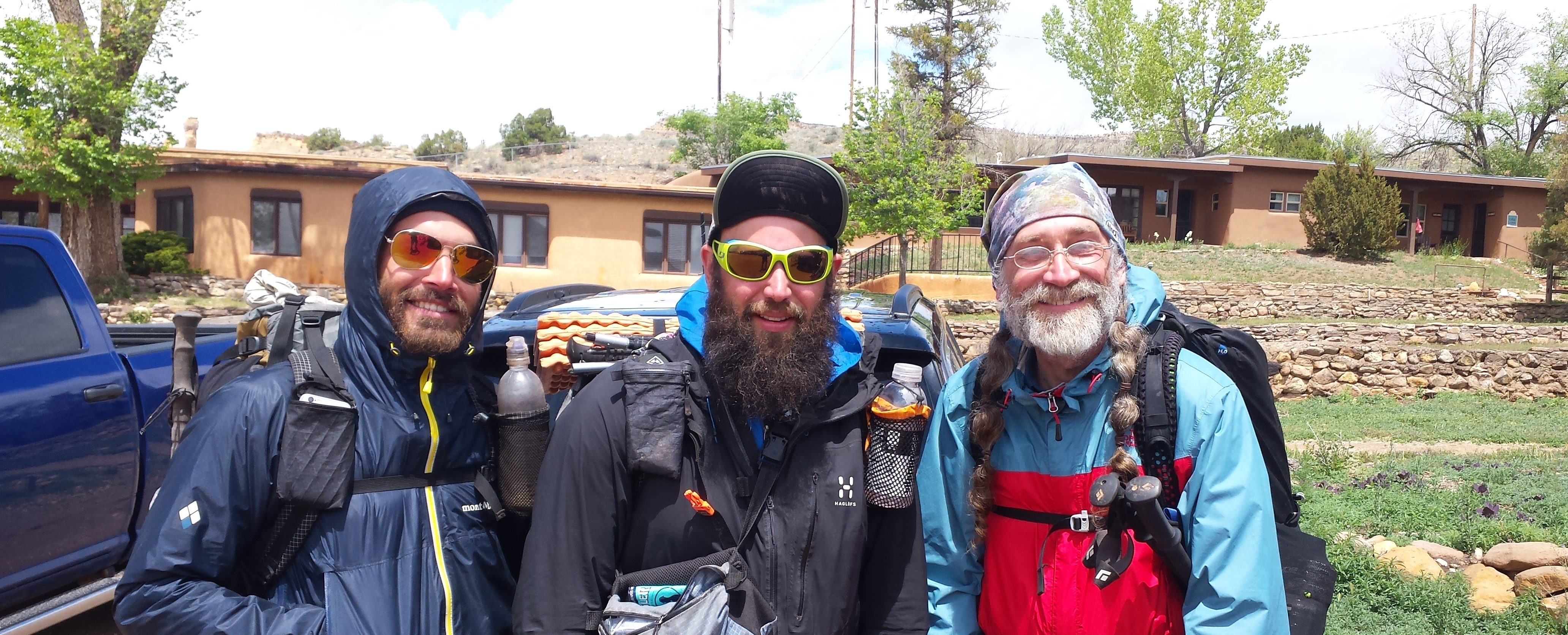
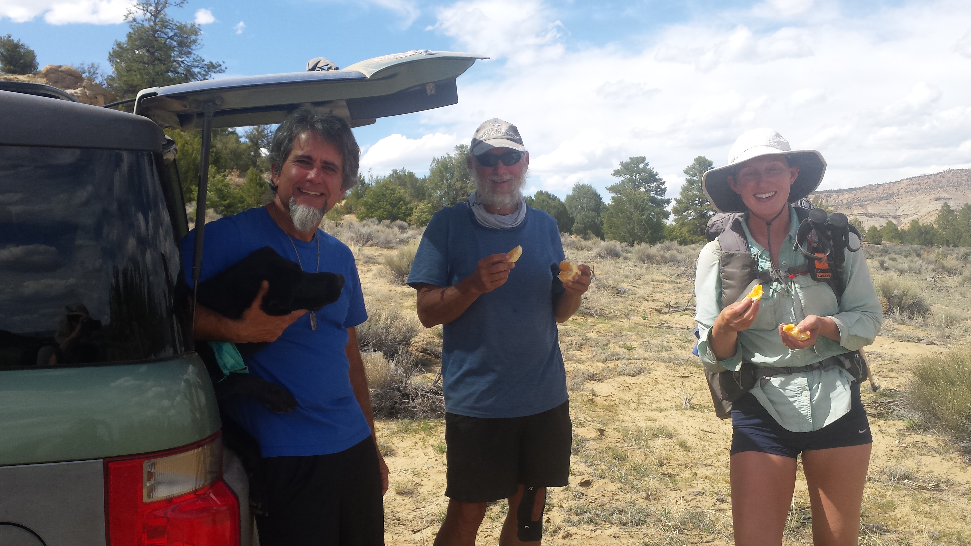
This post confirms that I’ll be back on trail beginning early the morning of June 15th (the day after tomorrow). Much to my delight, I’m restarting with three other hikers: MAV- my trail family brother from the Appalachian Trail, Cougar- a great hiker going for her triple crown whom you may recall had been temporarily sidelined back in New Mexico with foot issues, and Hammer- a rock solid waterman, surfer and hiking speedster to whom I was introduced by OB back in Cuba, NM. While all of us are technically “solo” hikers, having companions through Grizzly country is welcome by all and we’re antsy to start walking. We converge tomorrow across the Canadian border in Waterton in order to finalize our itinerary with the Glacier back-country office folks. We’ll then walk back across the border into the US the following morning.
My next update will likely be from East Glacier in approximately 7-8 days. Meanwhile, here are some recent photos taken while off the CDT. Cheers! Max
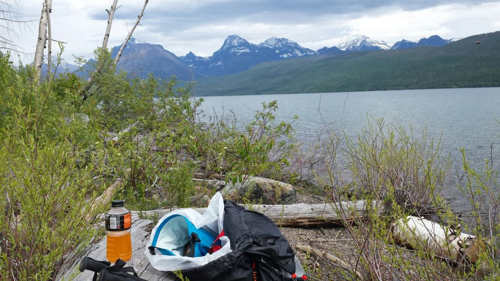
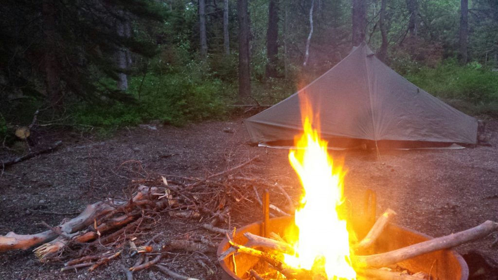
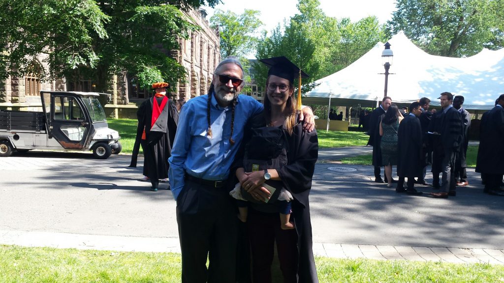
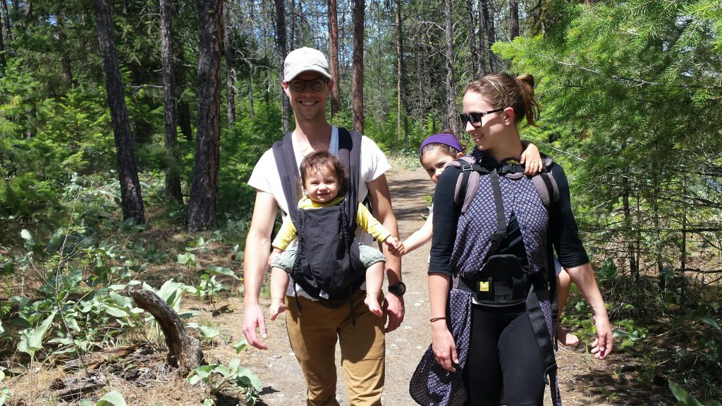
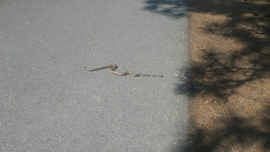
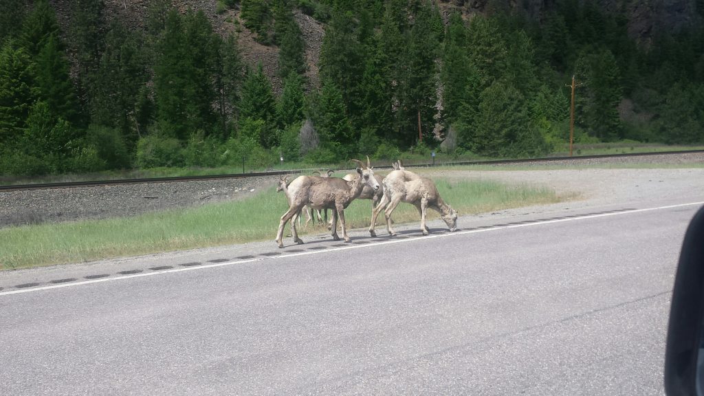
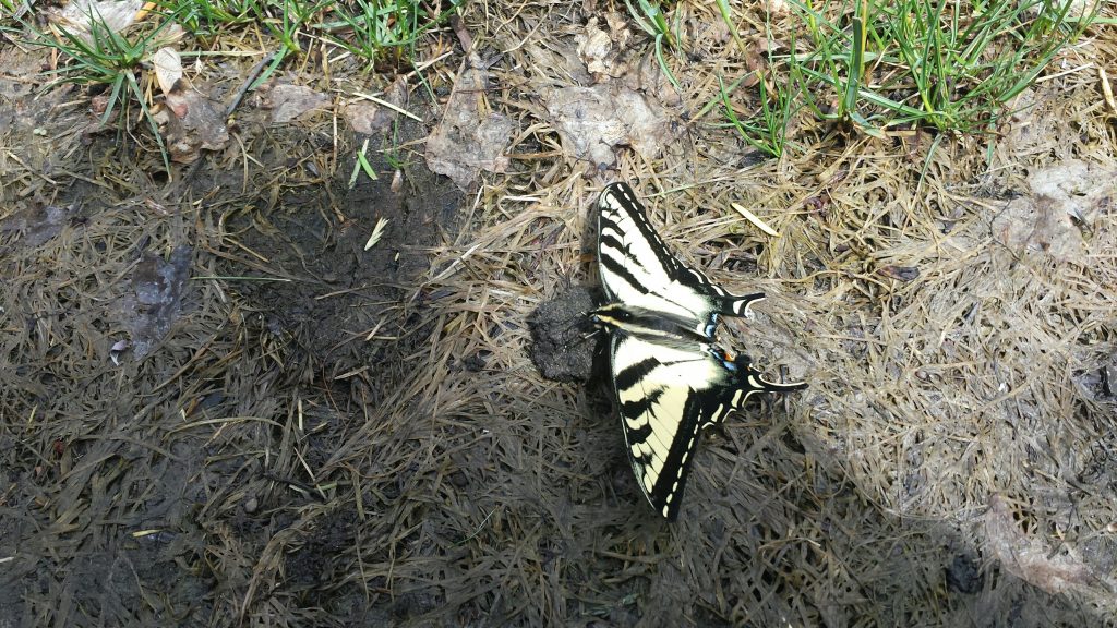
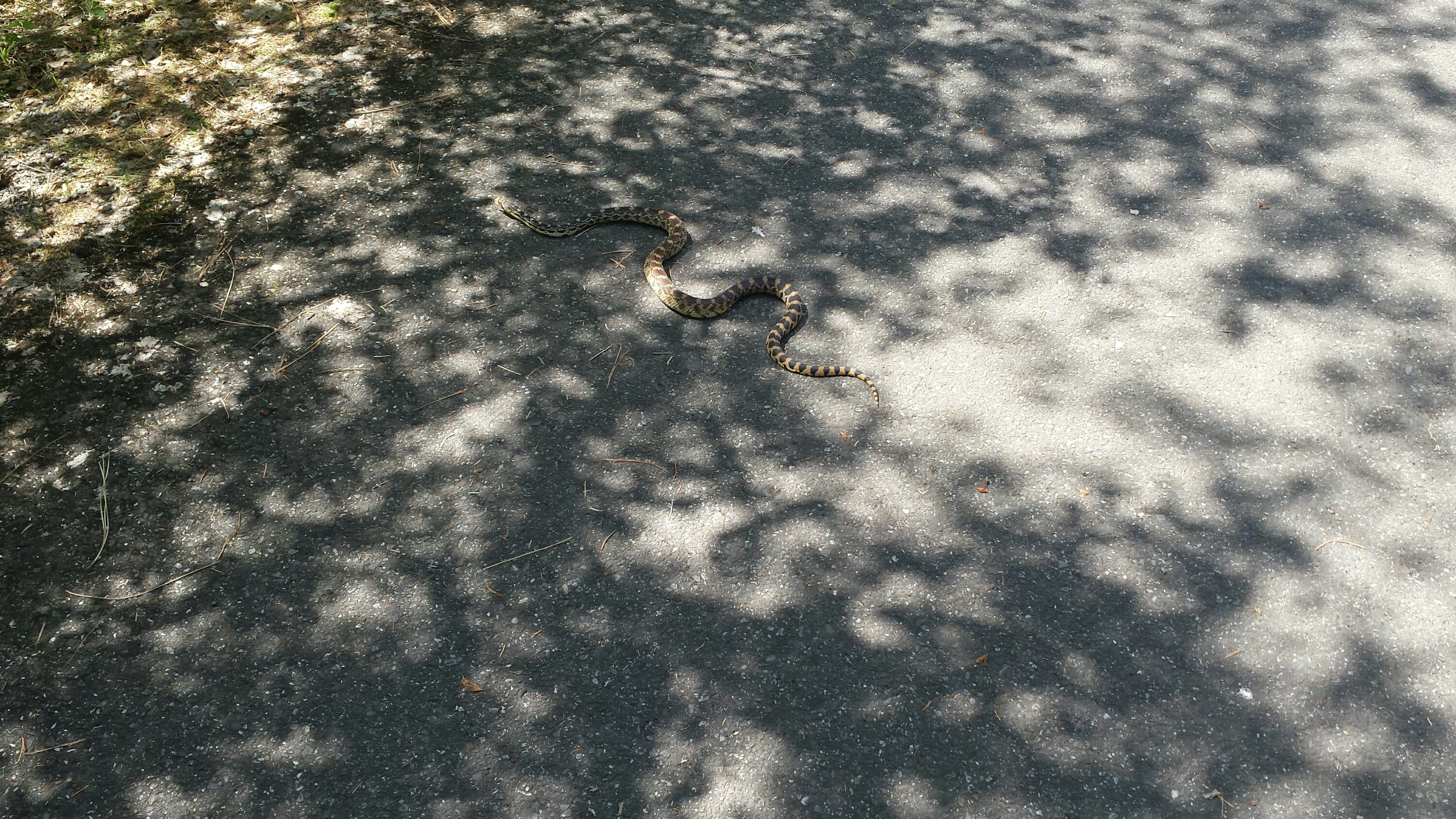
Fishless shore lunch on Lake McDonaldEvening fire in the Many Glacier campground. We’ll hike from Canada right back to this campground in a few short days.The primary driver for my trail break: my daughter (and her youngest daughter) at graduation.Family hike: Oliver helping Emily carry her daughters along the Spokane River.Wendy hiking along (the oft-recommended to us) Priest Lake in the Idaho Panhandle.Off-trail wildlife#1: snakes-a-plenty on the paved Centennial trail, Eastern Washington.Off-trail wildlife#2: absent-minded grazing on the road between Kalispell, MT and Glacier.Off-trail wildlife#3: This butterfly near our home posed graciously for this photo shoot.Impala (left) with me and Hammer en route to Wyoming a few weeks back. He’s now back walking other trails in the UK but will also be with us in spirit all the way. Long live Todmorden!
While transferring pictures from phone to computer I came across the following video clips I’ve taken on the trail. Most are less than 30 seconds and I can’t claim they’re particularly interesting- except for the one with the cow and me amiably sharing a trough…that was memorable. View as interested. Max
First steps on the CDT
First (NOBO) CDT sign
Copious wind and few trees, but plenty of beauty
Changing terrain: trees and a visible footpath
“Getting to know you, getting to know all about you…”
From the morning after camping out at “Doug the Hermit’s” place
Put away the camera after this mild crossing- it was a good thing I did
Milling around inside the Gila Cliff Dwellings made a terrific detour for an afternoon
Panoramic view of a stand of pines
OB coming down from Taylor
More OB descending…must’ve been a theme
Scraping mud off my feet on a walk bridge entering Ghost Ranch, NM
Windy ridge walk in the northern end of the Great Basin in Wyoming
Back in my home court: walking the Spokane River. Flowing well!
As you’ve seen in previous posts or possibly the national news, the weather has been a significant factor for northbound CDT hikers thus far in 2019. We had to say goodbye to an incredible NOBO hiker this morning as Impala is heading back home across the Atlantic to put his remaining hike time to use locally there rather than spin more cycles here waiting for the deep snow to clear. He will be missed greatly.
This snake was hogging the footpath
Meanwhile, I’m hiding out from the trail snow back home with Wendy for a week until our daughter Emily’s graduation, after which I’ll head to Glacier National Park (the CDT’s northern terminus) on 6/15, to resume my hike southbound amongst the likes of MAV, Cougar and Hammer. I absolutely loved hiking SOBO on the AT and am equally excited by the prospects for the CDT.
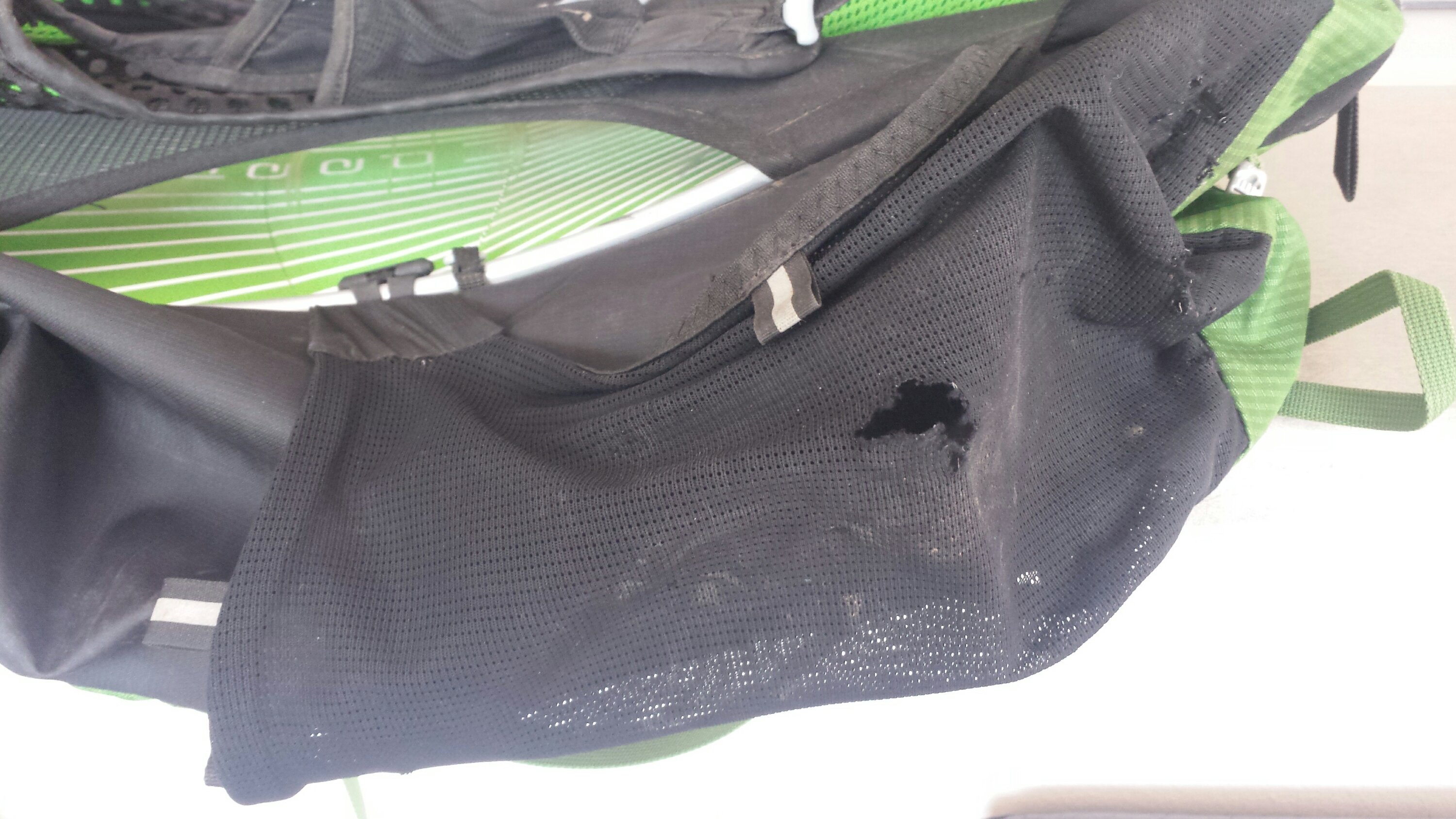
Osprey rocks! They’re sending a new pack due to a bunch of holes like this from several thousand miles of wear and tear.
Having completed most of the “deserty” sections already (New Mexico, Wyoming’s ‘Great Basin’) much of what remains includes some of the most scenic sections of the trail: Glacier, Yellowstone, the Bob Marshall Wilderness, the Wind River Range, all of Colorado, etc. I’m really itchin’ to keep the hike in forward motion. Whereas it took me longer (compared to the AT) to find my commitment for the CDT, I’m locked-in now and just want to move down the trail.
That’s all for now. I’ll problem do another post right around the time I head back to the trail. Thanks for your support! Max.
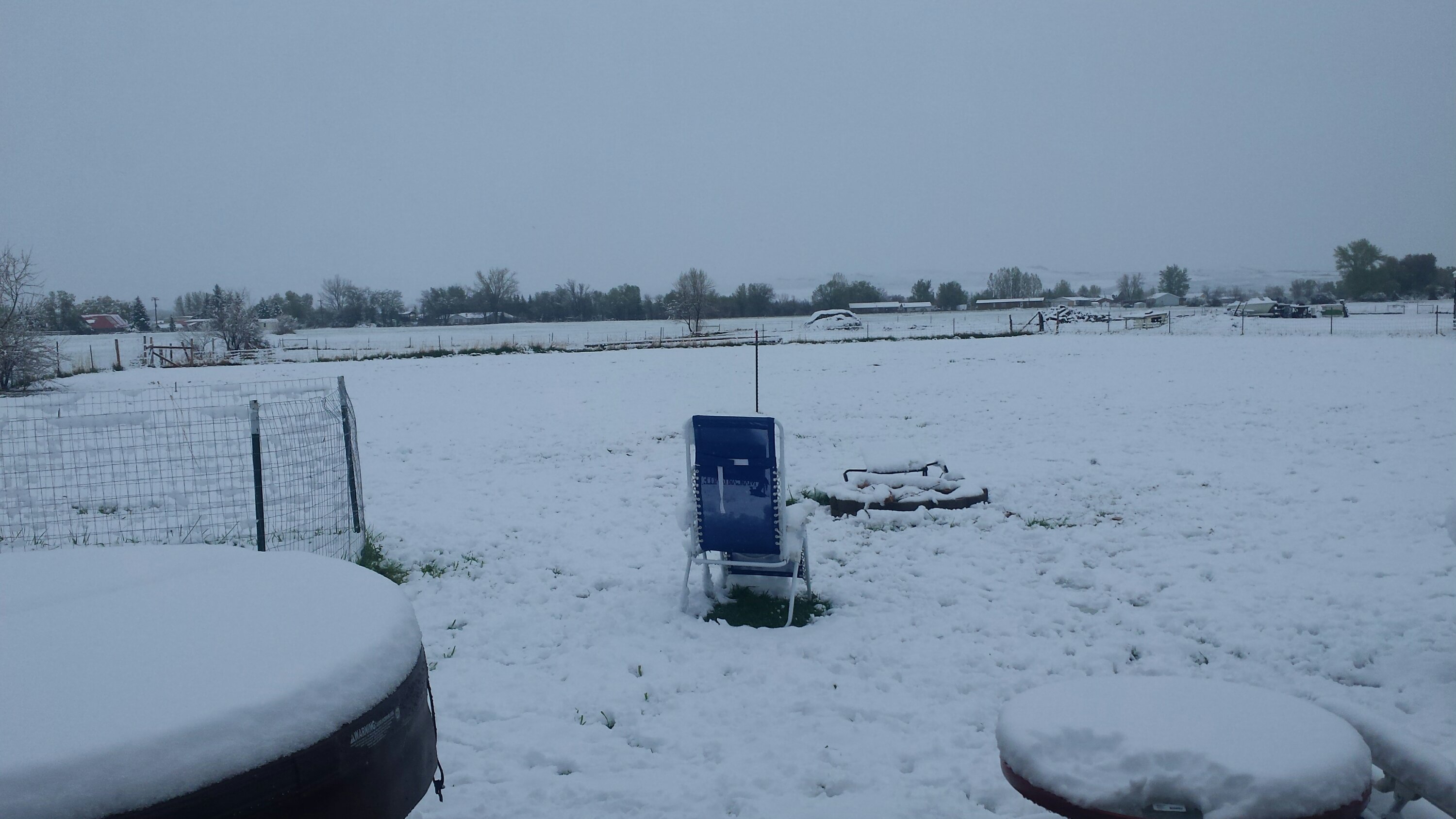
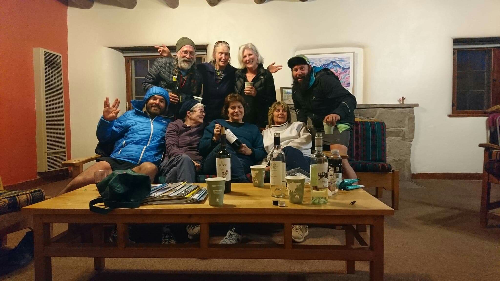
Quick post to confirm that we woke up to 4 inches of accumulation in Cal and Carmela’s yard in Lander and 4 days of steady precipitation forecasted as we move north. It’s simply not the time to hike back into elevation…the Wind River Range is no joke and we’re not out here to put ourselves at unnecessary risk. So, I’m heading home a week early for my planned commitment away from the trail. Impala and I will rent a car this morning and make our way back to Washington. Assuming all goes well, I’ll be back on the trail heading South from Glacier as planned on 6/15 with Mav, my AT trail family brother. Stay tuned and I’ll post again sometime during the interim. Thanks for your support and kind words and my hike will continue soon! Max
Ghost Ranch wine buddies “Thelma & Louise” and crew! Hours later we were en route to Rawlins.
First steps in Wyoming’s Great Basin.
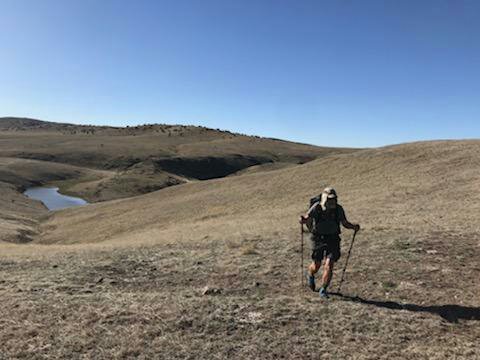
Impala and I hiked north from Rawlins, WY the morning of Mothers’ Day, descending into Atlantic City midday Friday fighting strong headwinds the final 12 miles or so. Some tough sledding toward the end but mostly easy, fun terrain…though not that hard to imagine it being much tougher in hotter months.
Impala on the “ribbon”, dual-track trail we’ve followed most of this stretch.
Walking the Great Basin kept us below 9000 feet and mostly free from snow crossings and precipitation, but the next section northward has us entering the Wind River Range where once again we’ll hike into higher elevation with lots of snowpack. While we’ve been anticipating that, the current forecast is for thunderstorms the next few days in towns and 5-8 inches of new snow in the mountains.
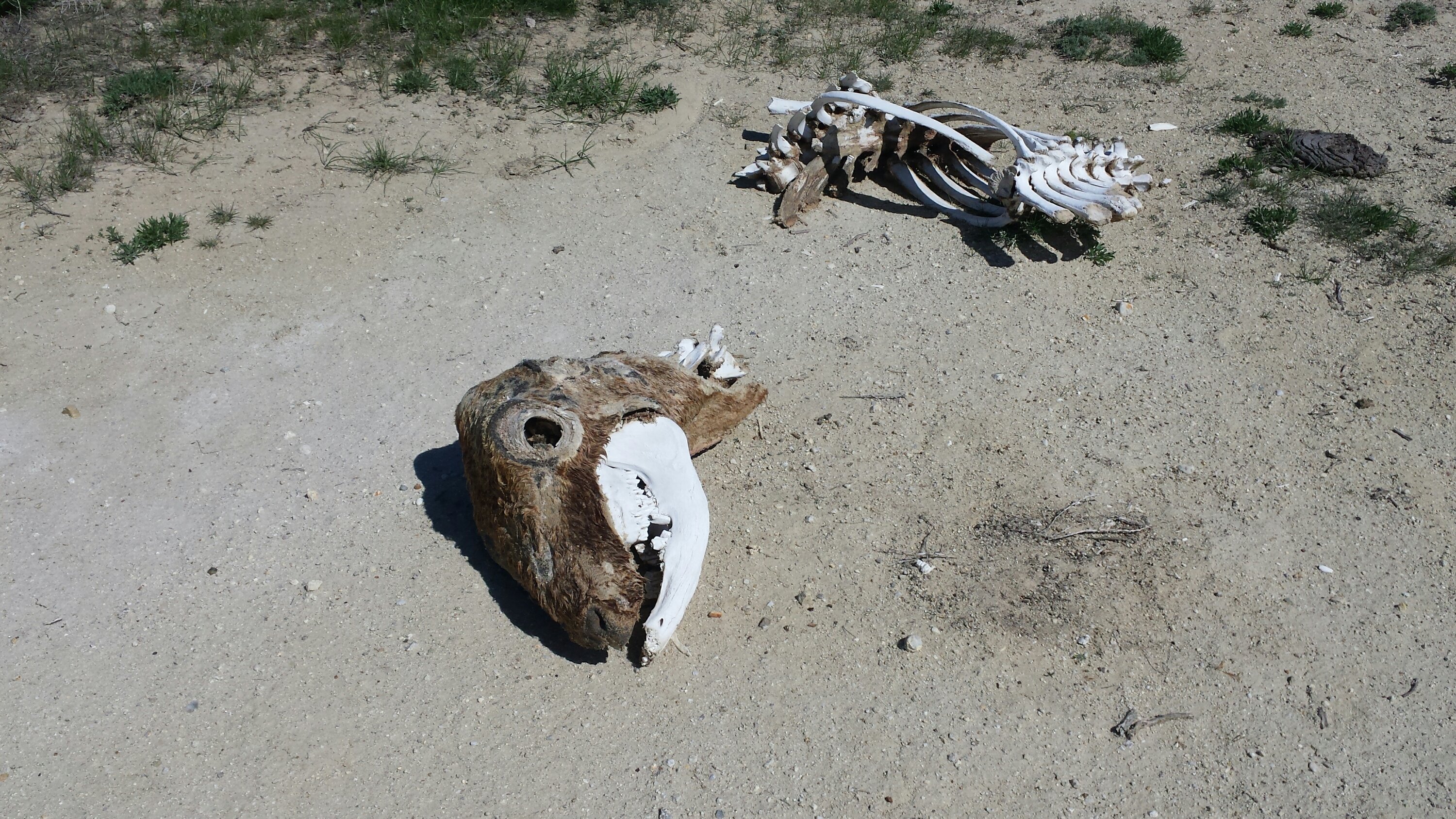
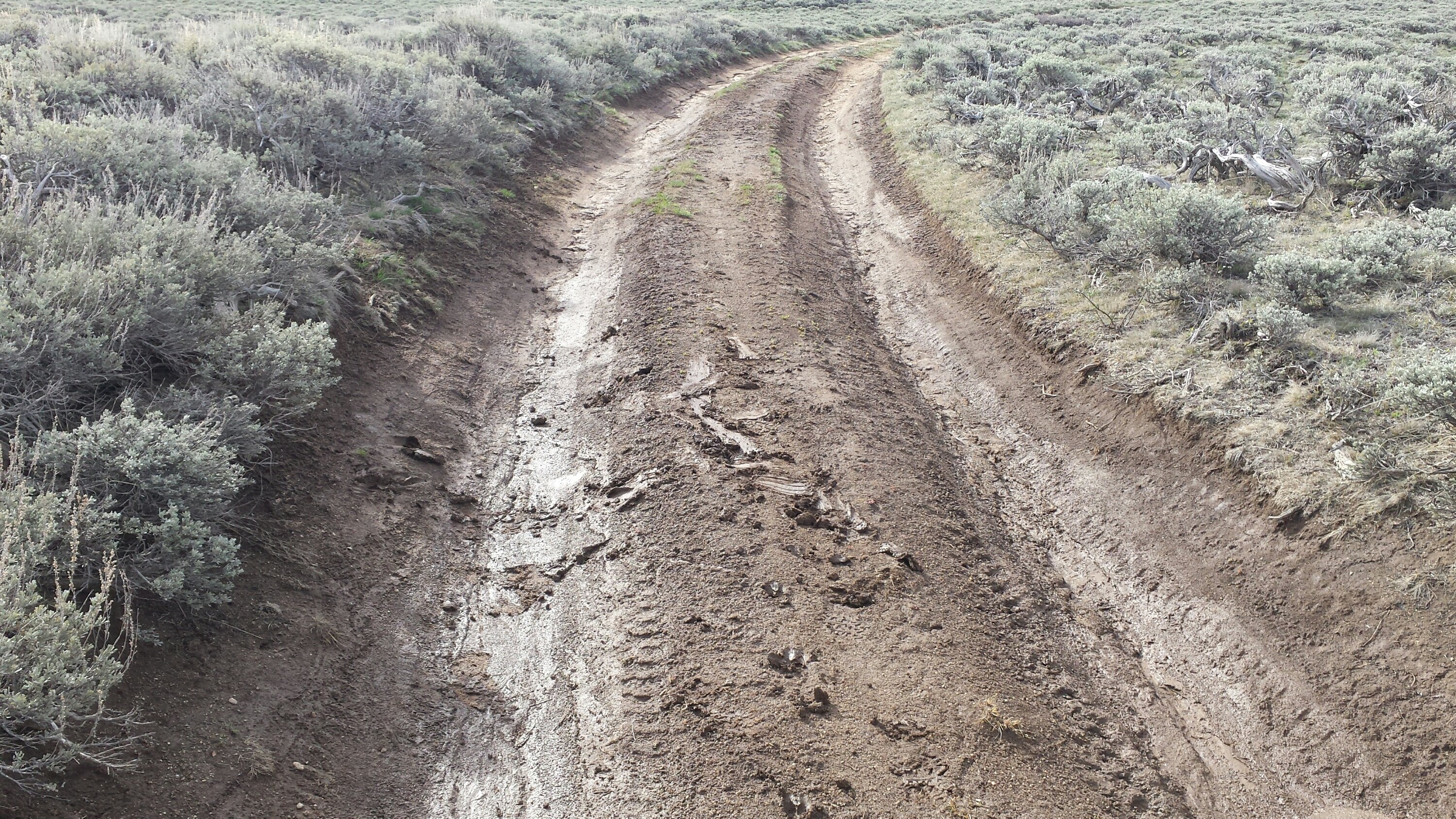
You see a lot of dead stuff on desert trails.
The slip track that ended with me covered in mud.
…and the remnants of the snow bath required to clean myself up.
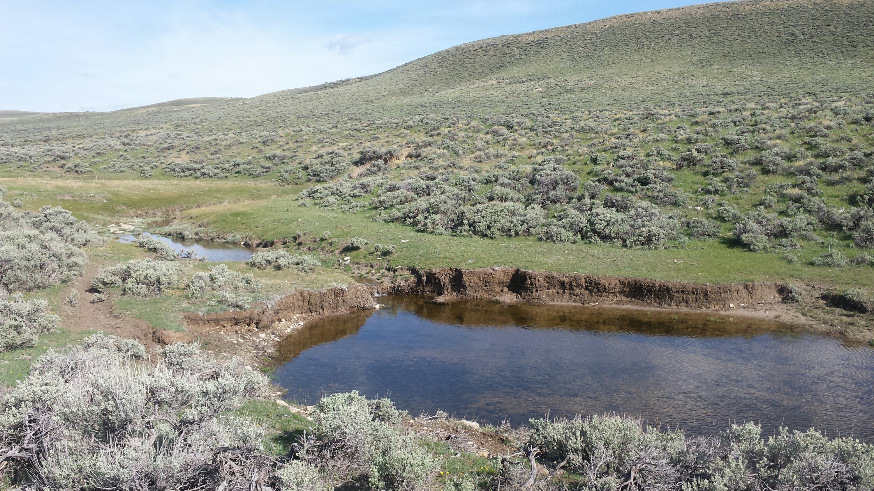
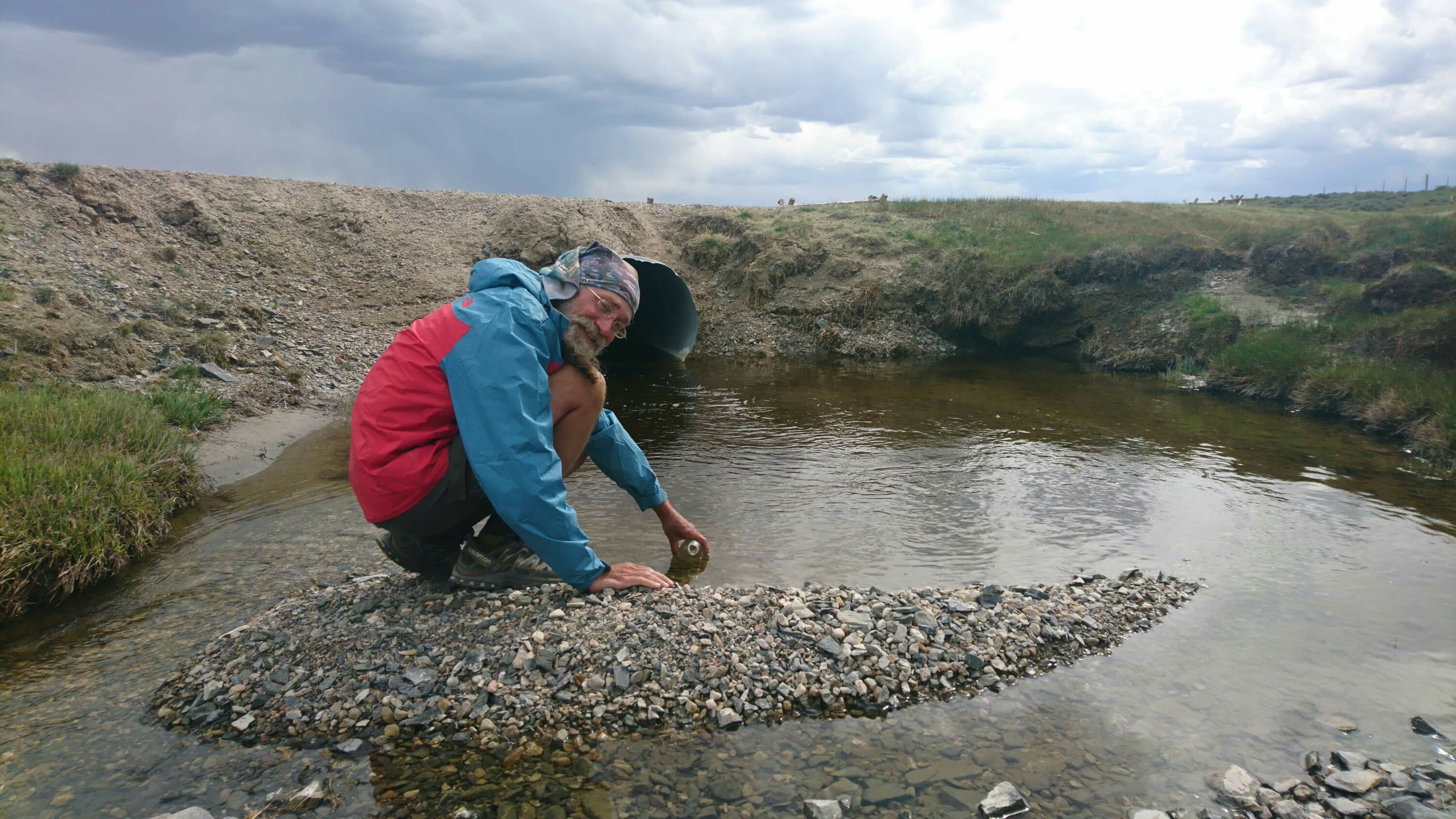
Some water sources are incredibly beautiful.
Some, less so. Yeah, that’s basically a ditch pipe behind me.
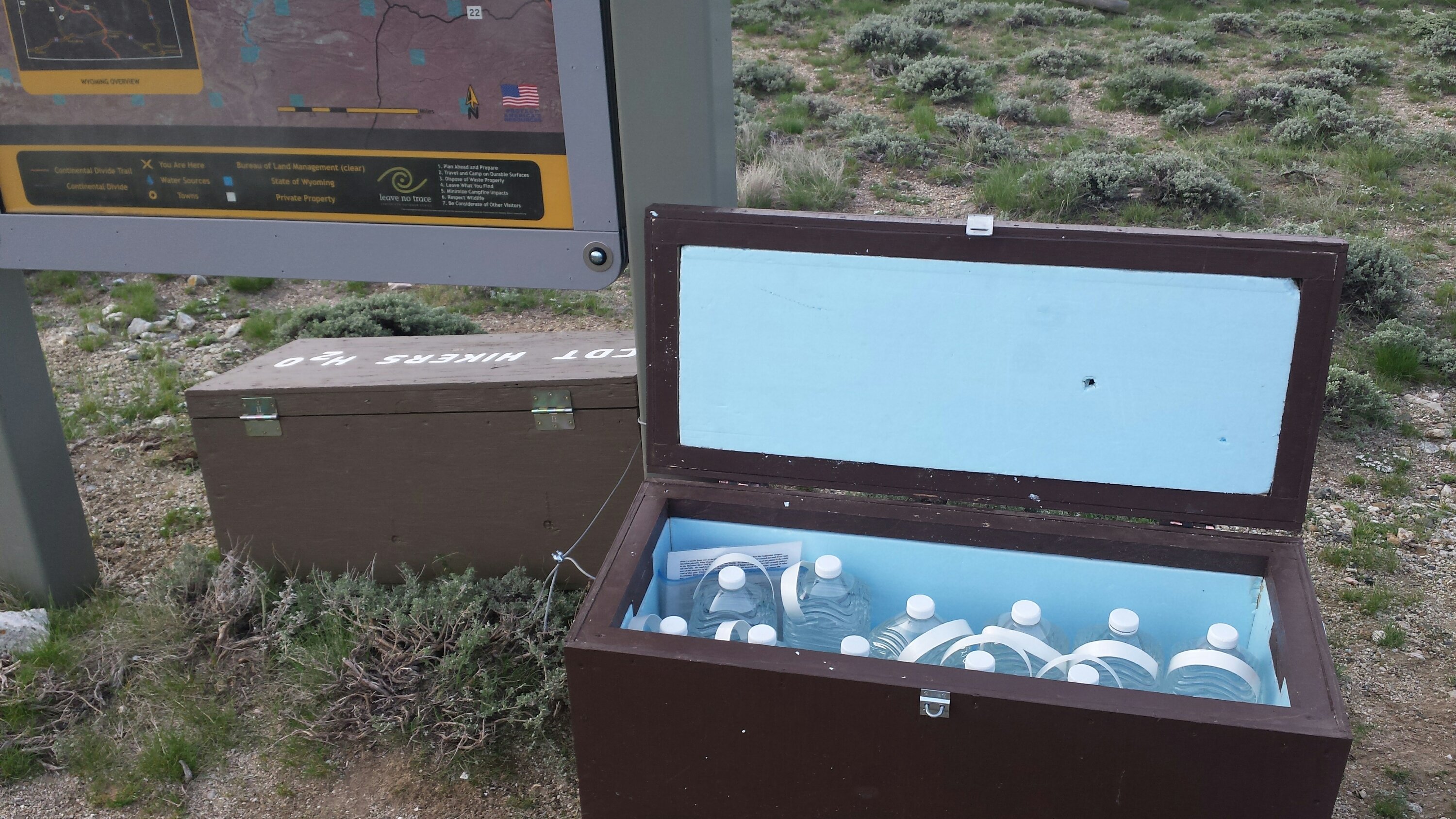
And sometimes, you find a ready-to-drink cache!
Meanwhile, I have an off-trail commitment in another week or so that will take me home to Eastern Washington and then to New Jersey for a few days. I’m hoping to minimize the time away from the trail as much as possible so as not to lose the physical (and mental/psychological) momentum one acquires incrementally through consistent daily hiking.
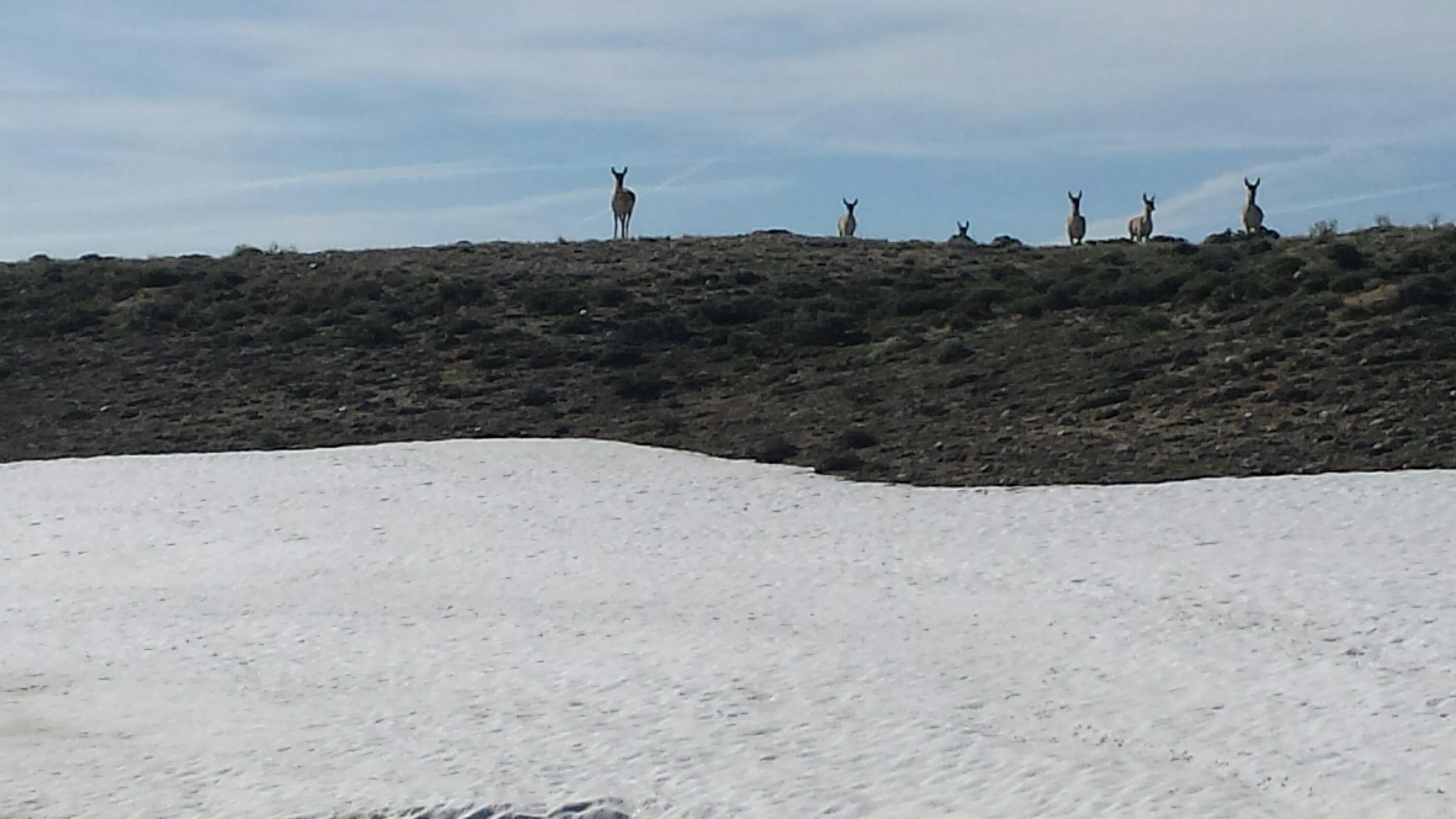
Pronghorn antelope checking me out from above a snow-covered reservoir.
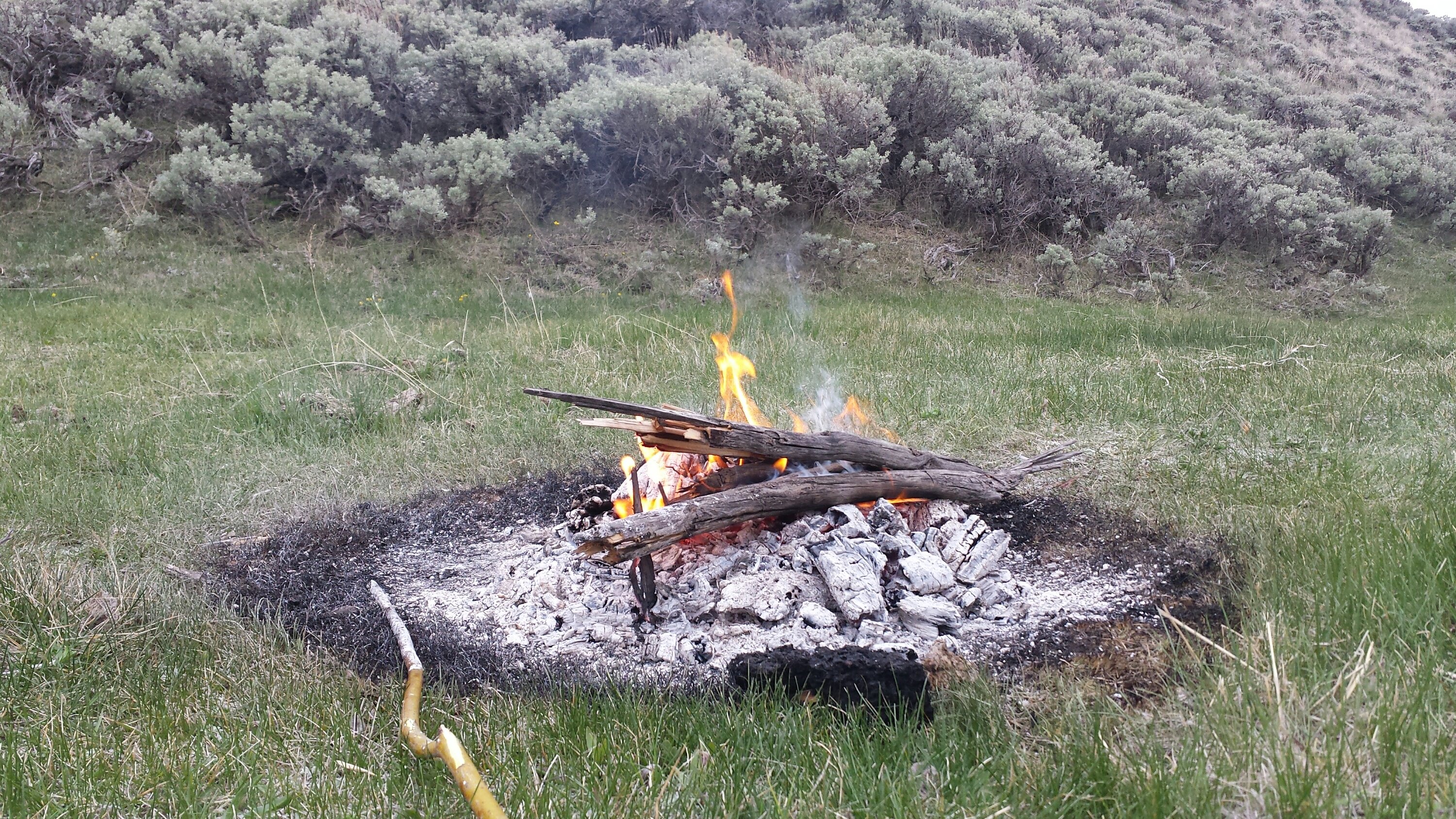
Keeping Hammer’s tradition alive with nightly campfires has been a highlight of each day.
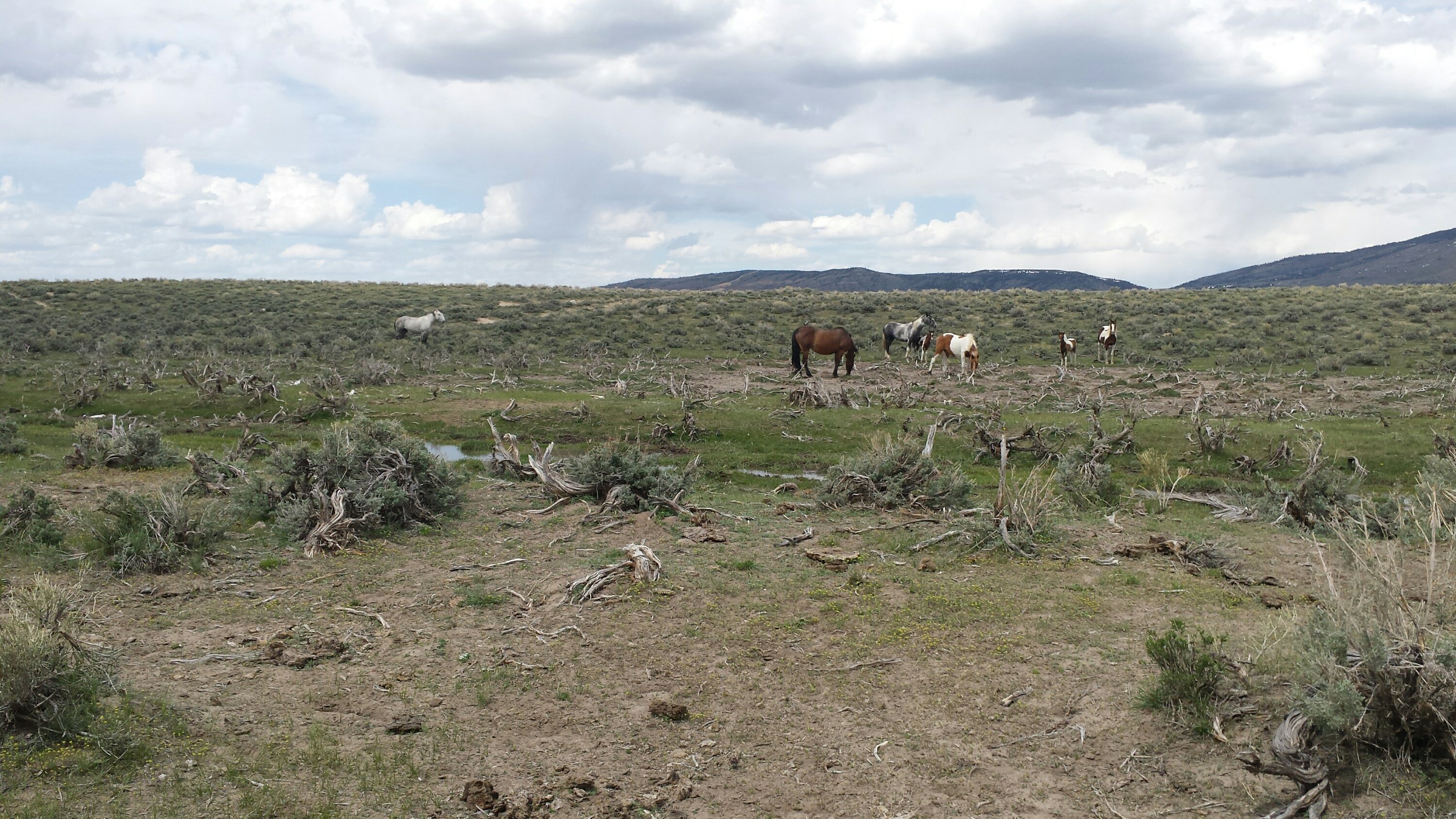
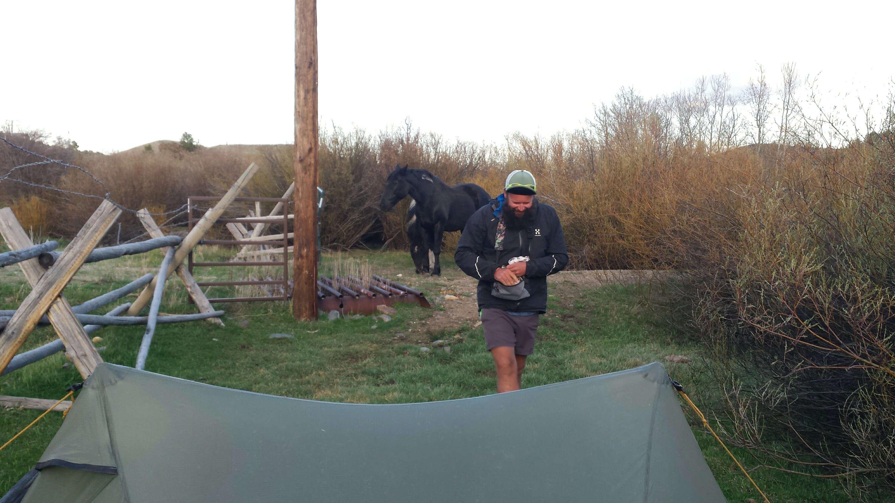
Wild horses roam free here…incredible!
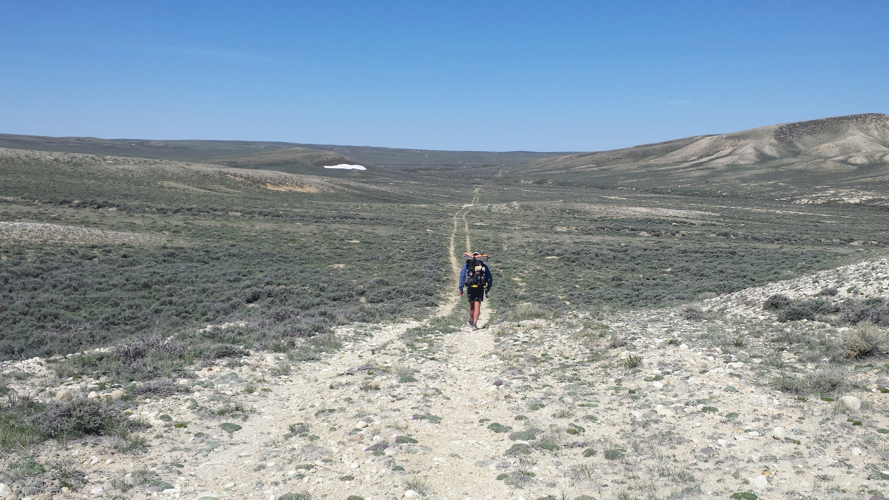
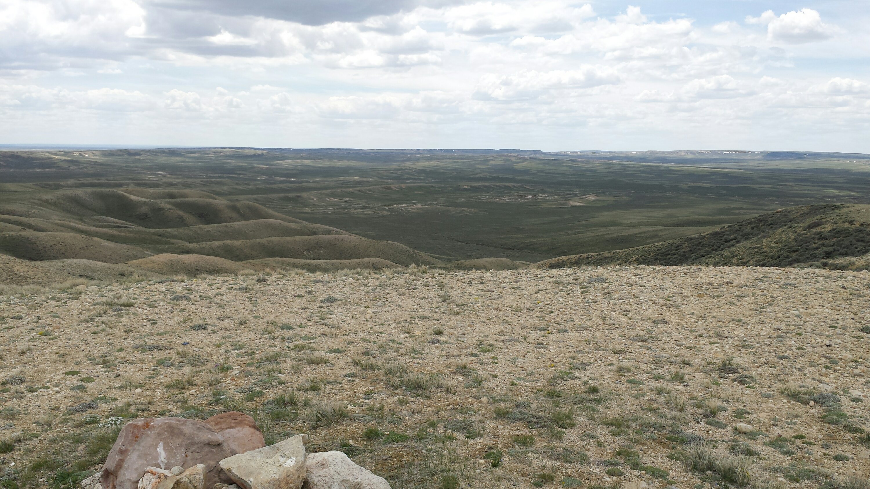
Views that seem to never end in the Great Basin.
That brings us to this morning, the Sunday after mother’s day. I woke up under a heavy pile of warm blankets in the beautiful home of some new friends we met yesterday who live in a former Anglican Church in Lander, Wyoming, which they renovated/converted in the past few years.
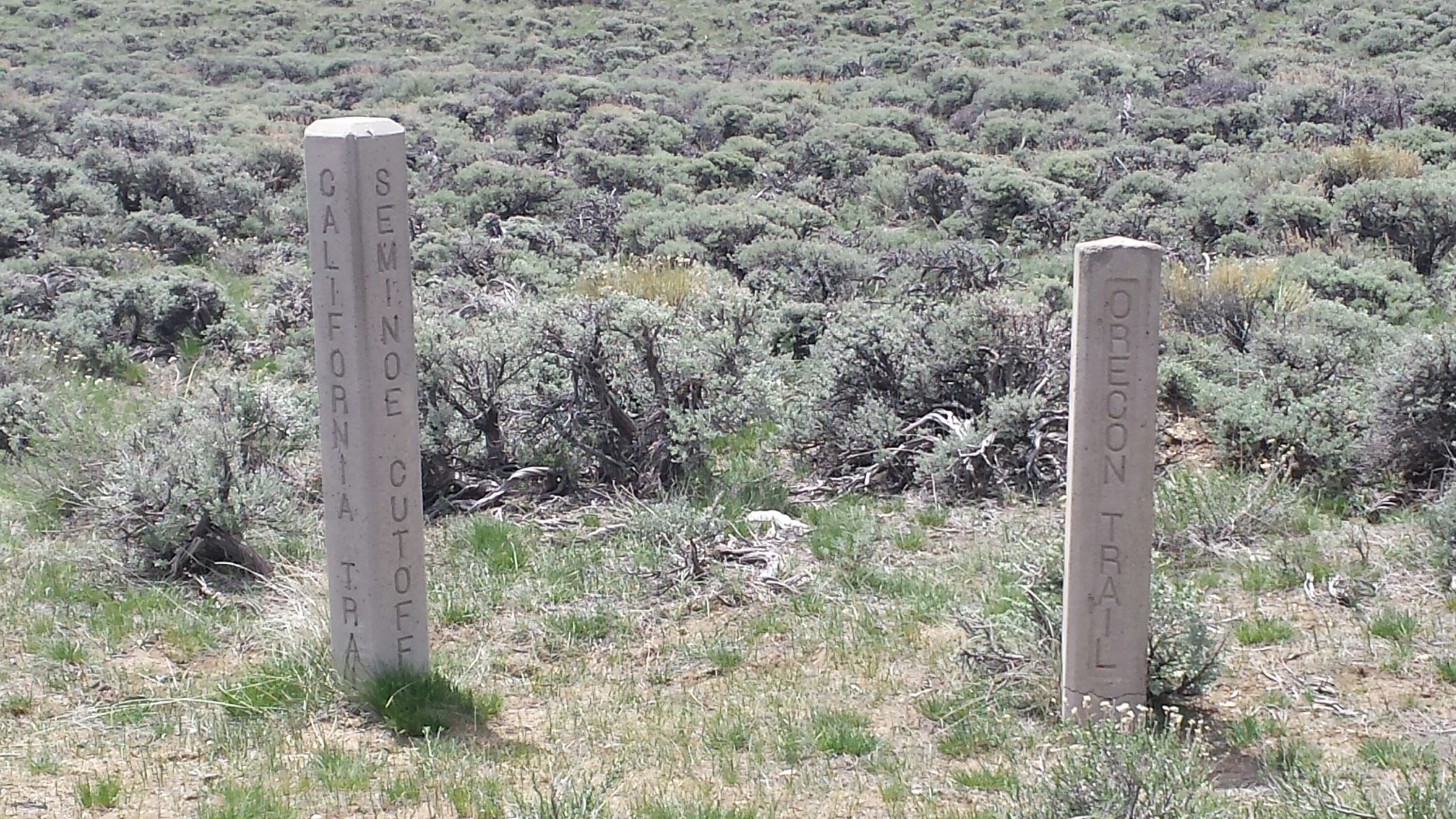
Per the post on the right, the CDT in parts of this section is concurrent with the old Oregon trail.
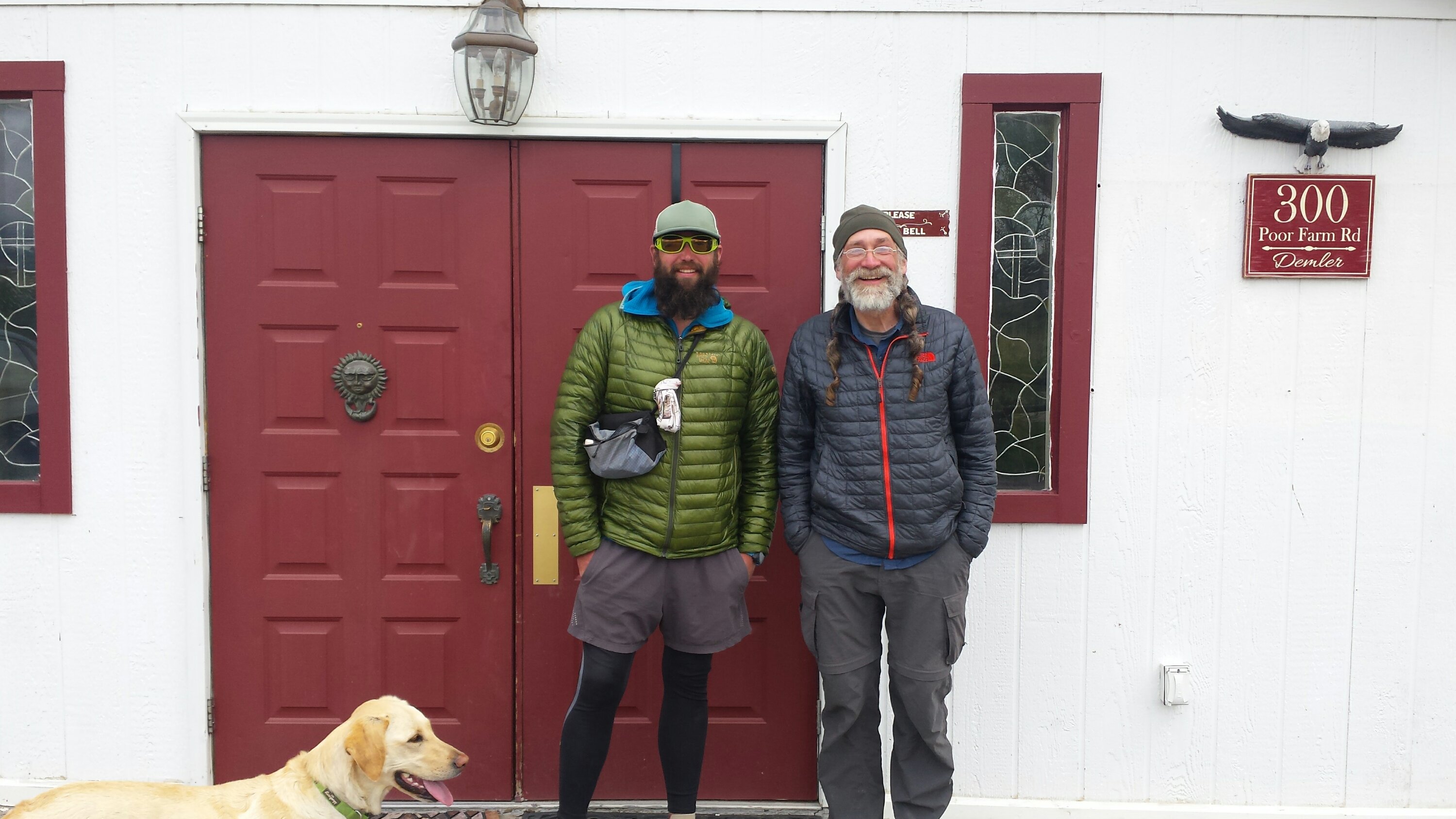
Impala and me in front of the church of Cal and Carmela! Photobomb by Hebe.
Getting to know Carmela and Calvin has already become one of those incredible “we’ll never forget” stories from this hike.
Great omen on the wall of the Miner’s Grubstake
Jumping back to Friday to fill in the details, we camped that evening in Atlantic City after gorging ourselves on burgers for lunch at the Mercantile, a place that’s been around for nearly 150 years. Next door to that is the Miner’s Grubstake, the other food and drink spot in town, where we had supper and where the story really takes off.
L-R: Impala, Rebecca (Atlantic City resident) and Lucille, a French woman road biking the CDT.
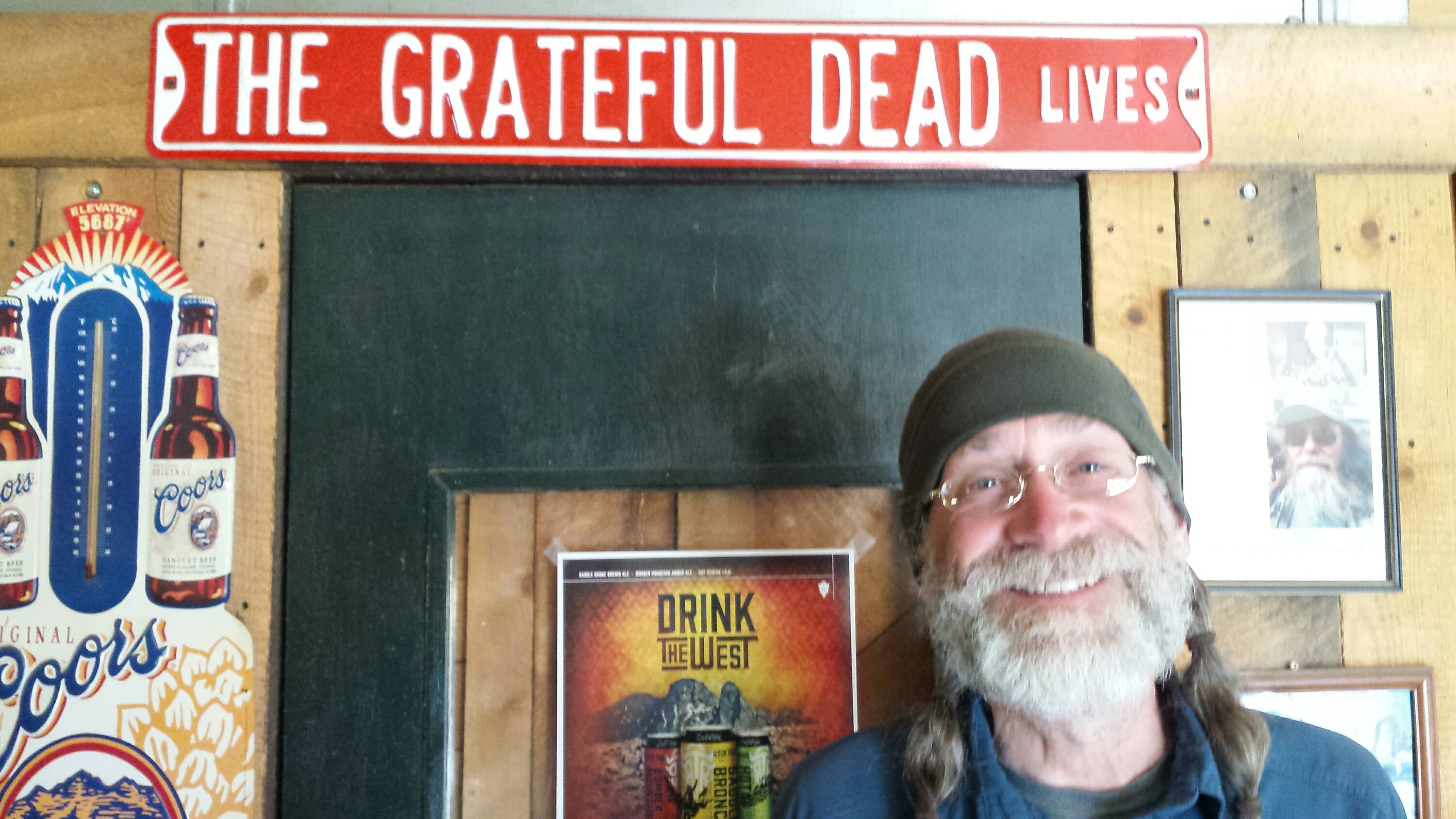
Impala and I sat in a window seat in a second dining room while the main room filled up with patrons anticipating live music. Owners Laurel and Dale had made a point of telling me they thought I’d really enjoy the show and before long two young hippies (one on guitar/dobro/harmonica and the other on piano/violin) were playing a selection of lively originals and atypical covers of Neil Young, the Grateful Dead, Bob Dylan and other of my favorite music.
Horses following Impala behind my tent.
I jumped back and forth between our table and the main room, cheering on the players, more loudly with each Dead tune they played. It was an unexpected treat and by the time we hiked back down to our tents we were warm, fed and content. Several horses kept us company, huffing and stomping lightly outside my tent like they didn’t want us to go to sleep.
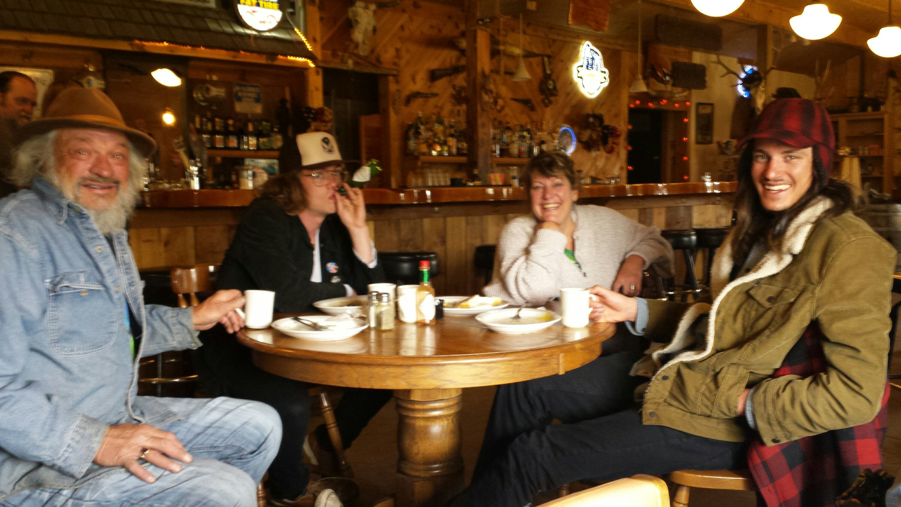
Uber trail-angels, fellow Deadheads and all around incredible hosts Calvin and Carmela with musicians Shane (between them) and Nick their son (far right).
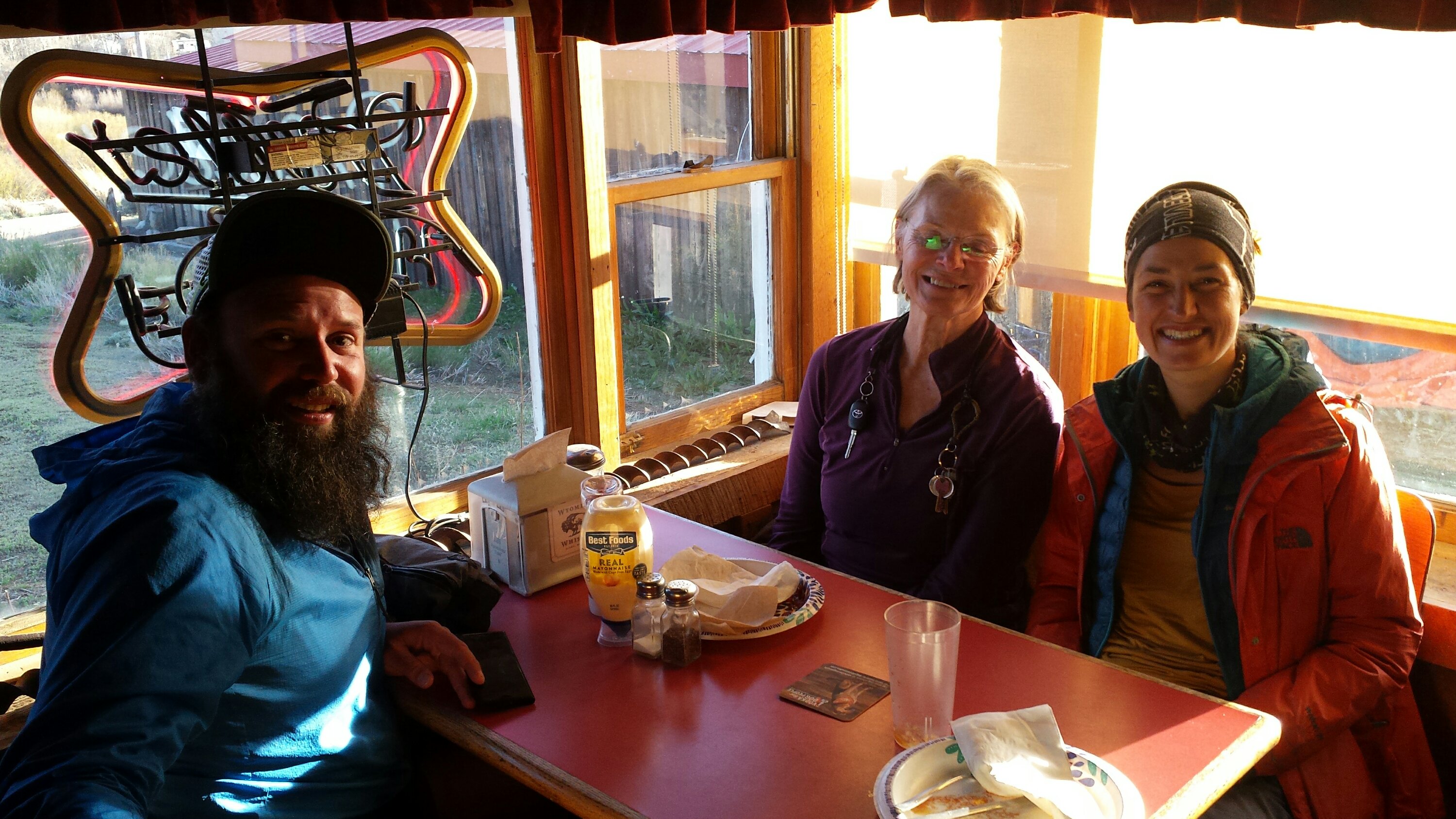
We woke to a thick coating of ice on our tents and broke camp quickly to head back to the Grubstake for a hot breakfast before setting off for the 36 mile hitchhike along highway 28 to our resupply point in Lander, WY. As we were waiting for our pancakes, a couple in tie-dyes that appeared to be my age sat next to us and we got to chatting. Cal and Carmela- it turned out- were the parents of the lanky guitar player from the previous evening. They had driven up from Lander for the show. They are lifelong Deadheads and we quickly discovered we’ve been to some of the same shows together over the years! Not only did they offer us the ride we were seeking to Lander, they invited us to stay as guests in their home (from where I’m writing this), handed us the keys to one of their cars which we used to do our food resupply and visit a local outdoor shop for some gear items. Then it was back to their home to play with their dogs for a bit before a delicious dinner of smoked ribs, garlic bread, fresh salad and Bananas Foster! We followed that up with a relaxing sit in their hot tub before bed.
Impala, Cal and Carmela near the Middle Fork Popo Agie river.
We’re staying a second night with them to let the worst of the snow fall before resuming hiking tomorrow (Monday 5/20). They even took us hiking locally this morning and Cal is driving us back to the trail in the morning! Yep, we’ve been getting the royal treatment.
I’ve commented on amazing incidents of trail magic before, but meeting Cal, Carmela, Nick (their son) and Shane and seeing their kindness and generousity has to rank as one of the best and most inspiring occurrences I’ve experienced during any hike. They are truly “trail angels” in all the best ways.
The Sinks, Wyoming. Water dissappears into this mountain crevasse, re-emerging a quarter mile down the mountain after traversing and unknown/unseen path.
As for the details of miles walking the Great Basin, I’ll let the photos (such as they are) tell the rest of this chapter of the hike, but I need to say that I’ll never see Wyoming the same way again. I absolutely love this state and it’s big spaces and relatively few humans.
Finally, with only a week (or so) before I leave the trail for a week (or so), I’m looking back at some great memories on the CDT thus far. I’m not sure where I’ll be when I post next, but I bet there will be another story! Cheers, Max.
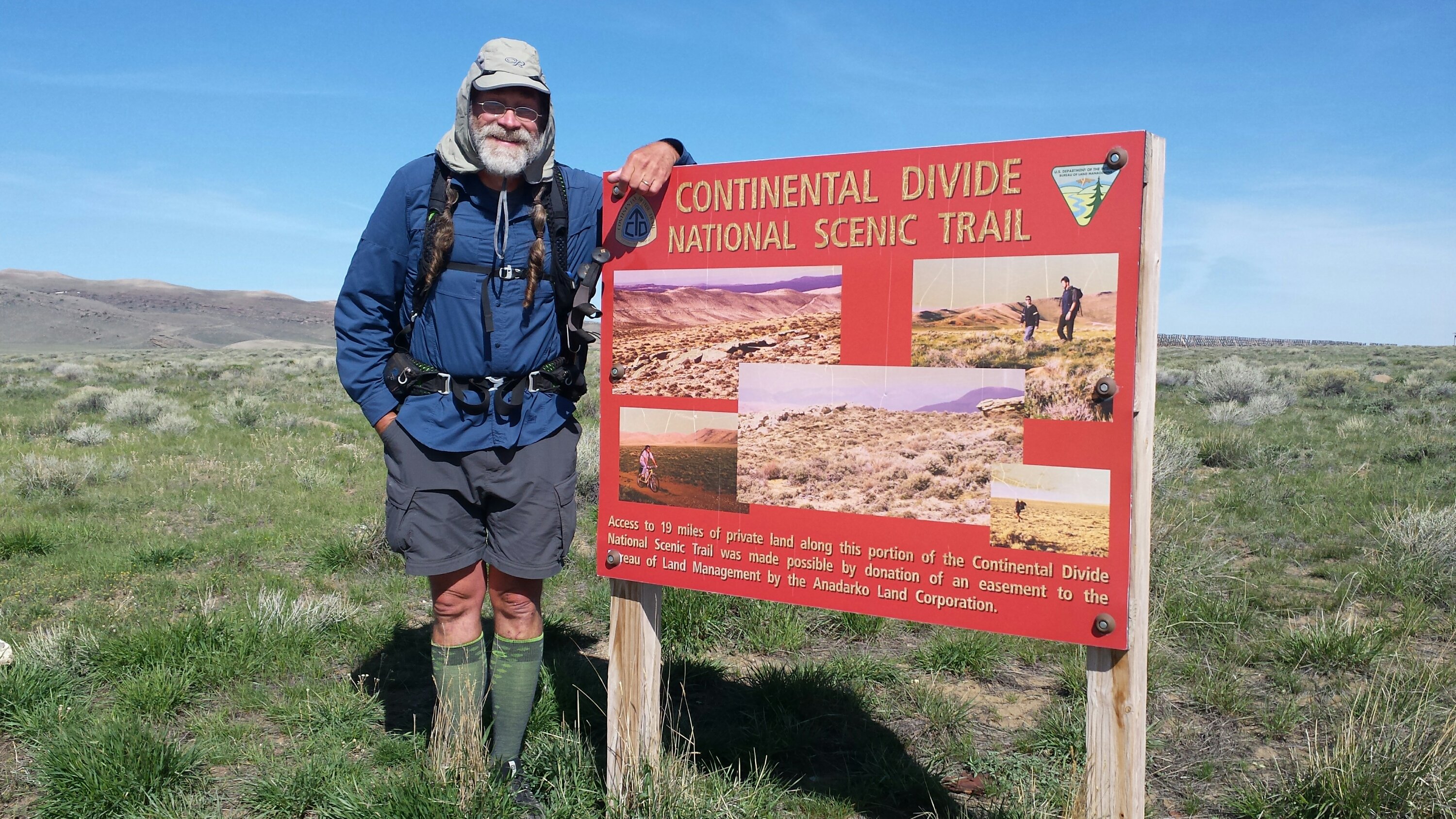
I ended my last entry with the comment: “Unless something goes wrong, my next post should be after I’ve crossed into Colorado…” Rather, I’m writing from Rawlins, Wyoming where my hike resumes tomorrow morning in Wyoming’s Great Basin, another section of the CDT.
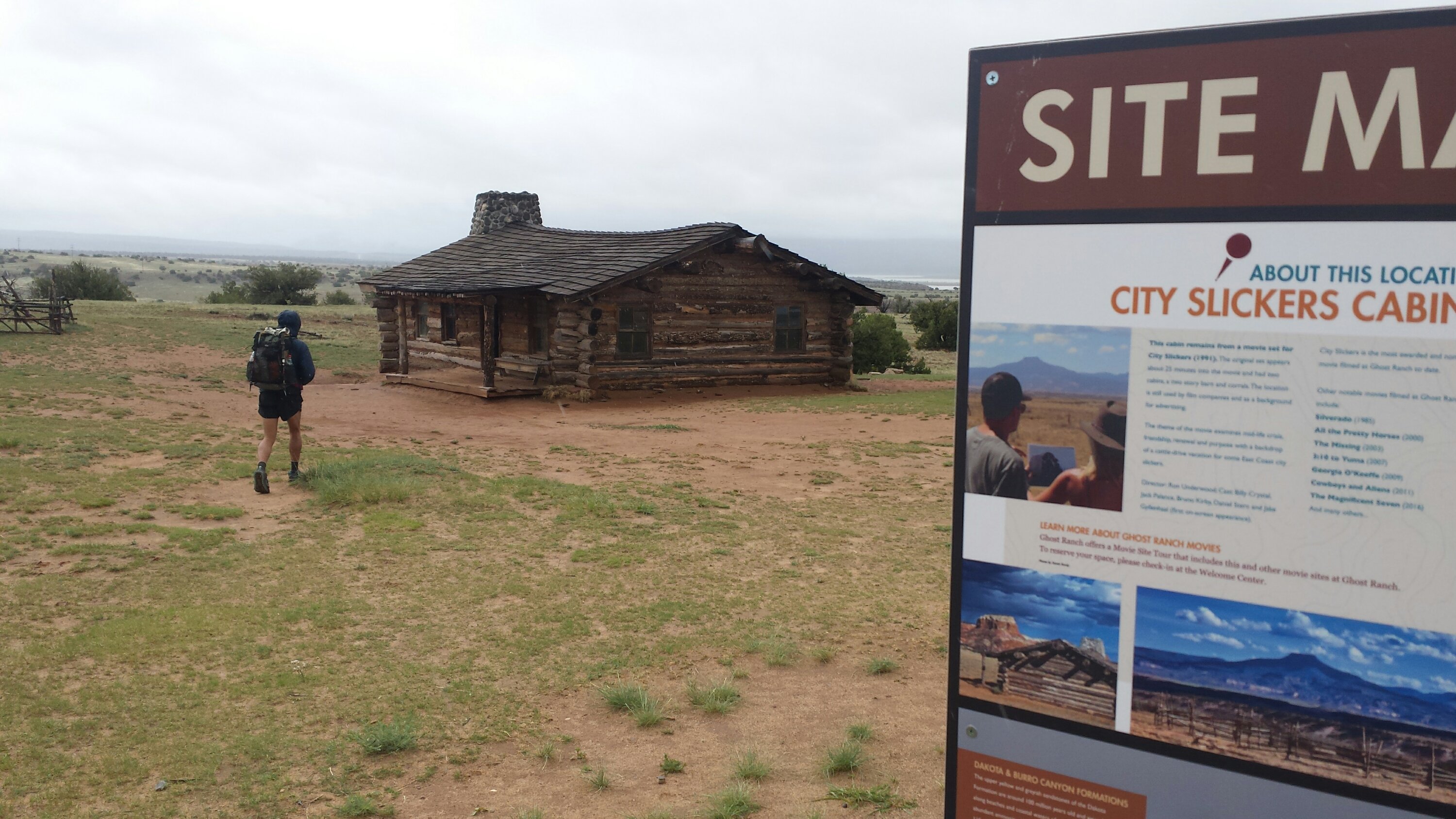
The cabin from “City Slickers”, one of many films made at Ghost Ranch.
After arriving at Ghost Ranch, we learned that the snow conditions in Colorado were simply not ready yet for hiking and won’t be for some time. Rather than suspending the hike or bypassing incredible places like the San Juan mountains, we decided to hike “out of sequence” and have jumped ahead.
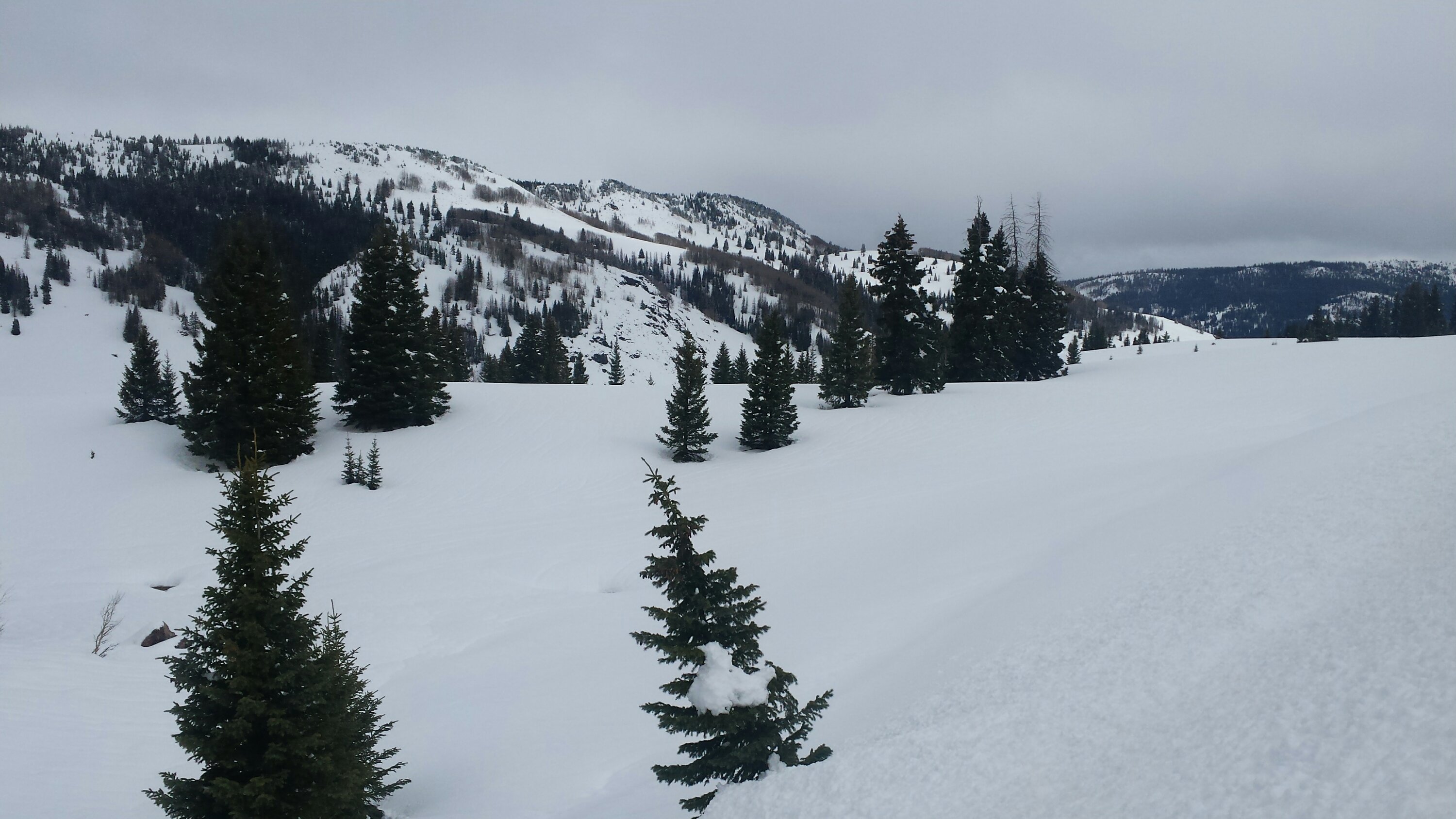
This is the snowy scene we saw all along the Colorado CDT
Going north to avoid snow sounds counterintuitive, but the section we’ll begin hiking tomorrow is largely at lower elevation and thus has less snow to contend with. My commitment to complete the entire trail this season is unchanged, but I’ll have to settle for doing it in a bit of zig zag fashion.
Rawlins Road trip along the Continental Divide
No other updates to report for now. Will post again in 5-6 days or so. Cheers, Max.
This will be a brief post as its only been a few days since my last and I’m working against a limited time window on the Ghost Ranch library computer.
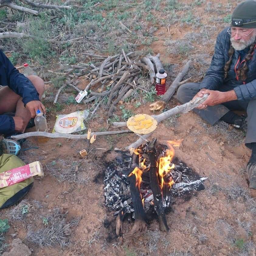
Flatbread and cheese toasted over a fire. I was focused.
The walk out of Cuba was a slow, steady climb up to a plateau at about 10,500 feet. We knew to expect snow up there and we found plenty.
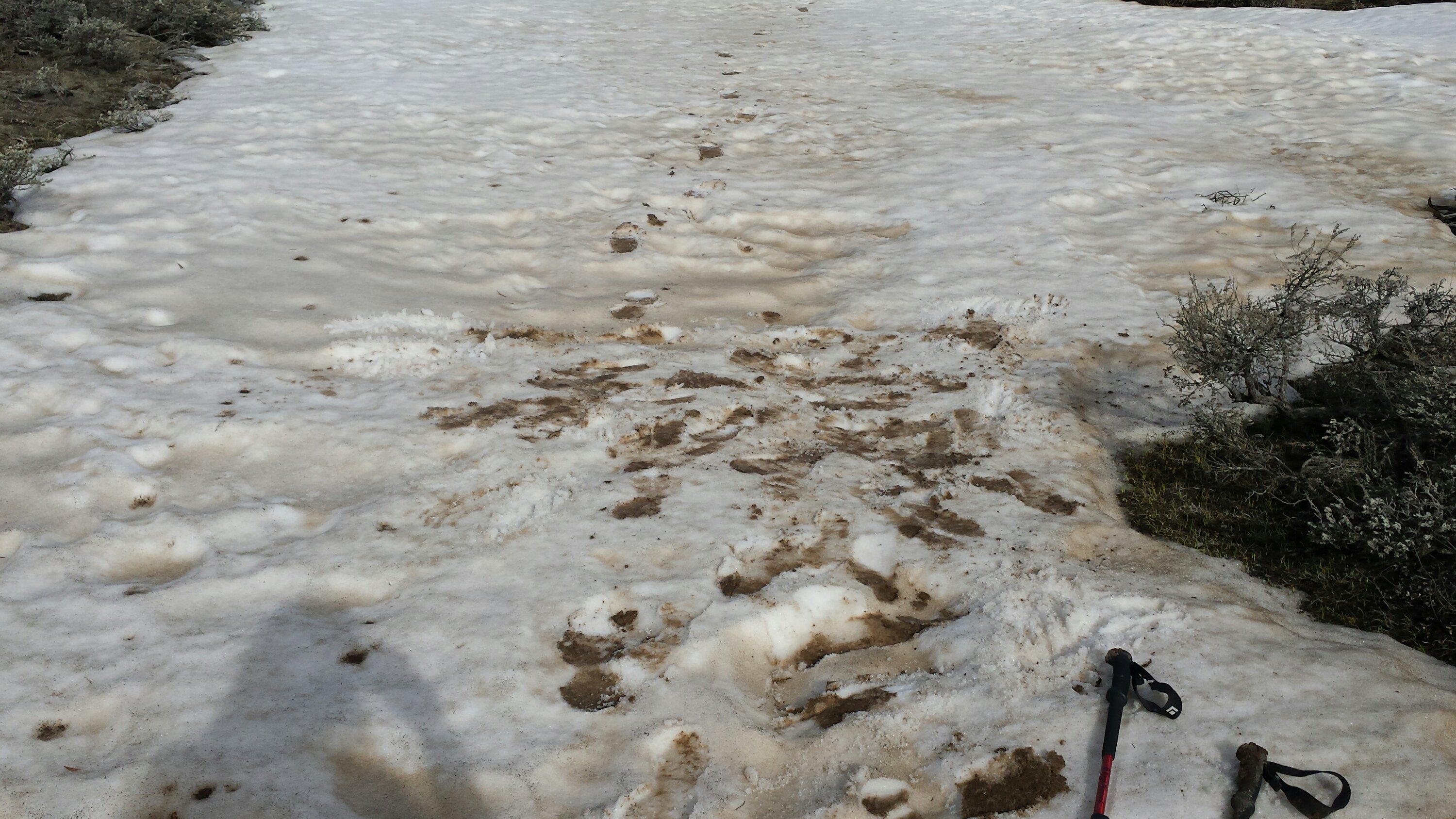
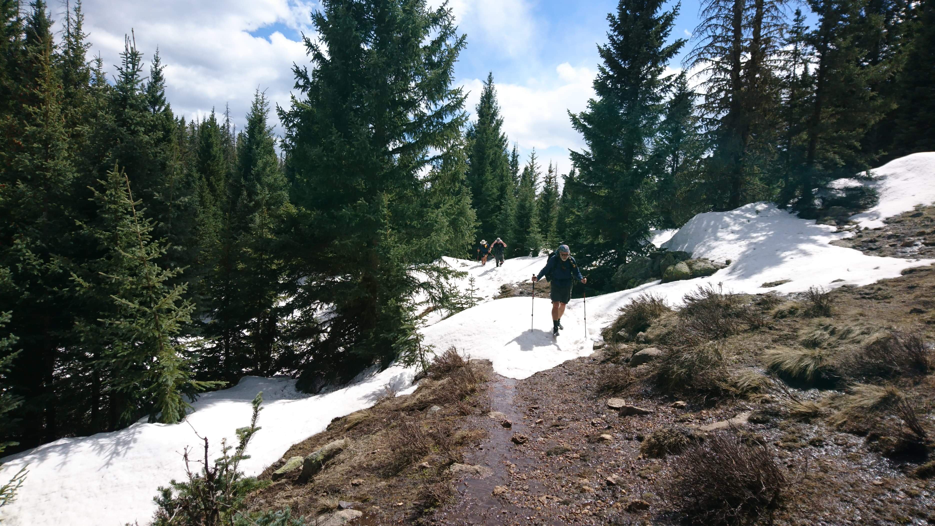
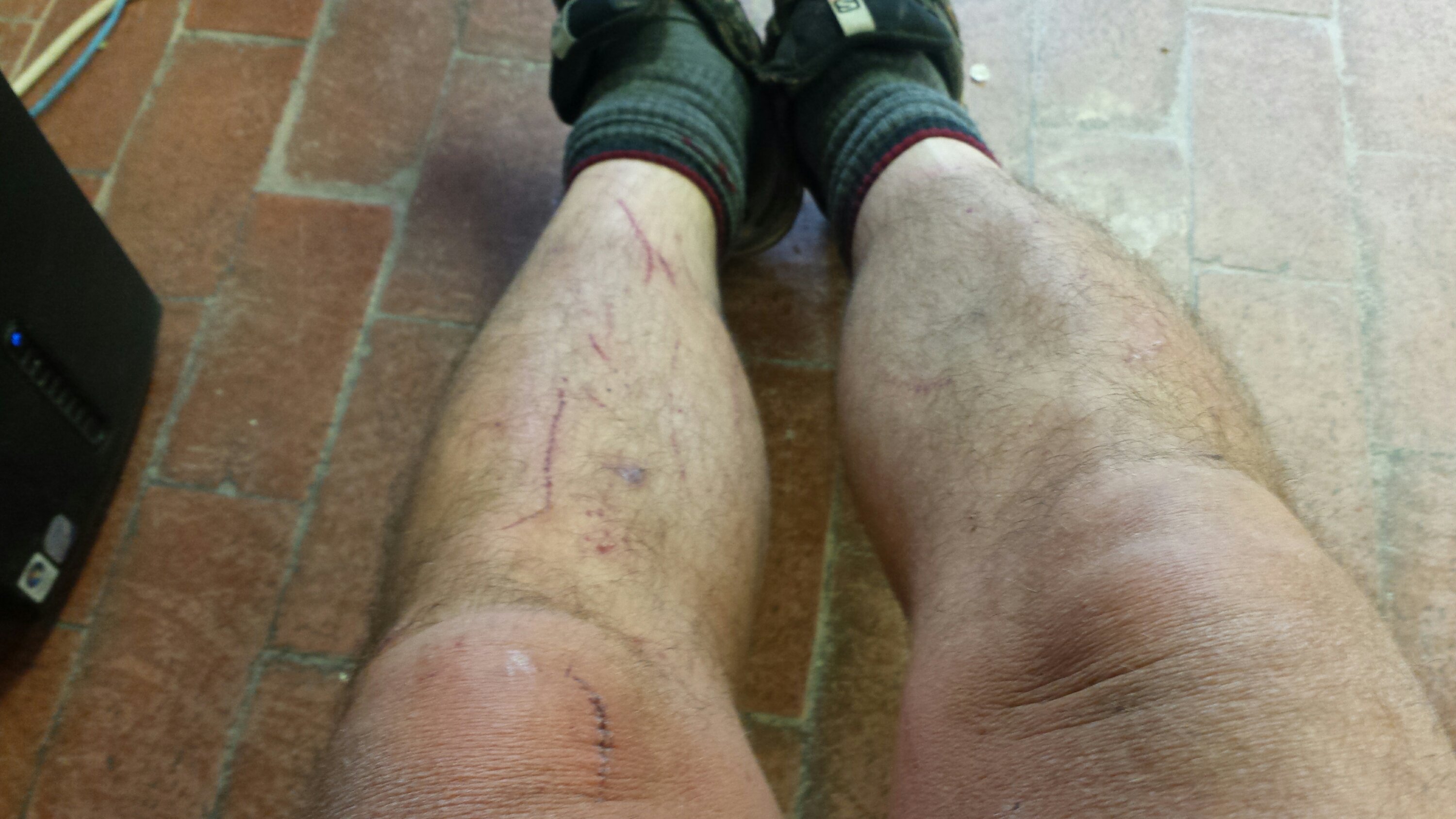
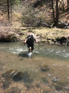
Impala crossing a shallow snow field north of Cuba.Trail again! Descending out of the deep snow. Scratches from post-holing in deep snow
We spent the next 4-5 hours post-holing in knee-to-waist deep snow, punctuated by several crossings of snow-melt mini streams of icy slush that went up to the bottoms of my pants pockets. You’d step in and your feet would go numb immediately. I’ve never done a polar plunge but I suspect its similar. Then you step up the other side of the little stream and resume post-holing in deep snow, only now the snow feels warm to your bare, frozen legs. Hammer got some good video of post-holing and the slush crossings, so I’ll try to post that later.
Two guys with whom I really enjoying hiking: Hammer (Virginia) and Impala (Yorkshire, UK). Impala and Hammer just before arriving at Ghost Ranch.
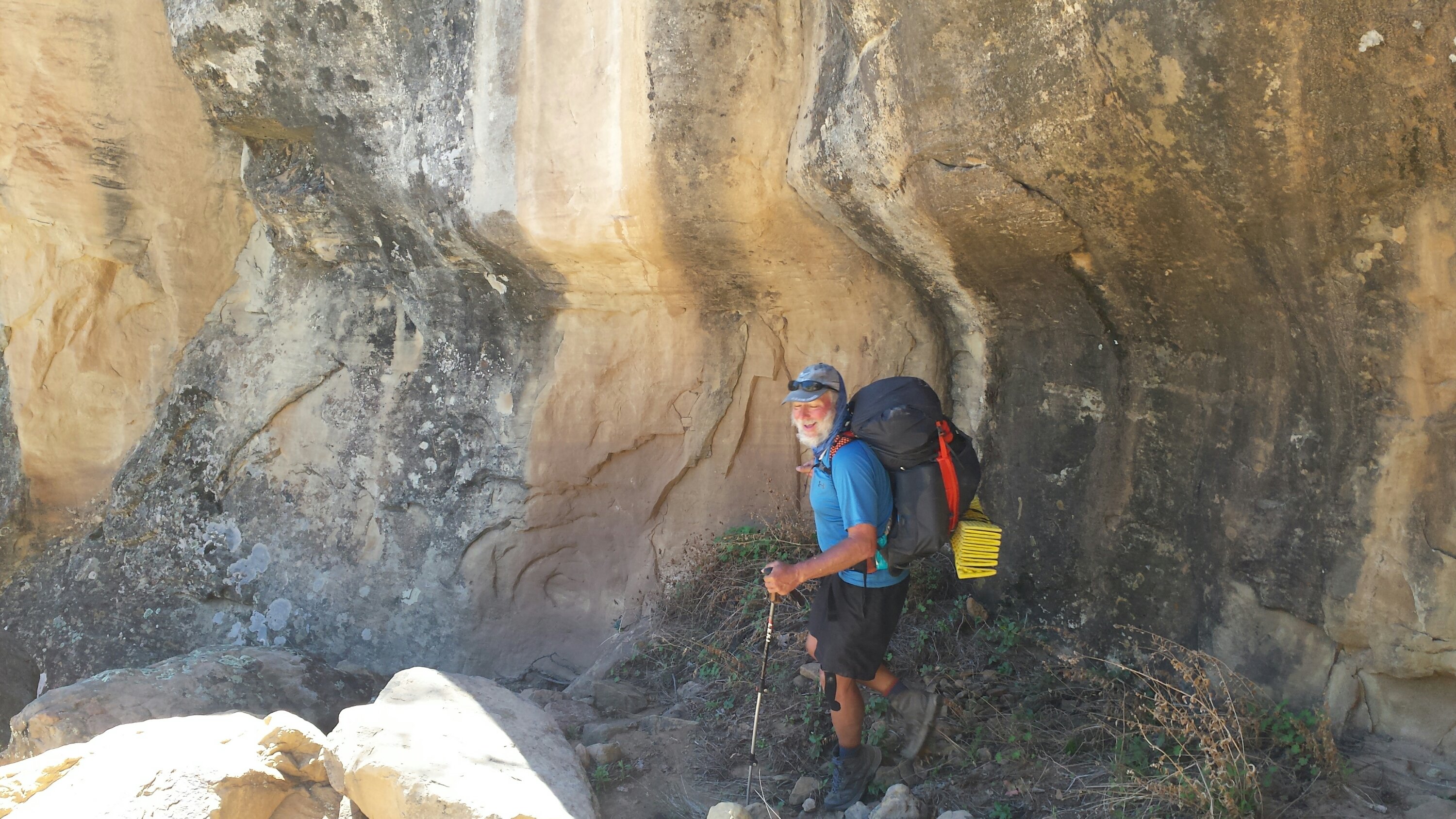
Speaking of that, I’ve hit it off very well with the two hikers I met in Cuba- Hammer (from Virginia) and Impala (a Brit from Yorkshire). They’ve both hiked the AT and Impala has also done the PCT, the Te Araroa trail in New Zealand and others. They’re great hikers and fine companions and I’m glad to have connected with them both.
I should say a few words about Ghost Ranch, beyond the fact that when we rolled in this morning cold, wet and hungry, we sat down to a magnificent breakfast feast. I spent time earlier today going through the history tour of the place, and will visit the museum after I’ve had my shower but its no wonder why it has been such an inspiration to so many as it surrounded by incredible landscapes on every side. We get to check in to the room soon and will also have breakfast here again in the morning before heading out.
Surrounded by colorful mesas.Mesa near Ghost Ranch.The day after 4-5 hours of postholing in knee deep snow we got 27 miles of mostly wonderful, peaceful trail to walk.
Speaking of which, there is a winter storm warning in the surrounding mountains through tonight, with 10-20 inches of possible new snow (at higher elevations). We’re back into the 10,000 foot range again tomorrow so fingers crossed on that snow, but luckily I just got the micro spikes Wendy sent from home so they should come in handy for this next stretch.
Me crossing a bridge leaving a very muddy wake.Pre-dawn hiking after packing away tents wet.
Unless something goes wrong, my next post should be after I’ve crossed into Colorado, approximately 5-6 days from tomorrow. Cheers and thanks for reading! Max
Welcome to the world, it’s not all I’d have given you. Just shining pieces of a dream, that almost coulda been… And still might yet come true.(J. Barlow, A. Pessis).
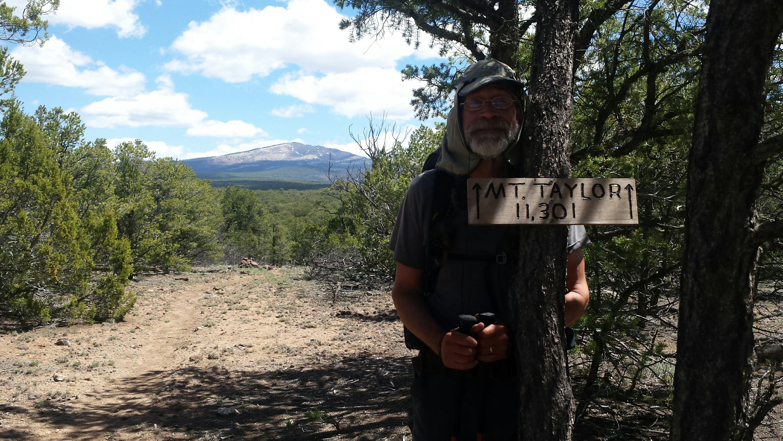
Mount Taylor: approach (Taylor in background)
That touchingly somber- but ultimately hopeful- song has been playing often in my mind’s soundtrack during this stretch of days. I’m not sure what sentiment my subconscious is suggesting, but those lines definitely resonate. Perhaps its because I haven’t yet reached the level of passion toward the CDT that I felt from the first mile on the Appalachian Trail.
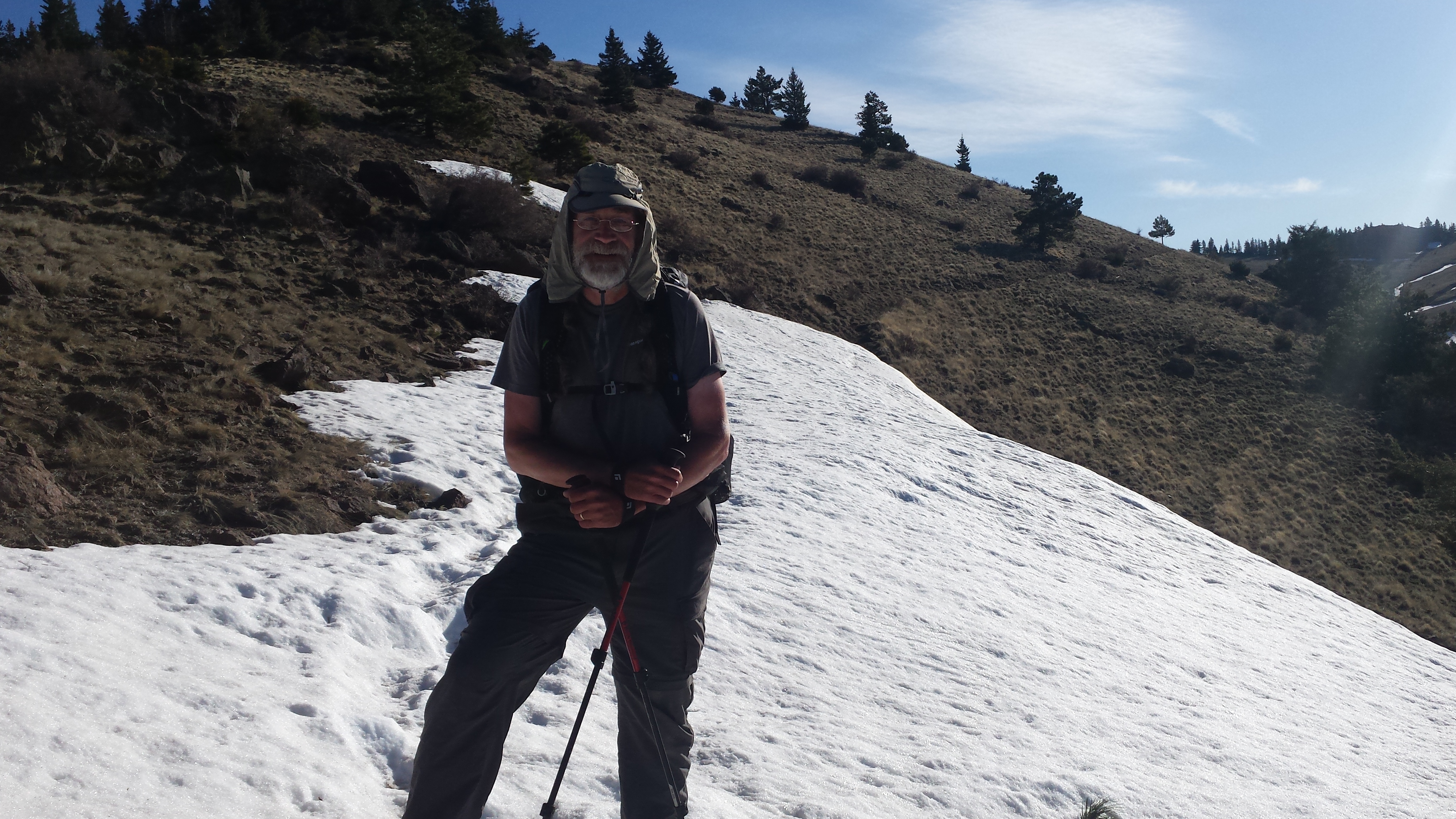
Mount Taylor: ascent
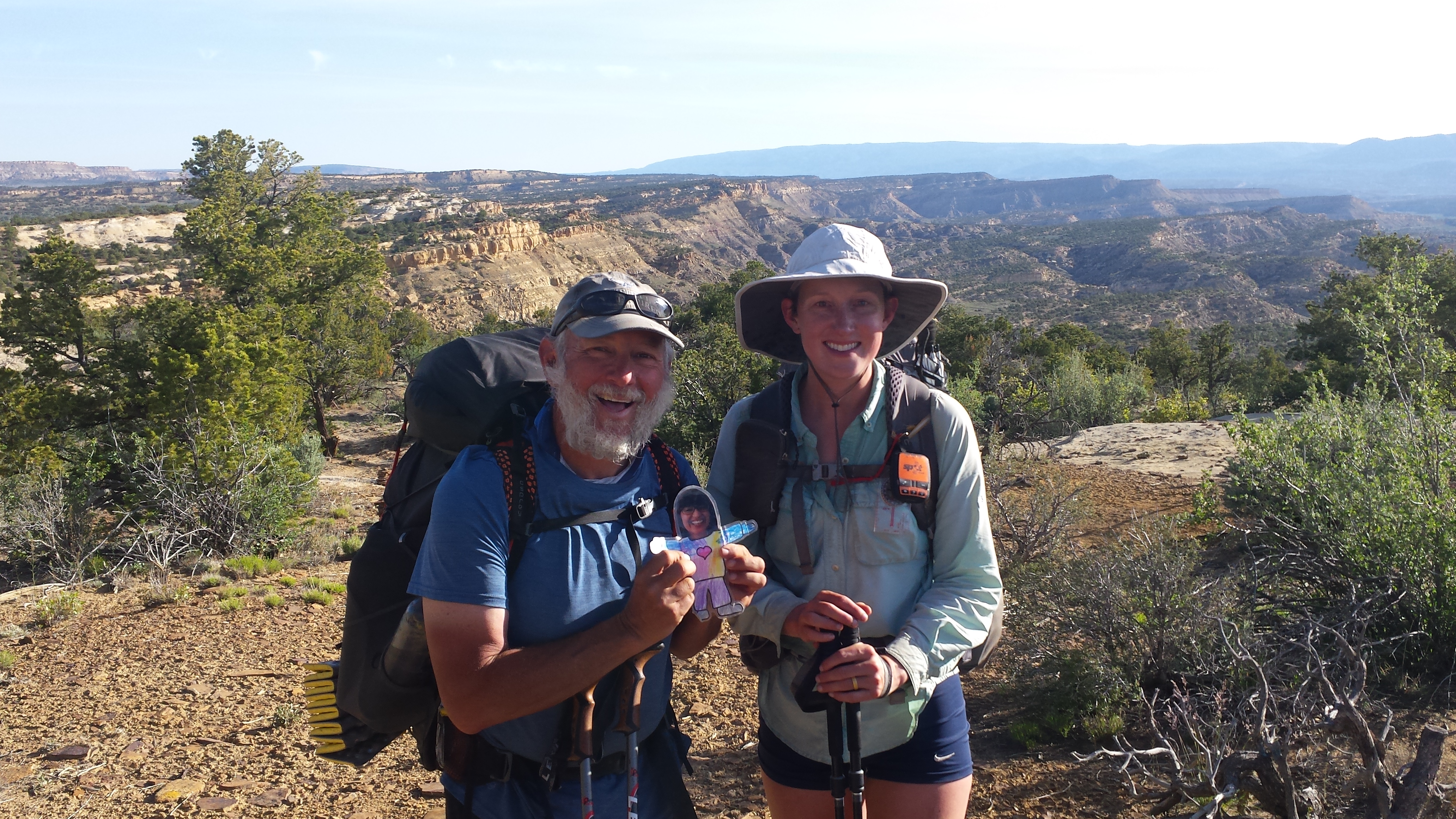
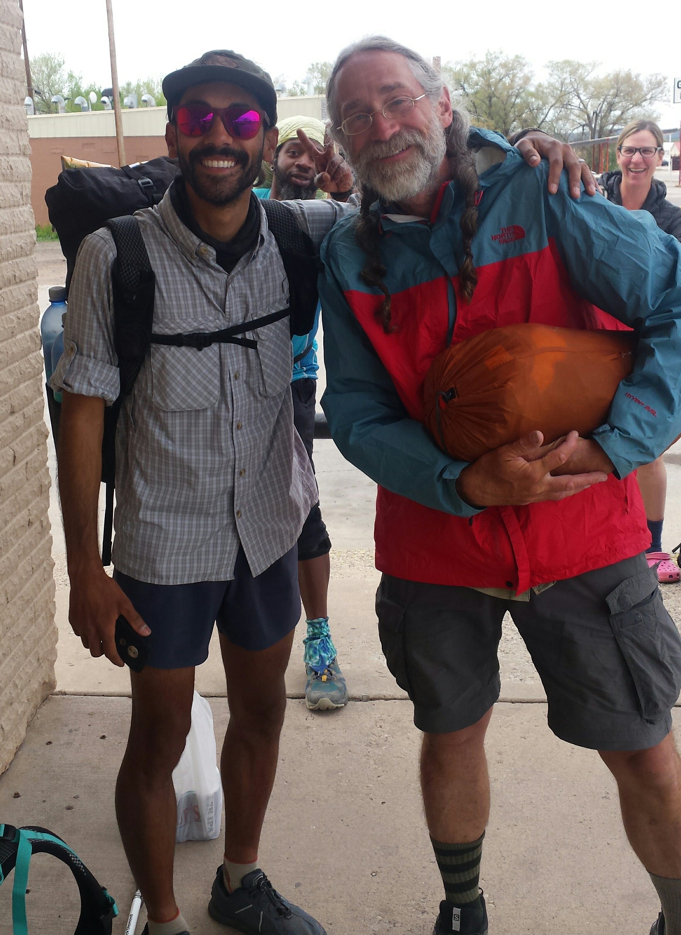
Having said that, the hike has improved measurably since I’ve had more chance to walk with others. Recent hike companions like OB (Old and Busted), Cougar and Locomotive ignited some new energy and though the three of them are all off trail now or about to leave, I’ve just met a couple more hikers (Impala, Hammer and Not Guilty) with whom I’ll be heading back to the trail tomorrow morning out of Cuba, NM, from which I’m posting this entry at Cuba’s charming public library.
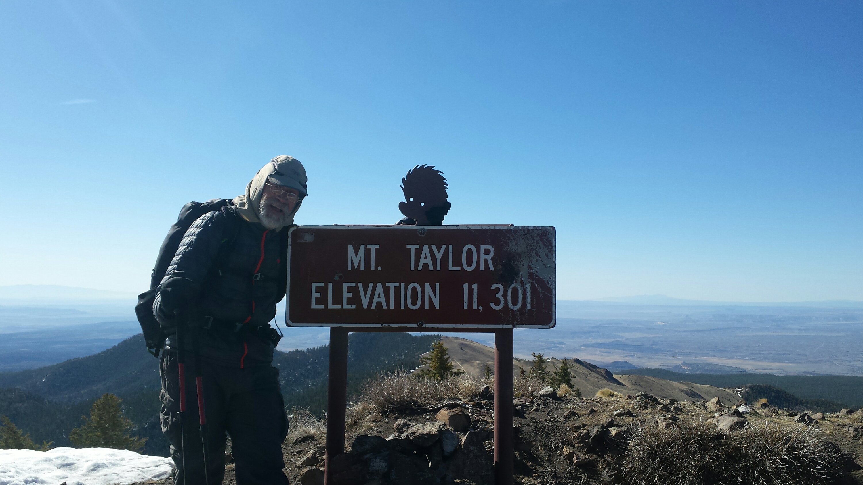
Mount Taylor: summit, my highest climb to date.
This section featured a climb up Mount Taylor, the tallest peak in New Mexico on the CDT. The summit is over 11,000 feet and while we managed to avoid snow on the way up, we were postholing in knee-to-waist-deep snow for some time on the way down. My understanding is that there is much more in my near future (tomorrow). Another recent brightspot is that the past few days of terrain have been the most beautiful I’ve seen so far.
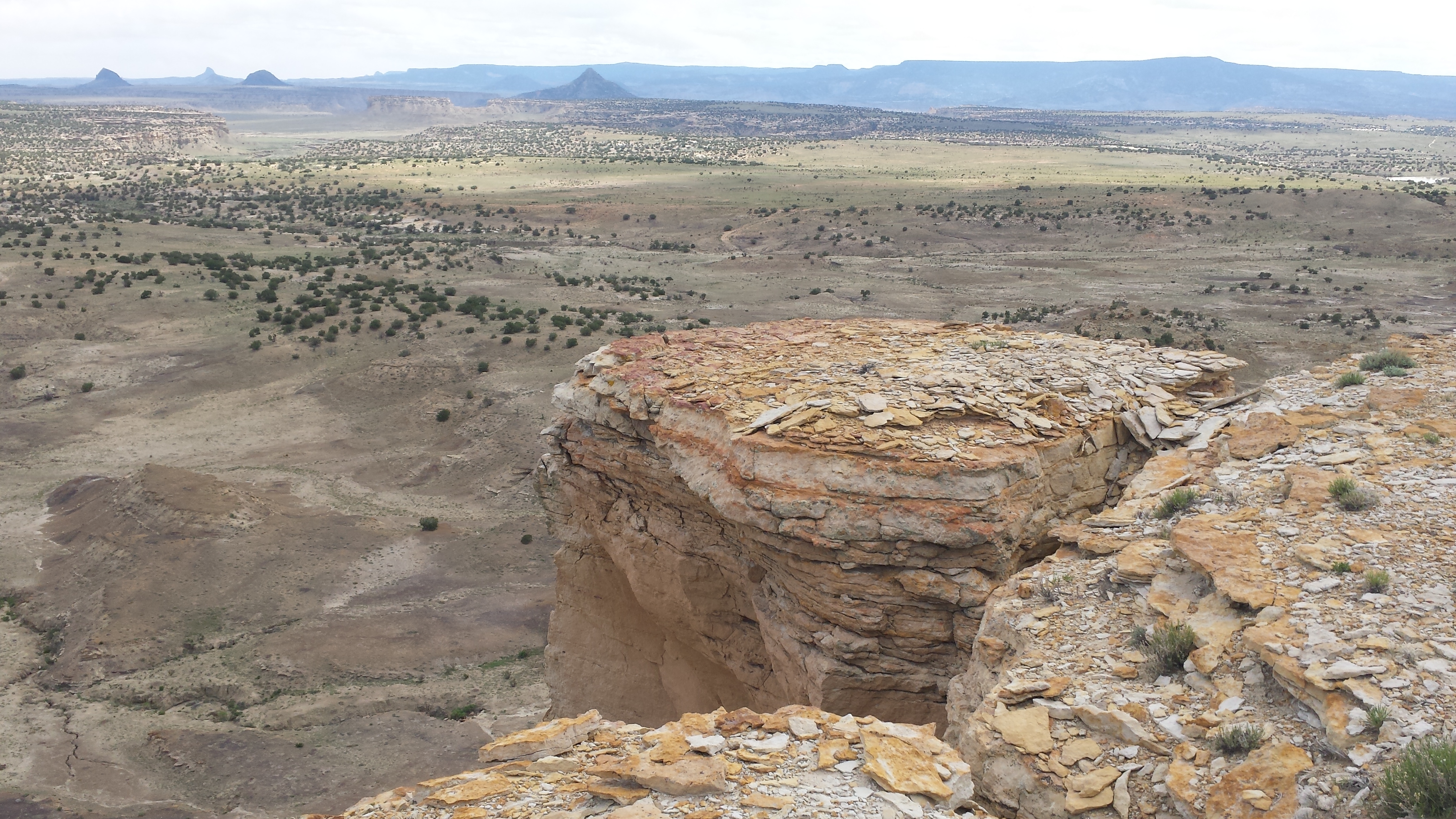
Mesa beauty
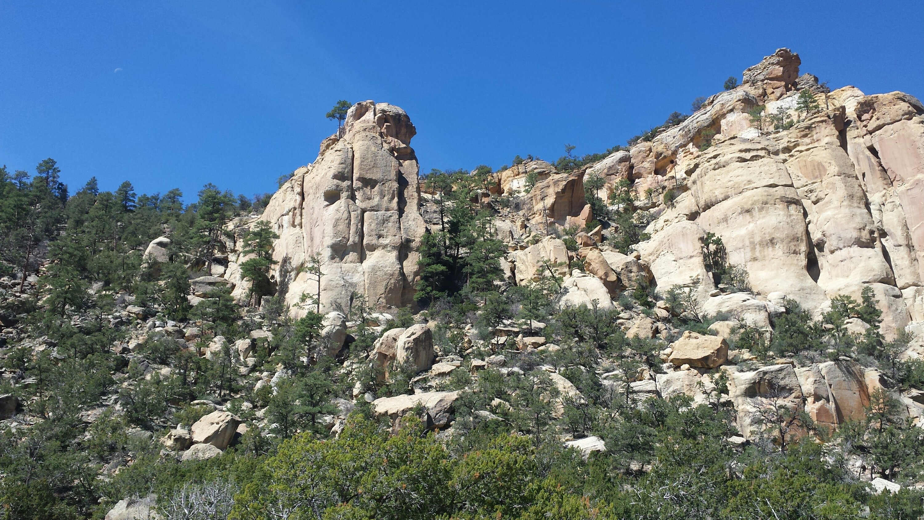
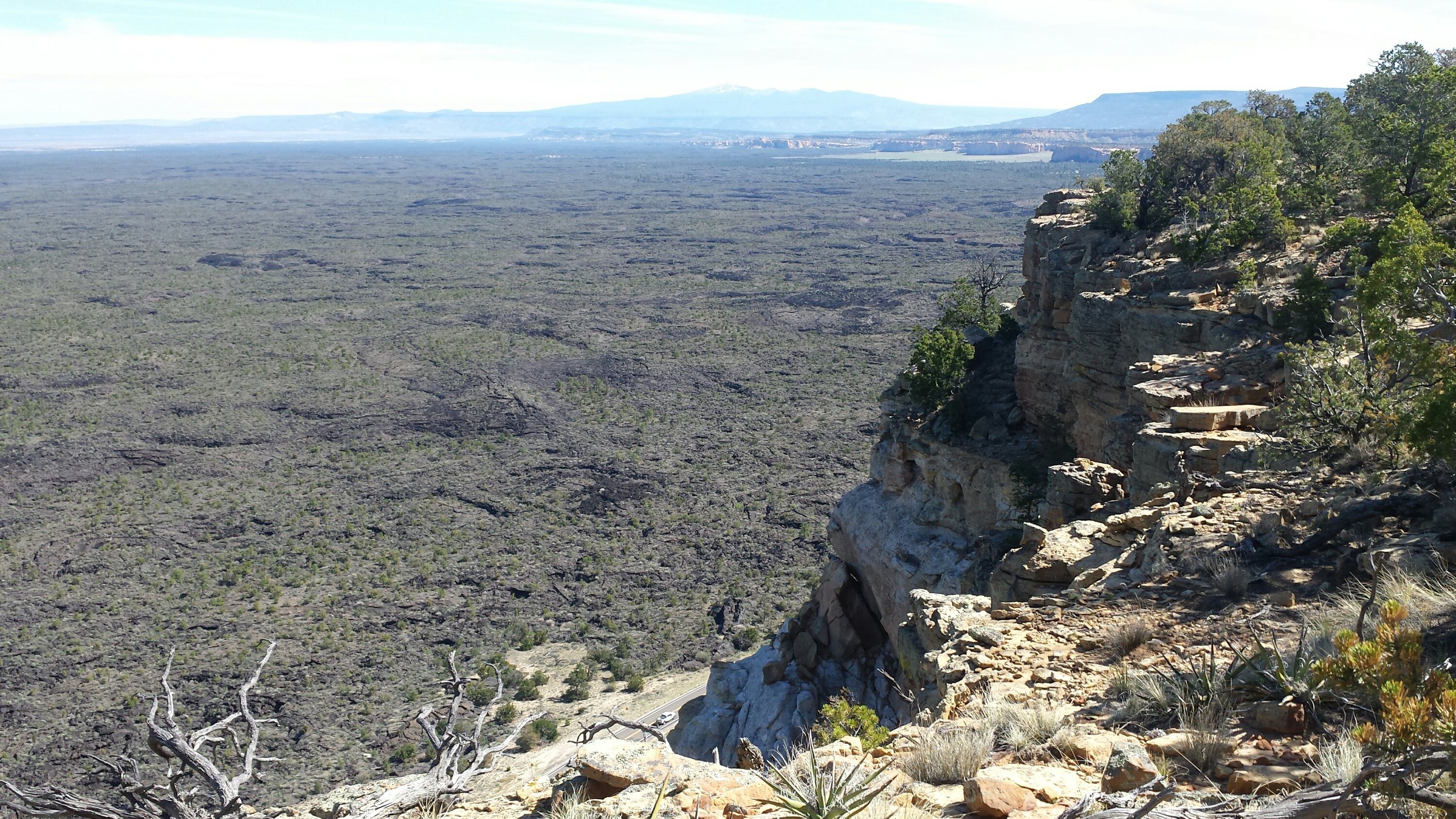
This area is comprised of picturesque mesas of differing heights, some of which we’ve walked atop for miles at a time, others we’ve climbed up and over, and many others we’ve viewed with awe from close by.
More mesa beauty
The floor between mesas still looks very desert-like with loads of dust and sand, cactus and very little water, but the rock formations have provided incredibly eye candy throughout.
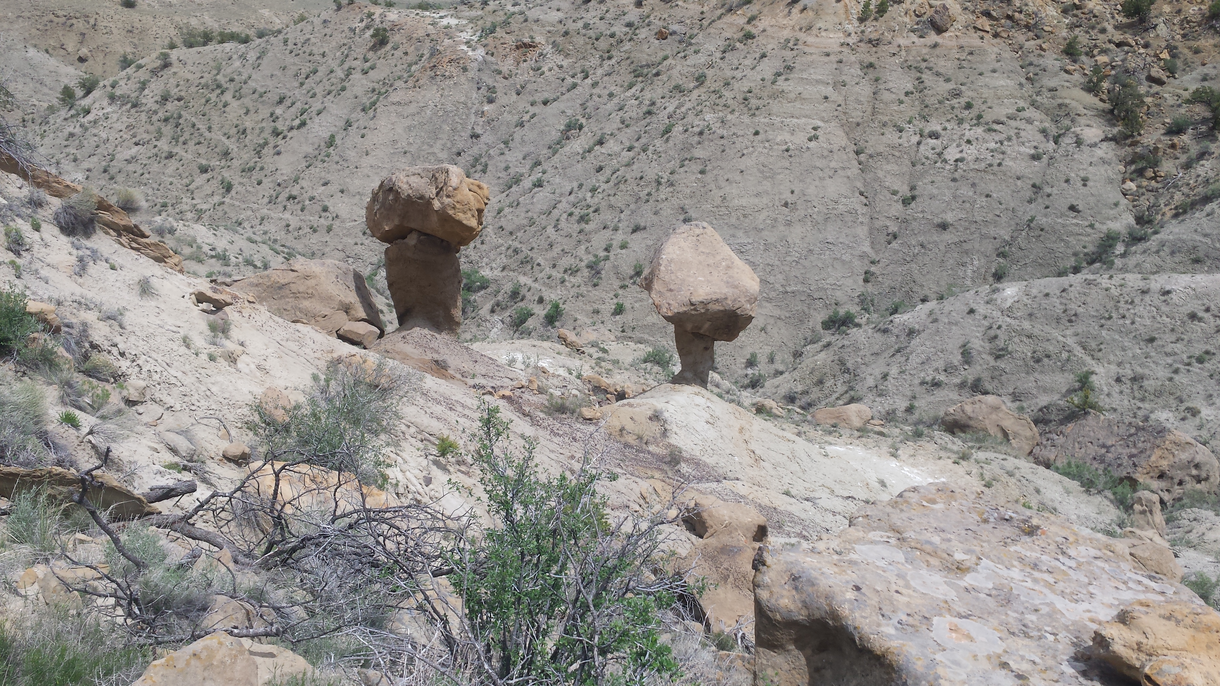
Huge phallus rocks
In addition to meeting several new hiker buddies, we also met another great trail angel yesterday, just before walking in to Cuba.
Drank three liters from this cow trough.
Toward the end of the day we had just descended from 8000 feet up a mesa, tired, hot and extremely thirsty. As we made our way through grazing cows toward an “iffy” water source, from a vehicle with California plates parked along the dirt track emerged a hippie looking guy asking if we needed a ride.
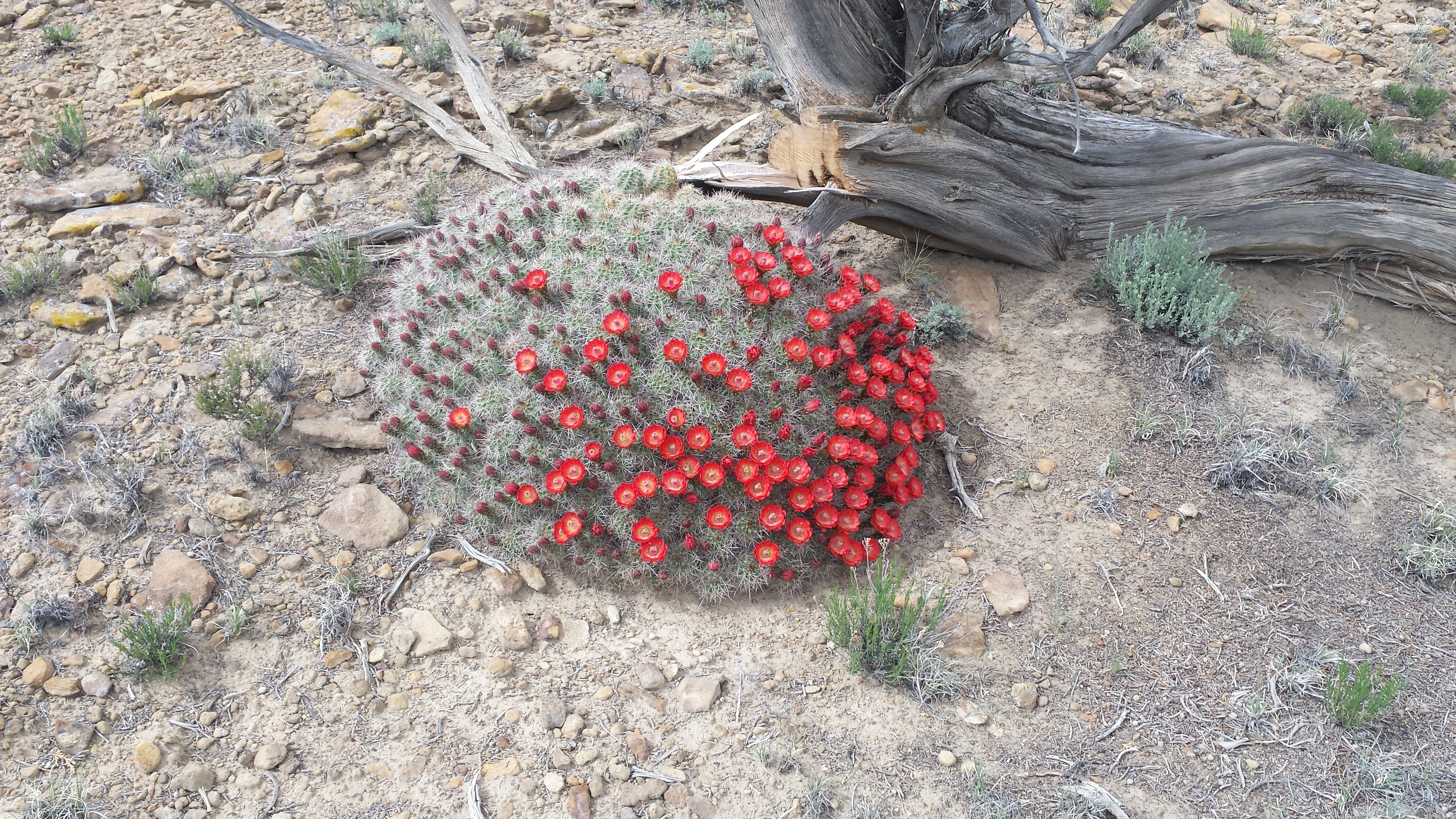
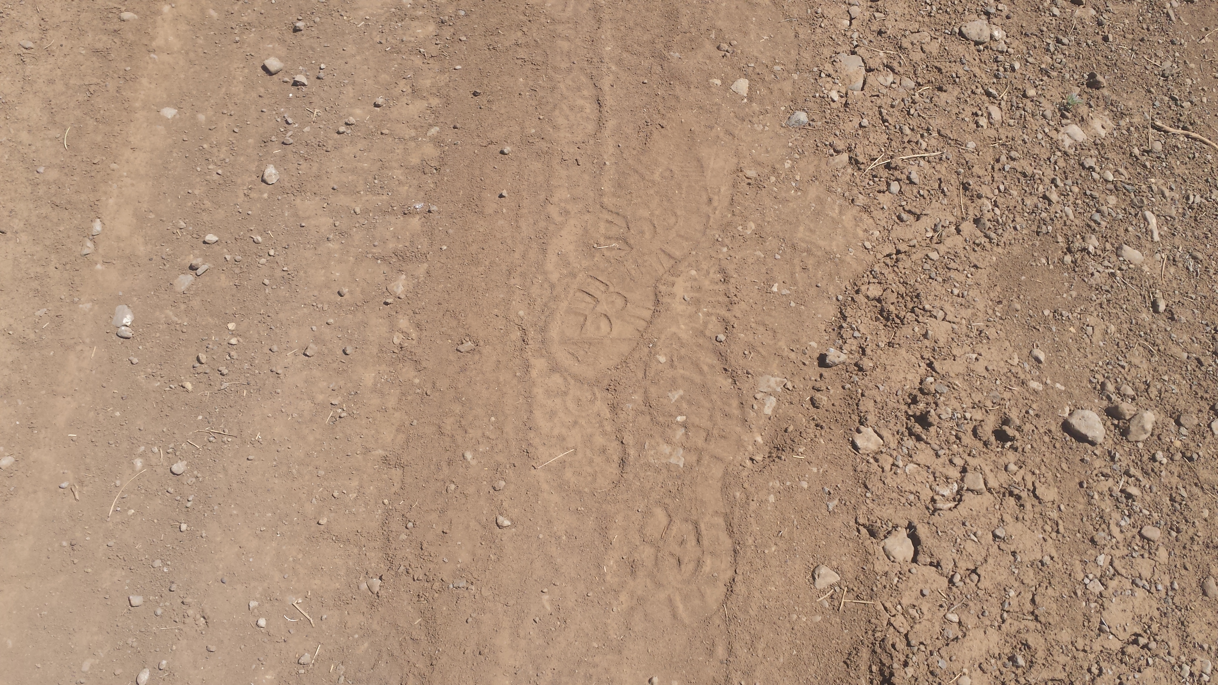
OB and Locomotive atop a mesa.A single blooming cactus.OB climbing up a mesa.Eventually, you get to know hikers by their footprints!
Turns out it was Cheshire Cat, a fellow hiker there solely to assist other hikers. We turned down the offered ride ride but accepted with greedy hiker drools his oranges, fresh-cut pineapple and water. And as we ate and chatted, he introduced his dog as Stella Blue.
From left: Stella Blue, Cheshire Cat, OB, Locomotive.
I’ll spare you the esoterica but this marked him as a fellow Deadhead and- needless to say- we got along famously. If this is unfamiliar to you, see this one of my old Dead tour blogs or that one for more insight into one of my life’s lingering obsessions.
Finally, I thought it may be interesting to explain exactly what I carry in my pack. The below photo shows it all.
My pack and all its contents, fashionably arrayed in my 1970’s motel room.
From right to left: my empty pack in background, blue extra water bottle for emergency, white tyvek groundsheet for tent, grey and yellow sit pad, tent in the green case, sleeping bag, liner and pillow in the blue case, air mattress with white writing on the case, “puffy” down jacket, orange bag containing an extra set of clothes, gloves and rain jacket, red case containing everything else I carry except food (toiletries, extra glasses, first aid kit, fix-it stuff, rain cover for pack cover, toilet paper and shovel, headlamp, extra batteries, etc.) and finally, my aqua blue food bag with (in this example) five days food. The three bottles in back next to the pack are the three liters of drinking water I’ve been carrying (triple what I normally carried on the AT.) And that’s everything.
Ok, my next post will be in a few days from Ghost Ranch, the former home and studio of Georgia O’Keeffe, as well as the subject of some of her paintings. And after that, the last town I’ll hit before Colorado is Chama, NM. Cheers! Max.
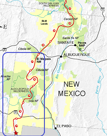
As of last night, I’ve covered the portion inside the blue rectangle
Last night (Sunday, 4/28) OB and I walked into Grants, New Mexico in the dark with headlamps, completing my longest day on any trail (32 miles).
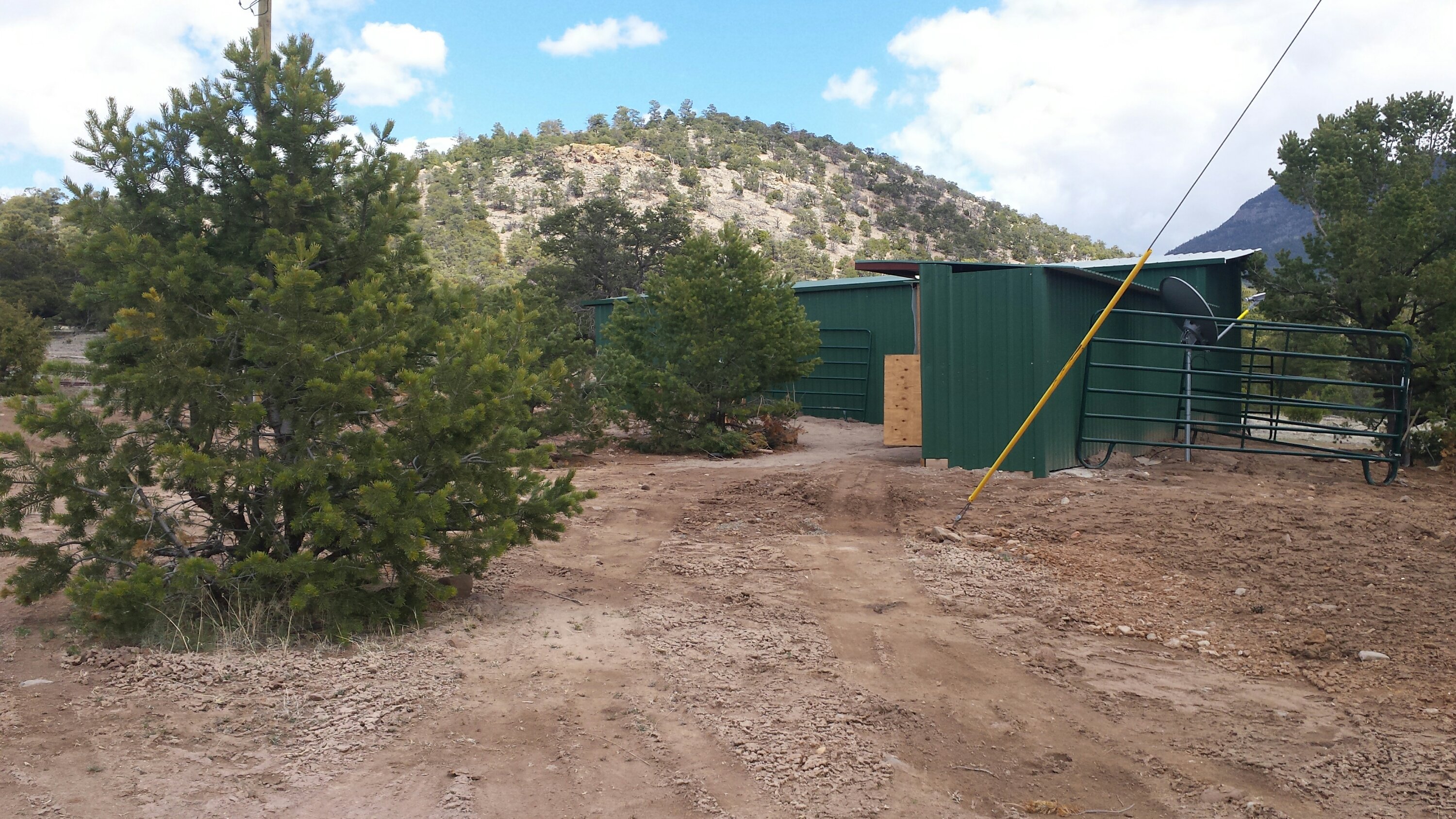
This nondescript building is trail-side hiker support par excellence: hot showers, laundry, kitchen, fully stocked fridge (food, soda, beer) electricity to charge devices, etc.
Thanks to the town’s shuttle service this morning and the timely visit of beloved AT family Mav and Birdie, me and three other hikers (Cougar, OB and Colorado Matt) managed to complete today’s in-town to do list: visit the post office to collect packages from home, hit the laundromat to mask our trail smells for a day, resupply food and other trail needs, hit the ATM, etc. Grants is somewhat spread out so the rides came in very handy.
Colorado Matt, me, Cougar and OB piled in Mav and Birdie’s car to run town errands.AT family Mav and Birdie with me and OB at the Grants Public library, after a visit to the local ice cream parlour.Catching up with the aptly named Mercury at the laundromat. He carries a small pack, crushes miles and always has a smile for you. Fellow thru hiker/Merrill ambassador/trail angel Hakuna with the photobomb assist.From a week or so ago: me at a shallow Gila crossing.We saw a herd of 30ish Elk in this desert meadow a few minutes after this picture.OB on one of many highway miles we had to log in this section. Tough going on the feet.La Ventana natural stone arch
Whereas I spent the first few weeks of this trail trying very hard to see the “fun” in the hike, that fun started to materialize in abundance over the past week or two after connecting with the aforementioned hikers and seeing the miles fly by. We’re currently on northbound CDT mile 536 and gradually I’m starting to see trail legs emerge.
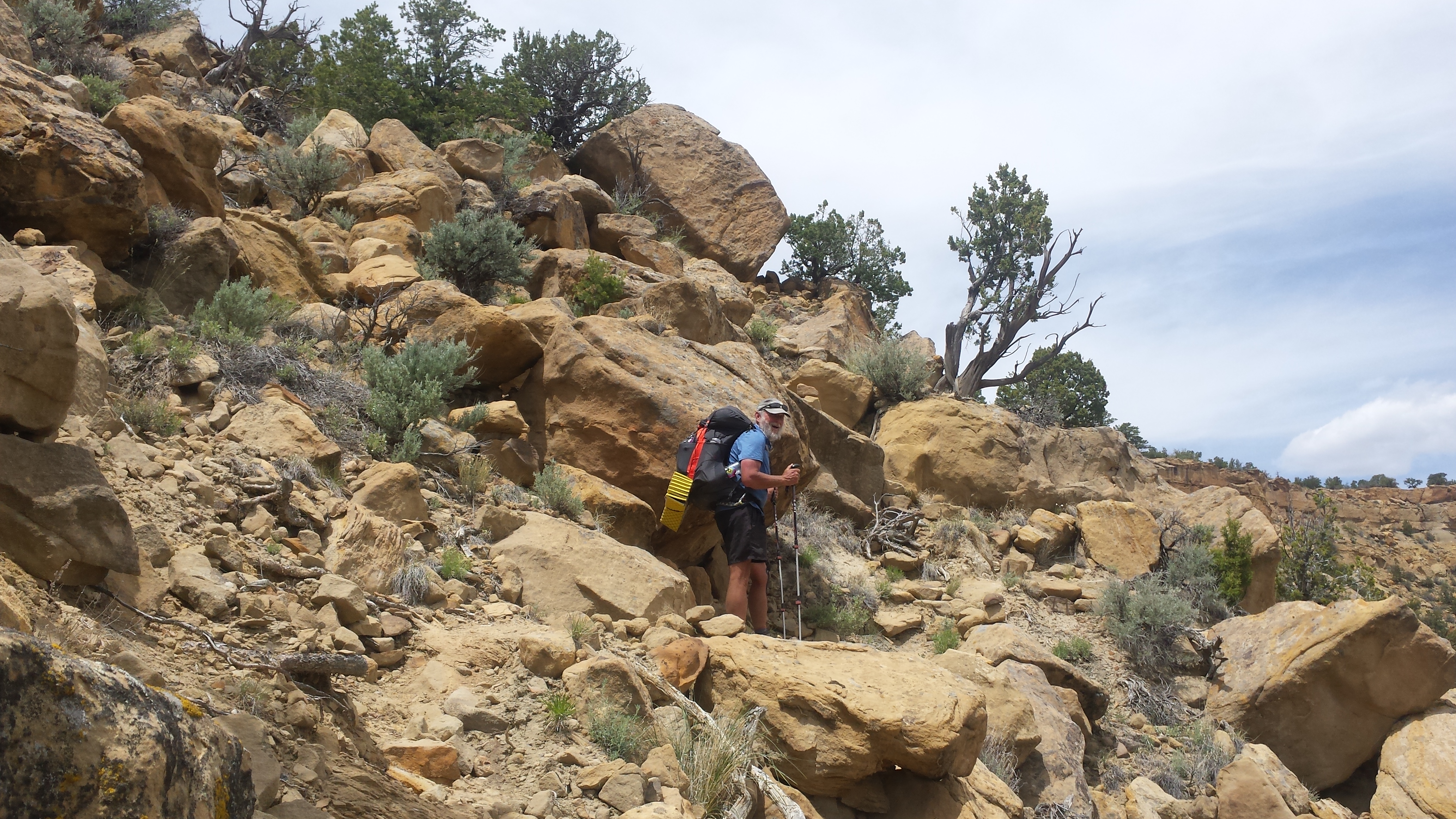
The TLC Ranch, home to some of the kindest folks I’ve met on the trail so far.OB and I forged our own trail from the summit down the heart of this boulder scramble. Fun!OB surveying the way down.
The day we left Pie Town, we had a chance to call in to the homey TLC Ranch, run by Larry and Charity along with Tim and Yvonne, Esther, Lanette and Gracie. Their ranch is right along the trail and they welcome in hikers for home cooked (family style) meals and warm conversations in their comfortable home. Larry sent us off the next morning with fresh made biscuits, gravy and prickly pear jelly! Some of the nicest folks I’ve met on the trail so far.
Cougar and OB in front of a historic stone cabin along the trail.
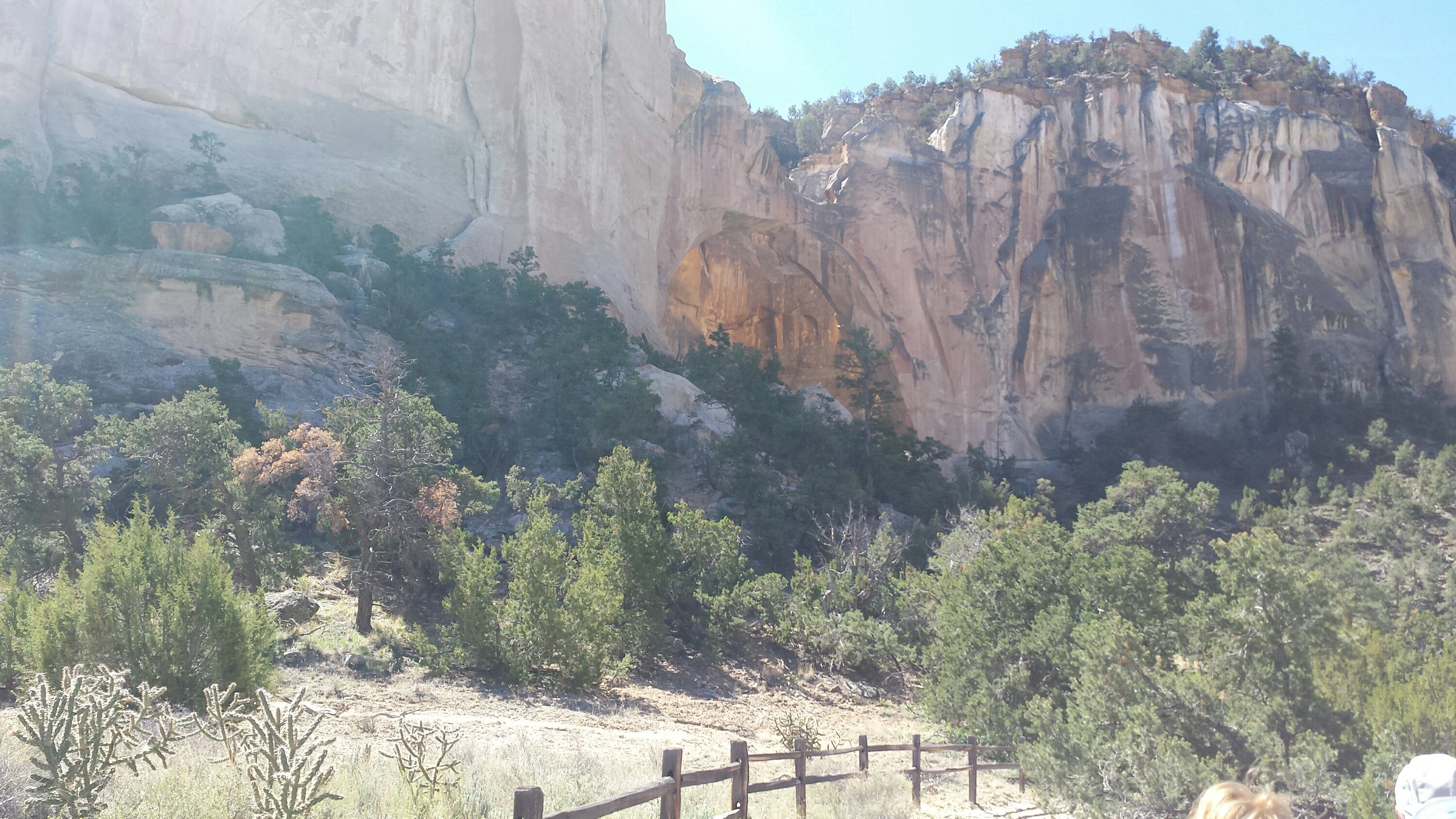
Soon thereafter we found ourselves hiking up to the top of a beautiful Mesa, from which we blazed our own trail down, scrambling over boulders in a dry waterfall to reach the bottom and a stunning view of La Ventana Natural Arch in the El Malpais (translation: the Badlands) National Conservation Area. It was a thrilling section and a nice change of pace from the lengthy road walks we’ve had on this a part of the trail.
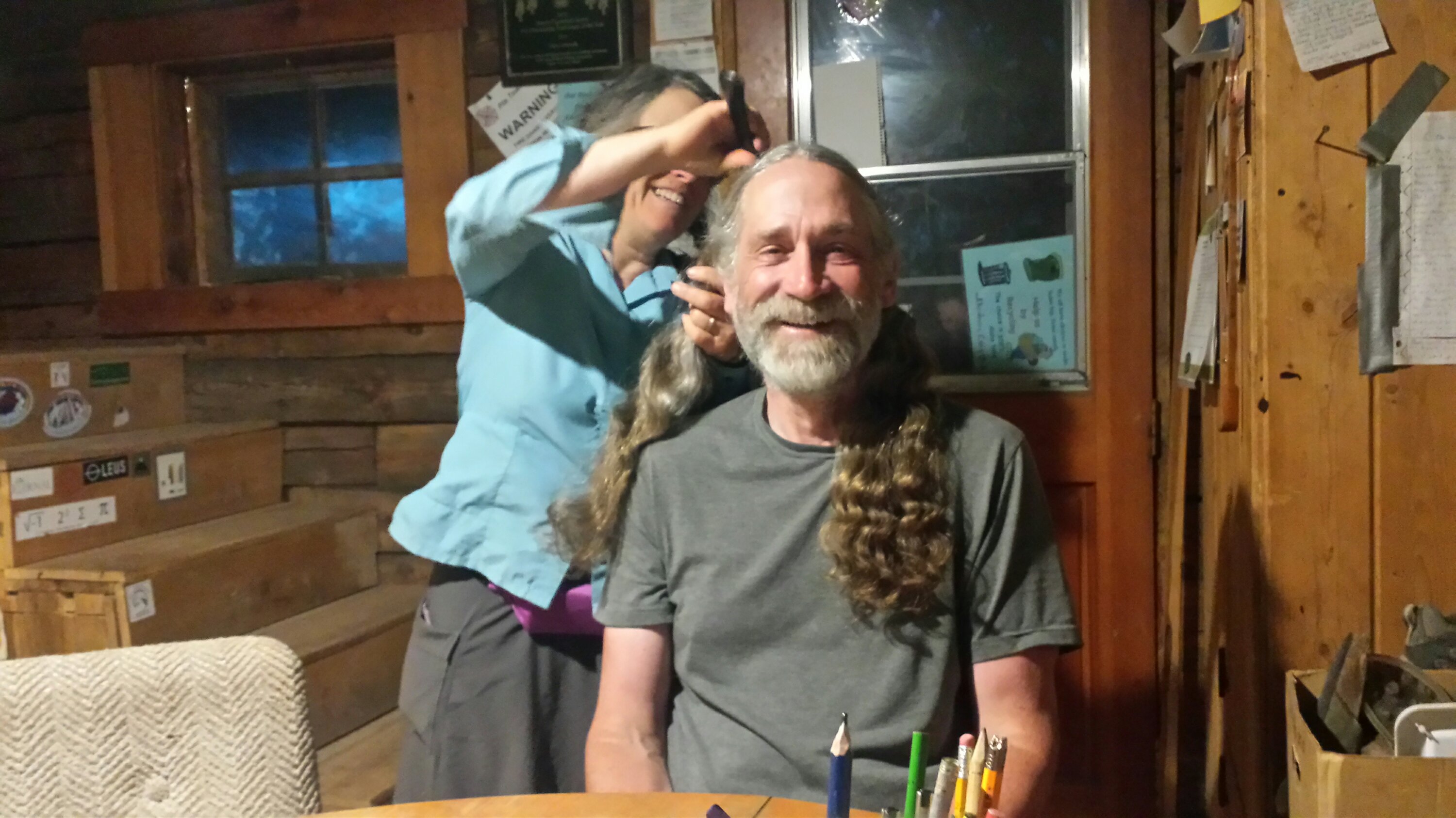
Veggie giving my hair its first braiding since hitting the trail.
In addition to seeing my old AT hiker pals Mav and Birdie today, yesterday I was reunited with hikers who had been days ahead of me after my longer stay-over in Silver City when I was giving my feet some rest and attention. They had been off trail the past weekend attending the CDT “trail days” event back in Silver City. Not only did I get to catch up with a few of them, a couple (Hakuna and Undecided) brought us some snacks and drinks yesterday and drove our packs in to our hotel for the final 13 or so which allowed to high step it a bit and roll into town late, tired but happy.
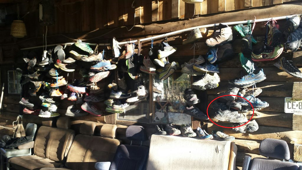
My discarded old Solomons hanging on the shoe wall at the toaster house. RIP.
I find my confidence gradually building (as it did on the AT) and earlier today I picked up a care package from Wendy with gloves, warm socks and my sleeping bag liner. Managing clothing layers in a desert hike is new challenge for me. I need to wear copious amounts of sun screen during the day, but have been shaking ice off my tent most mornings as the evening temps drop.
Lush view from the Mesa near La Ventana Arch.
I hope that those reading along can find something interesting in all this. If you were sitting next to me in the beautiful new Grants Public Library right now you’d have the added dimension of my hiker odor-funk to paint the picture more clearly, but you’re probably content taking my word for it. Love and peace to you all. Max, finally starting to feel strong on the CDT.
"…so I washed my face in the morning dew, bathed my soul in the sun, washed my face in the morning dew, and kept on movin' along"